May 24/25th, 2011 was the first time since February 2008 an EF-4 tornado stuck our area. The tornado that hit Etna, Denning and eventually northern Johnson County will be researched in the years to come because of interactions between a squall line and the supercell that produced the deadly tornado.
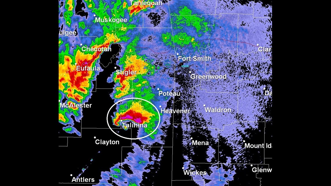
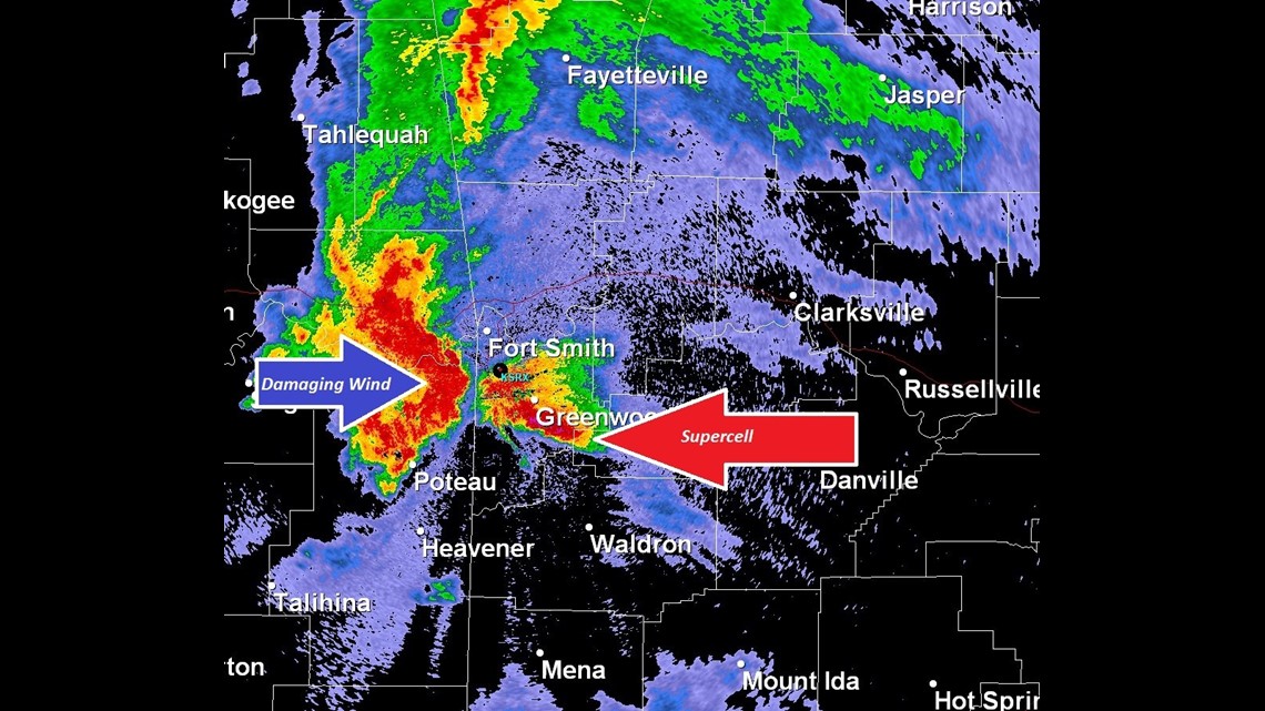
Late on the 24th a supercell was tracking into Le Flore county with strong rotation. This supercell had a classic structure with a well defined hook echo. Notice the line of storms back to the west that would eventually produce damaging winds.


The tornado soon dissipated but the supercell continued to move northeast. Even though the tornado dissipated, the embedded rotation remained within the supercell.
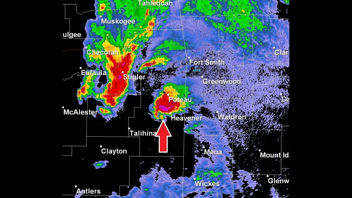
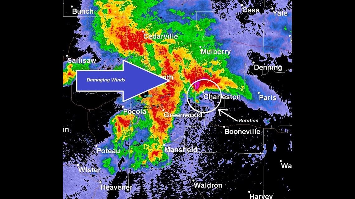
As the supercell continued to slowly drift off towards Franklin County an intense line of storms with damaging winds was barreling towards the supercell from the west.

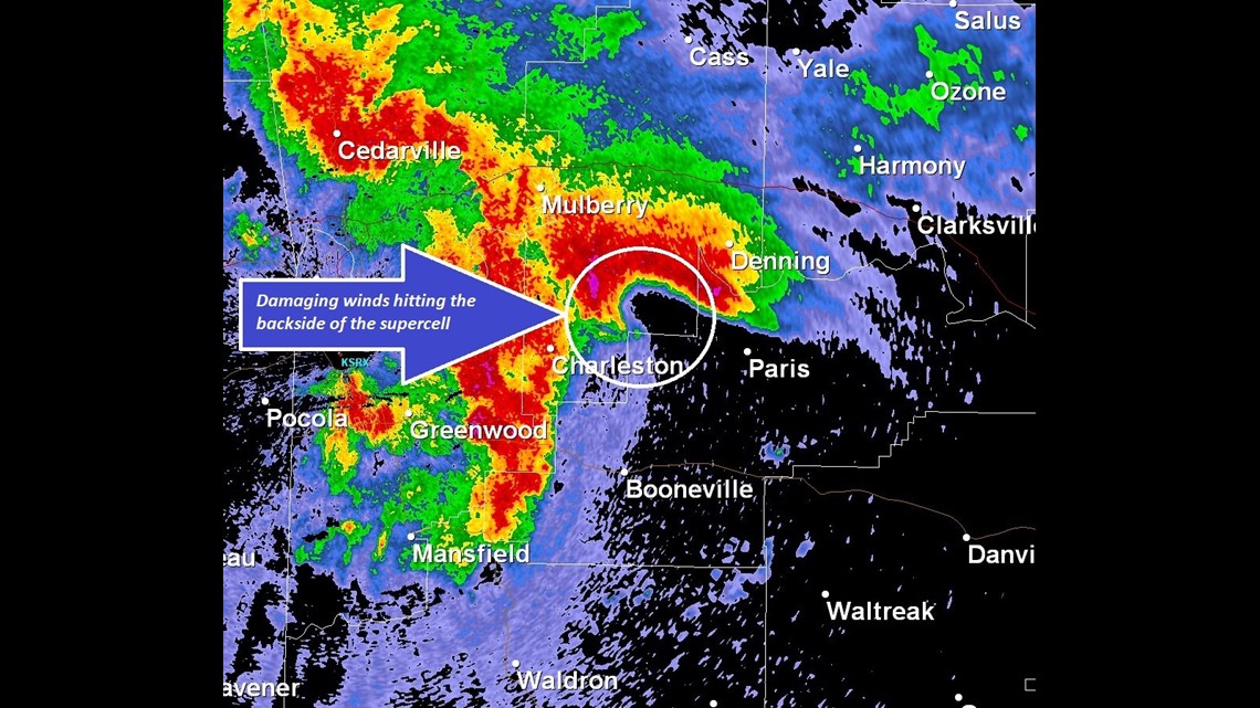
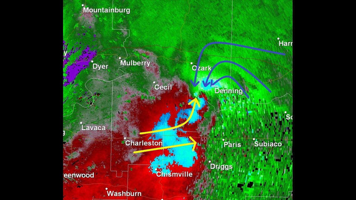
As the supercell entered Franklin County it still contained the embedded rotation as the line of intense winds were just a few miles behind the back side of the supercell.

Minutes later, the winds from the bow echo entered the back side of the supercell leading to a very quick intensification of the rotation. Without these winds from the bow echo, the strong tornado might now have developed.

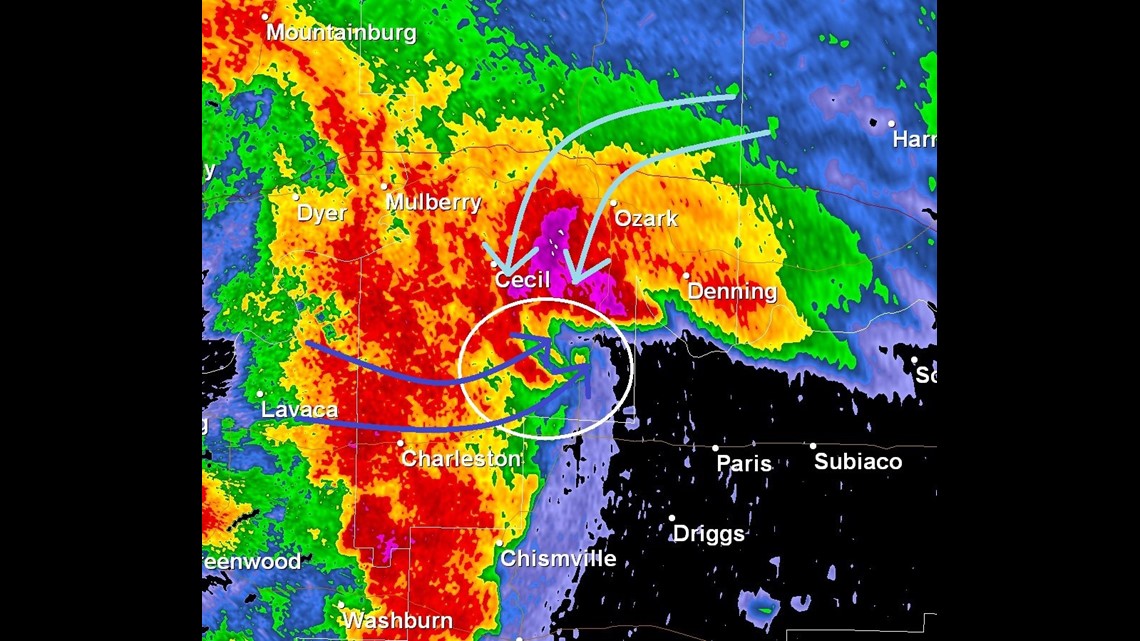
As the rotation rapidly spun up on this supercell the winds around the supercell began to wrap around into the developing tornado.

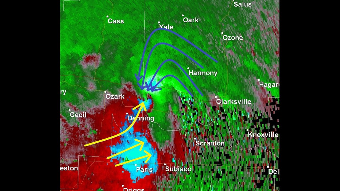
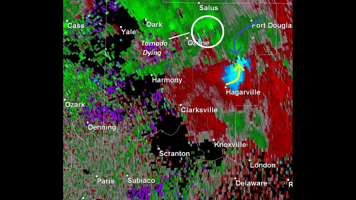
Now we look at the velocity, or winds within the thunderstorm. What is amazing here is winds were start to wrap into the tornado from as far away as Johnson County. Notice the striations within the green (or in-bound) winds.

The low level winds were very impressive as the tornado left Denning and continued into Johnson County. Notice the left over winds from the bow echo to the south. These winds were headed for the Clarksville area and would serve as a focus for the development of a second, strong tornado in Clarksville.

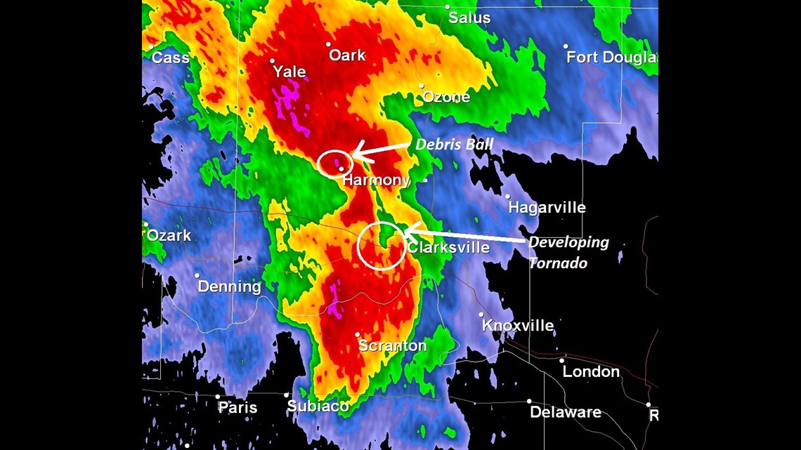
Now, this is somewhat of a confusing part of the story from the night of the 24th and the early morning hours of the 25th. The tornado that hit Etna and Denning continued into northern Johnson County hitting harmony (notice the debris ball still evident on radar) with toward the south a send tornado was developing just southwest of Clarksville near Old Spadra.

Looking back at the winds, a strong tornado was occurring near Harmony while the second tornado to the south was developing. At this time there were TWO tornadoes on the ground in Johnson County…two strong tornadoes.

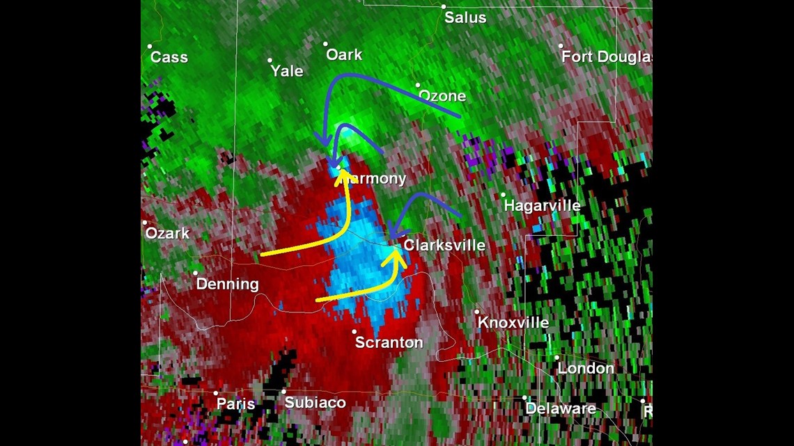
As the southern most tornado gained strength in Clarksville, producing widespread damage on the west side of town, the original strong tornado was starting to dissipate. This might be due to interference from the Clarksville tornado blocking inflow into that area of rotation.

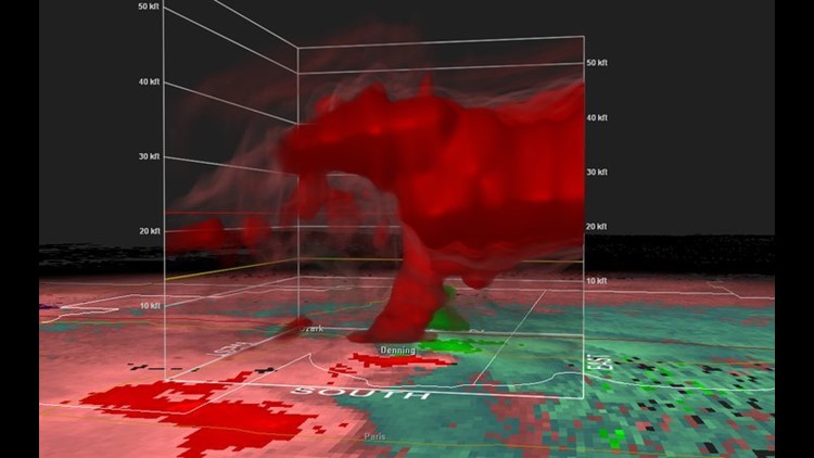
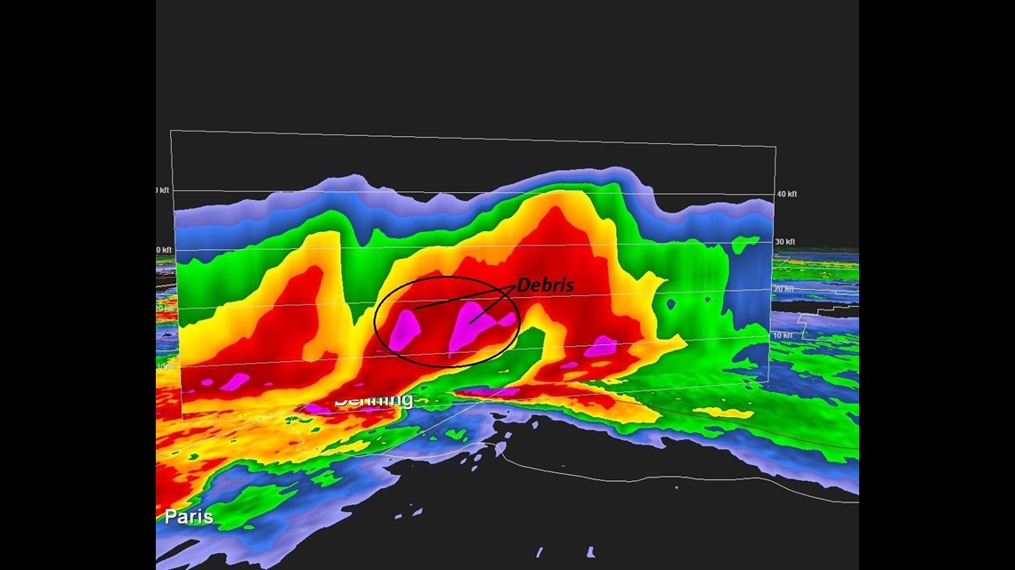
One last interest radar image from the night was a vertical cross section of the tornado in Denning. The debris from the Denning tornado was being thrown into the air almost 20,000 feet! In fact, the debris was already high in the sky of Johnson County well before the tornado actually got into Johnson County.

-Joe Pennington & Garrett Lewis