The summer drought continues with no significant pattern changes in the near future, but a weak disturbance drifting across the American/Canadian border could provide some temporary relief with scattered storms and lower temperatures.
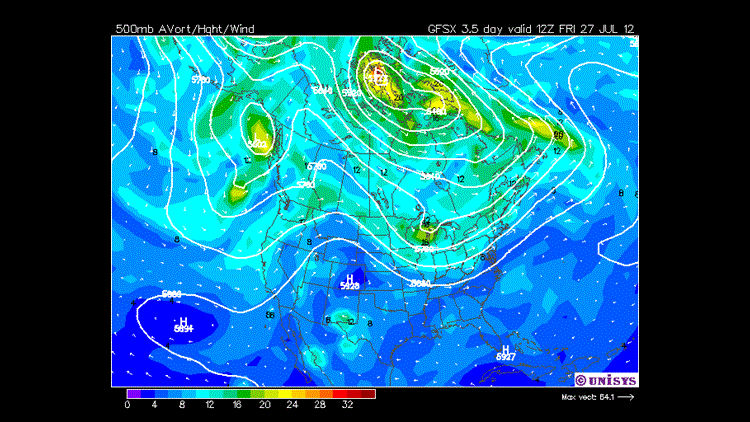
(Image shows energy in the middle of the atmosphere at 500mb. Note the ripple moving across the Great Lakes and the trailing curved lines back into Arkansas)
The overall weather pattern for the last 3 months has been dominated by a large ridge anchored over the central & southern United States. The ridge has wobbled and weakened at times allowing for a limited window of rainfall or scattered storms. Another ridge of high pressure will again weaken and shift southeastward on Thursday allowing for a weak boundary/front to move into the area from the northwest.
The main energy with this system is located near the Great Lakes, so we’re not expecting a major areawide soaking rain or even long-term colder temperatures. However, the boundary will combine with daytime heating to produce showers and thunderstorms in the afternoon. Due to the unstable air mass, severe wind gusts are possible with the stronger storms. Tornadoes are not likely. We’re lacking jet stream energy with updrafts oriented vertically instead of tilted. A tilted updraft will sustain a thunderstorm longer due to higher wind shear. Summer storms and vertical updrafts become clogged with rain and eventually result in the decay of storms and occasionally microbursts.
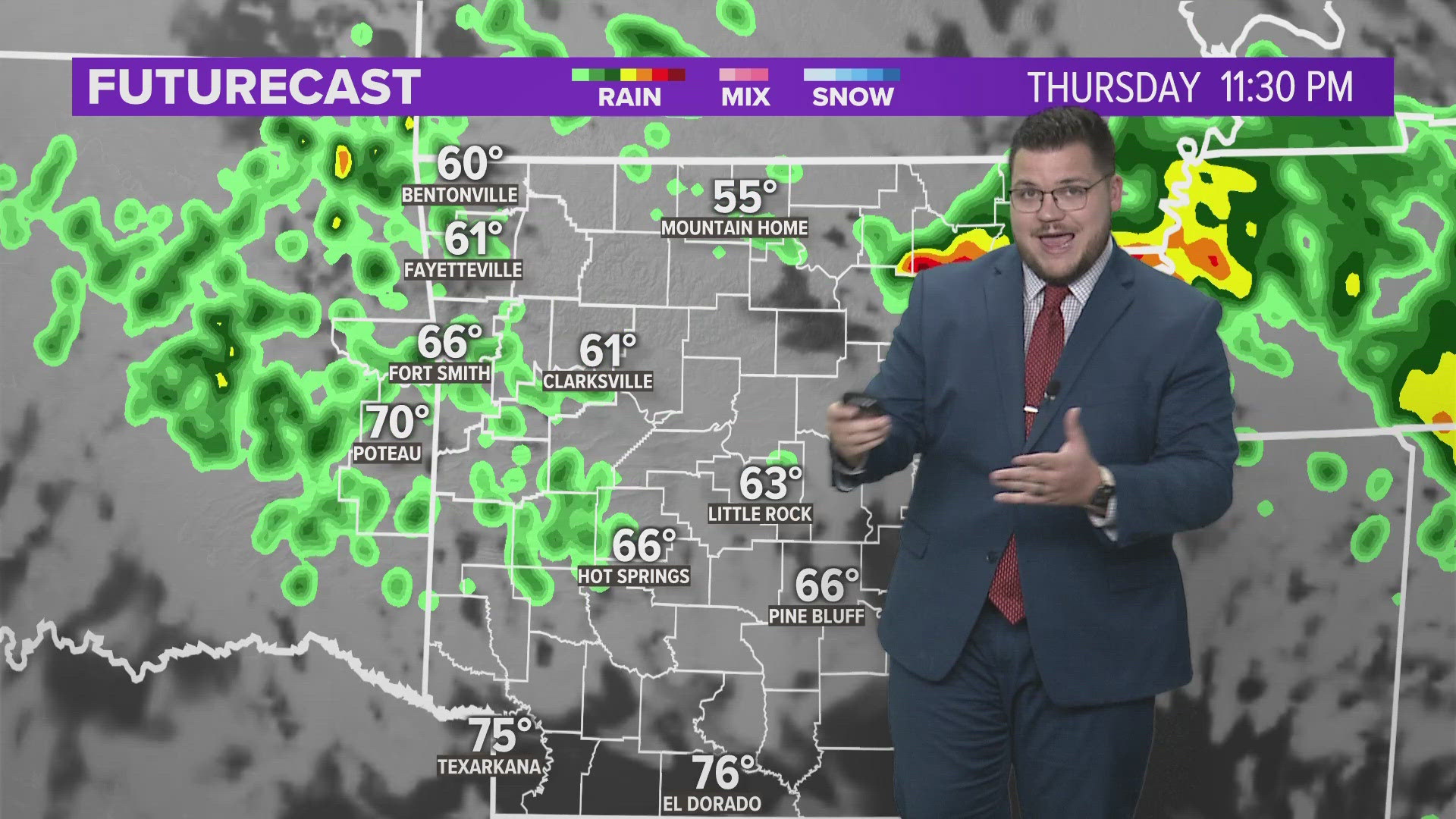
Bottom line: Scattered storms on Thursday & Thursday night. Some will be severe with gusty winds. For those of you who see rain… you’ll also see a 20-30 degree drop in temperatures. Everyone is hot, dry, and dusty again by the weekend.
Garrett