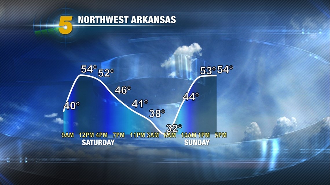
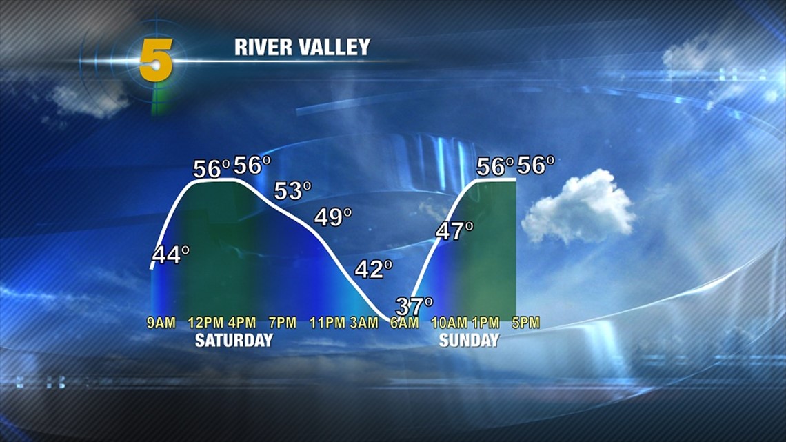
The polar jet stream continues to dig south across Arkansas with highs plummeting all day. We’re expecting overnight lows to continue the fall reaching the lowest on Sunday AM & Monday AM where a good portion of Northwest Arkansas will be near or below freezing. Temperatures are expected to remain above 32 in the River Valley.

Historically, the earliest Northwest Arkansas has seen a freeze was on September 27th, 1942 and the latest on November 17th, 1988. Last year, the first freeze occured on Oct 19th, 2011 so this is about two weeks earlier than last year.
For the River Valley… The earliest on October 8th, 1952 and the latest on December 2nd, 1931. Last year, Fort Smith experienced the first freeze on November 17th, 2011.
An interesting sidenote, temperatures typically cool around 5 degrees per 1000 feet in elevation gain for a dry airmass and about 2.5 degrees for a moist airmass (with everything else being equal). This “lapse rate” is why Northwest Arkansas is, on average, about 5 degrees cooler than the River Valley and it’s reflected in the charts above with 37 degrees in Sunday morning in Fort Smith and 32 in Northwest Arkansas. Local variations and valley effects can change the temperature profile but that’s why NWA is cooler and often receives more snow than the RV in the winter time.
Temperatures are expected to climb and become mild with highs in the 60s next week with another cold front towards the end of the week.
-Garrett