Things have been busy here in the 5NEWS Weather Center tracking our next weather maker which has the potential to bring some snow to Northwest Arkansas.
I know this may be surprising to read considering how warm it has been Sunday and Monday.
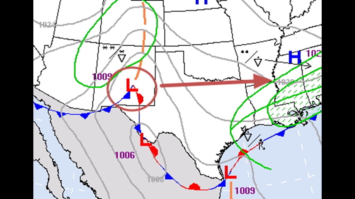
You can see in the picture below, the area of low pressure is currently tracking east through Arizona and New Mexico and will continue to move east before setting up over south Oklahoma and Northern Texas by Tuesday morning (Feb. 12).

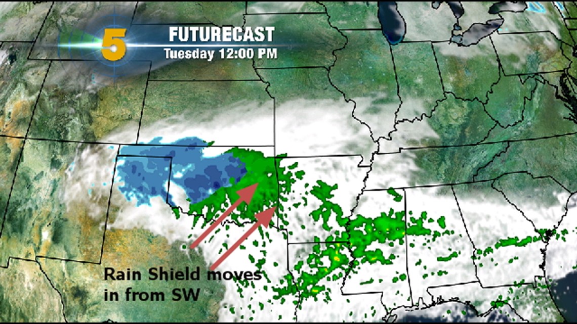
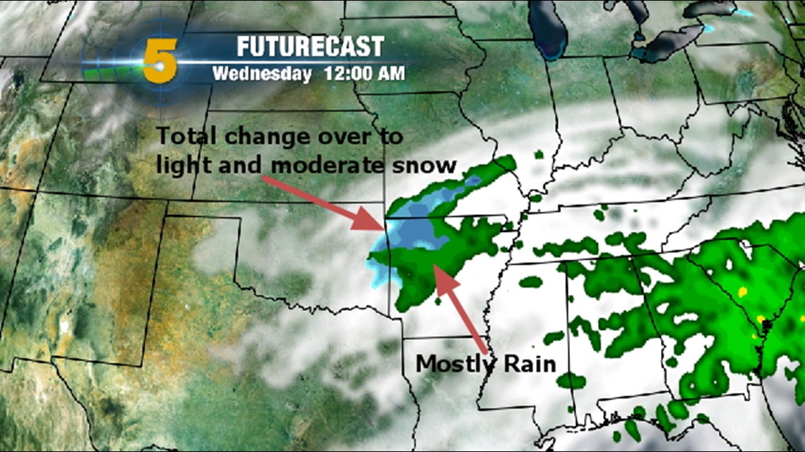
As the low approaches, winds will be out of the south and east, drawing up warm and and moist air into Arkansas. Light to moderate rain will initially move into NWA around midday from the southwest eventually spreading over the entire region by 2 p.m. Tuesday, Feb. 12.

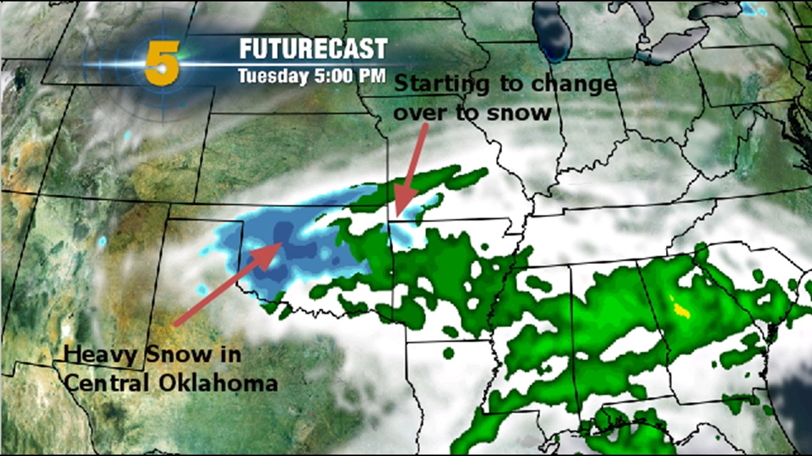
As the low moves east, winds will begin to shift out of the north and east drawing in cold air into NWA. This will begin to change rain over to to snow toward the late afternoon for areas north of the Boston Mountain range. Change over will be seen first in higher elevations as cold air moves in aloft first. This initial change over shouldn’t be much of an issue for your evening commute with ground temperatures still above freezing preventing accumulations. These ground temperatures will become more suitable for that snow to stick in NWA as we approach midnight.

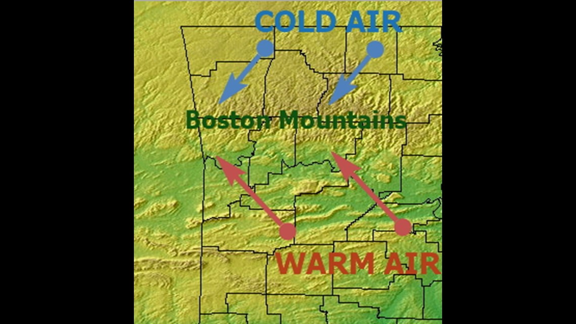
Terrain will be a huge player in who sees the snow for this event. The cold air mass needed for the change over will be fairly shallow so it will take a bit of time to move in from the north and push over the Boston mountain range creating a natural barrier for the River Valley south. This will keep temperatures in the River Valley warm enough for most of the event to see mainly rain.

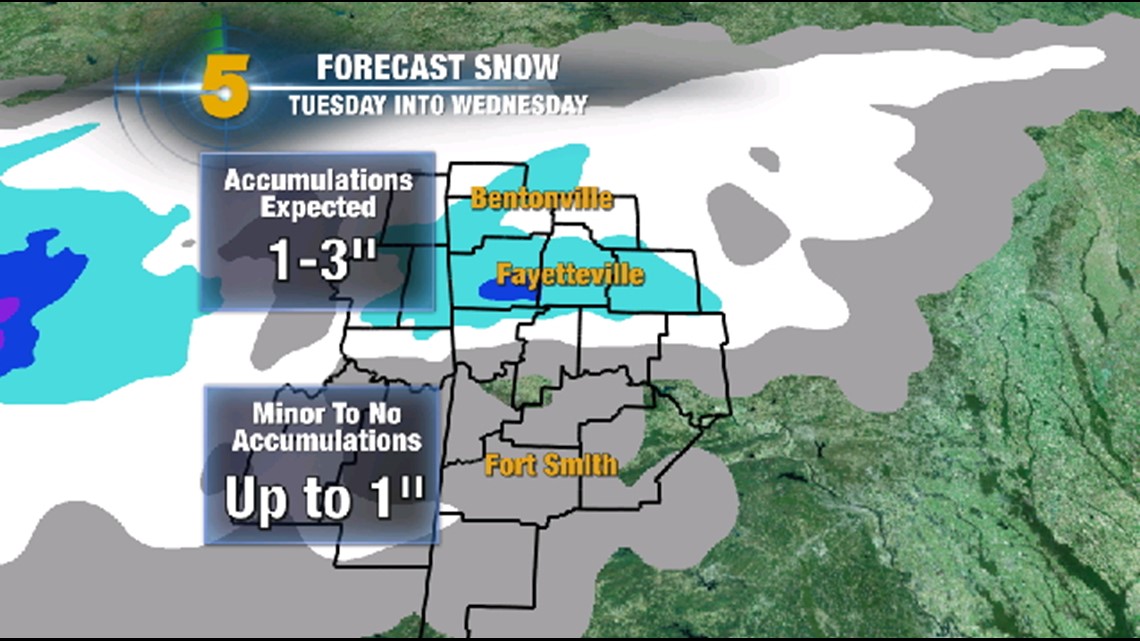
By midnight, all of NWA (north of the Boston Mountains) will have changed over to snow which will be generally light with some moderate bursts from time to time. Some areas of higher elevation mainly above 1000 feet in the Ouachita Mountains will likely also change over to some snow. Early Wednesday morning (Feb. 13) accumulations in NWA will generally be between 1-3 inches with the most accumulation coming in the high terrain.
The River Valley will likely see some change over as we approach the late night to early morning hours on Wednesday. If anything is to accumulate in the River Valley it will be less than an inch due to the warm ground temperature melting most flakes.

Any precipitation will come to an end during the early morning hours on Wednesday. Snow that does accumulate will not stick around very long. Temperatures will rise above the freezing mark by mid morning Wednesday before eventually warming into the 50s by the afternoon.
Here is a look at our current thinking in terms of accumulations:

-Meteorologist Tyler Southard
We will continue to provide updates on our website: www.5newsonline.com/weather
Updates also available on social Media: Garrett Lewis, Joe Pennington, and Tyler Southard.