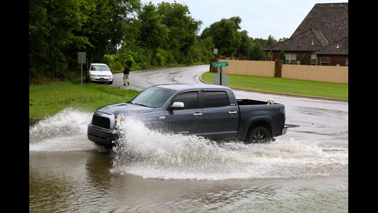
Yet another overnight round of thunderstorms moved into the area early Saturday dropping widespread heavy rainfall, occasional lightning, and minor street flooding. The iPIX shown is from Lisa Porter in Rogers.
Thankfully no severe weather was reported in our area and the risk remains low for the weekend, although damaging winds could be possible with the stronger storms.
Here’s a look at rainfall totals through the Noon hour.
- 3.11″ Beaver Lake
- 3.04″ Bentonville
- 2.76″ Springdale
- 0.91″ Fayetteville
- 0.49″ Siloam Springs
The weather should be much calmer this afternoon if you’re out enjoying the tax free holiday. Highs will be a little lower due to cloud debris and rain. Expecting 80s in Benton Co, near 90 in Washington Co, and closer to 100 in the Fort Smith area.
Sunday could once again start off with more heavy rain with flash flooding the primary threat. No severe weather is expected.
Garrett