A strong winter storm will affect the area on Thursday into Friday. There will be several opportunities to pick up wintry precipitation across the area; although the type will vary drastically from one point to another. This blog post will highlight some of the current thinking on precipitation type and impacts as well and times of arrival to help you plan for the next two days.
It’s important not to get too focused on totals of sleet or snow. A 1º difference could result in an increase or decrease due to the fact sleet compacts more than fluffy snow. Most importantly… watch the temperature, anything below 29º has a major effect on roads regardless of whether it’s 1″ or 7″ of snow.
Winter Storm Warnings are out for Northwest Arkansas. Expect travel to become slick and hazardous by noon, if not earlier. Highest snow/sleet totals will be in Benton County where as much as 4-6″ is possible Fayetteville and Washington Co will be on the lower end of the 4-6″.
Ice Storm Warnings are in effect for the River Valley. Unfortunately, this scenario is trending towards more ice instead of snow. As much as .50″ or more is possible. Power outages are likely… in some cases for days. Travel will be slick and hazardous by Thursday afternoon if not sooner. Additionally, around an inch or two of snow/sleet is possible late Thursday into Friday.
Below is a series of graphics to help you in the decision-making process:

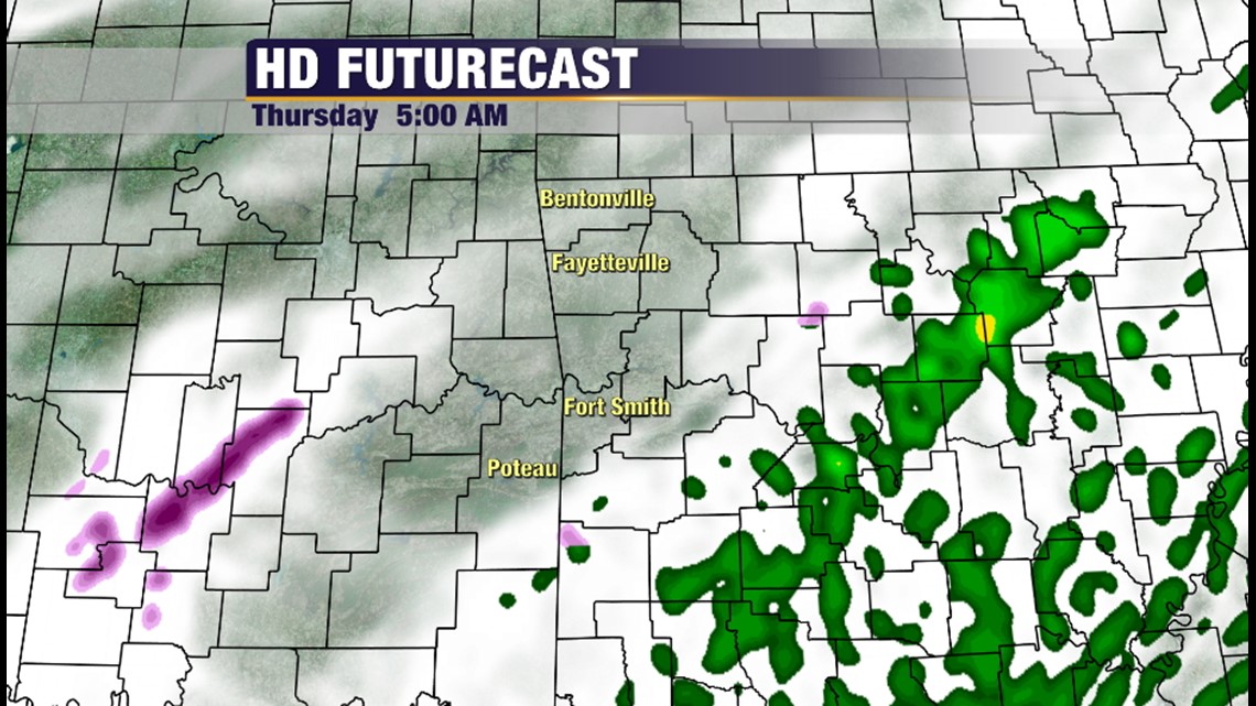
5AM Thursday: Most roads should be free and clear the precipitation will be starting out west and moving east. Temperatures around 30 in NWA and 39 in Fort Smith/RV area.

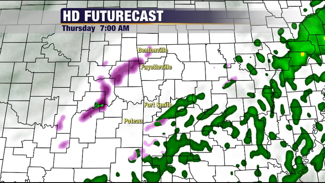
7AM Thursday: Coverage of precipitation is expected to increase. Temperatures will be near freezing in NWA and below freezing down. Most roads are expected to be fine.


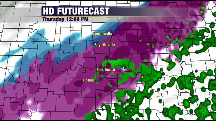
Noon Thursday: In a word: Messy. Widespread wintry precipitation will be falling and road conditions will deteriorate. It’s possible that many people could try to leave work or school early and this will undoubtedly result in traffic slowdown. Temperatures: 29 in NWA and 33 in Fort Smith/RV Area. A cold rain is possible at this point in the River Valley with traffic problems starting a little later than Northwest Arkansas.

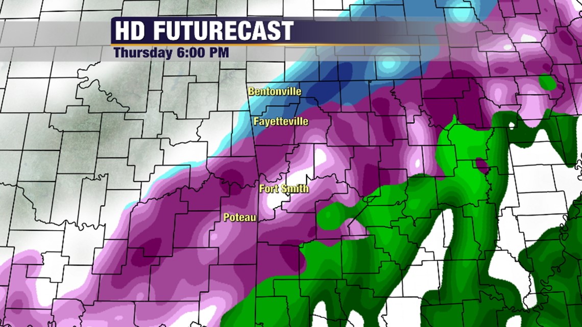
6PM Thursday: Widespread freezing precipitation area wide. Mostly sleet and snow in NWA and mostly freezing rain and sleet in the River Valley area. Travel is expected to be slick and hazardous; especially after sunset. Temperatures 26 in NWA and around 29 in Fort Smith area. Should power failure occur I would expect it to be somewhere around this time in the River Valley.

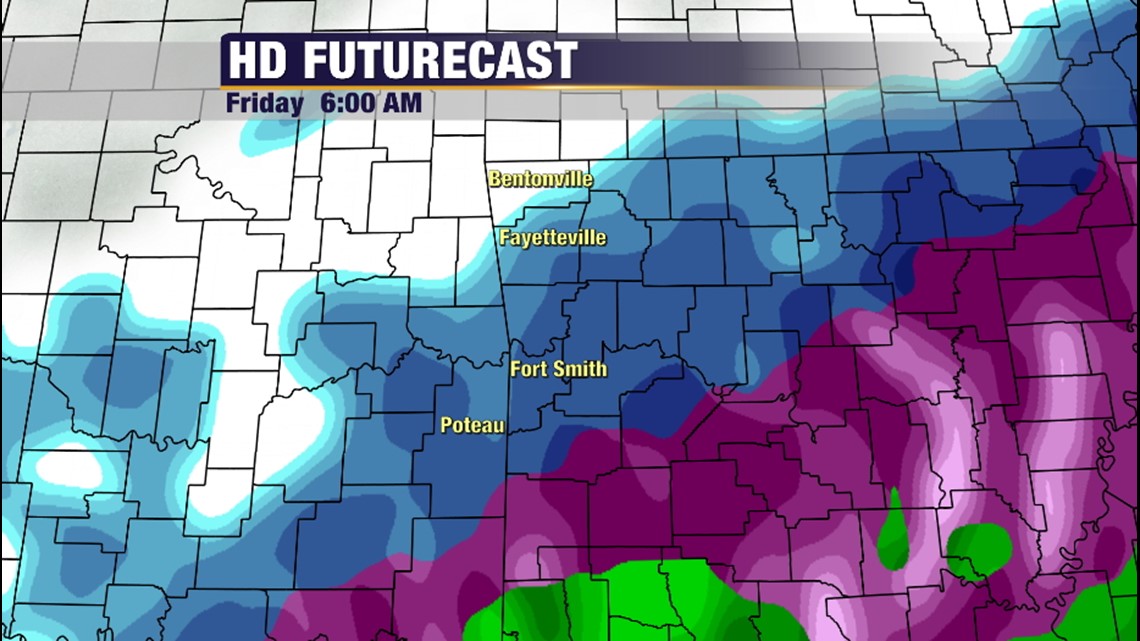
6AM Friday: Another round of sleet and snow will just compound ongoing road issues. Temperatures 20 in NWA, 26 in River Valley. My personal opinion is that there will be a number of school cancellations.

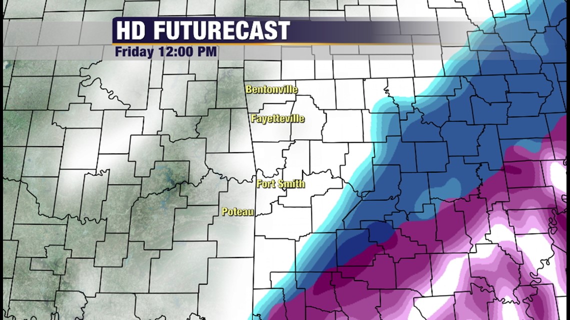
Noon Friday: Main event is over. Road conditions continue to be slick and hazardous in many areas.

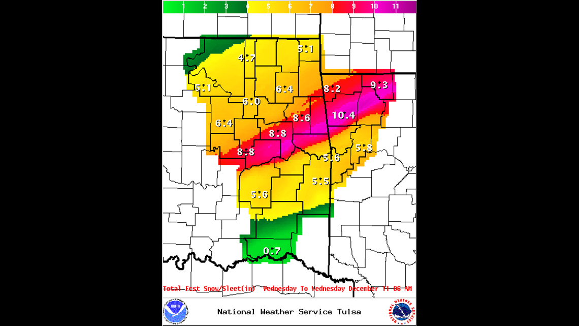
NWS Snow Totals. REMEMBER this is a week-long total that also includes another round of snow on Sunday of this weekend. Don’t get too focused on snow totals. Most forecasts will vary depending on the snow-sleet-ice ratio. Yes, I know Logan and Scott Co are not on here. The NWS in Little Rock handles those areas and don’t put out nifty maps like this. The conditions just west of your location will be very similar to what you see in those two counties.

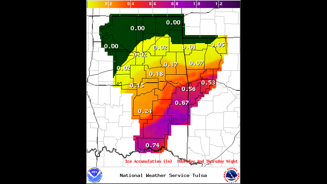
ICE ACCUMULATION: This is only for Thursday/Friday Morning. See the problem? We’re expecting enough ice to cause tree limbs and power lines to be pulled down. I feel like these totals are a little high and may represent worst case scenario. Best case scenario is still .25″ of ice or power which is plenty enough for power outages.

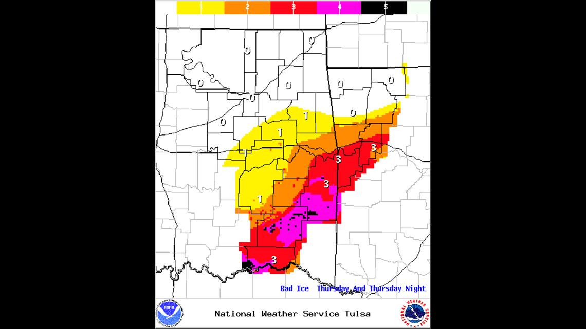
On the Sperry-Piltz Ice Index this is a Category 3 for the River Valley.

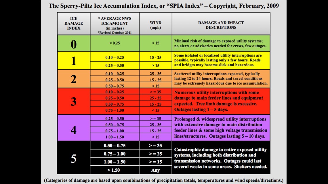
Here is what you can expect with an Ice Damage Index of 3.

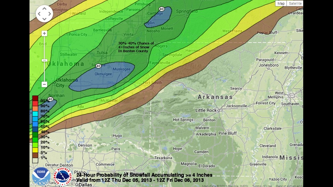
Snow Probabilities 4+Inches. Weather forecasting uncertainty is best expressed as a probability. There is a 30-40% chance snow will be over 4″ in Northwest Arkansas by Friday morning.

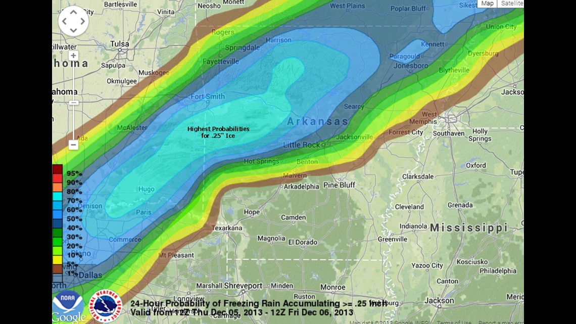
Ice Probabilities .25+: Since .25″ is the threshold for most power outages you can see the areas in blue are looking at a 60-70% chance of ice accumulating exceeding .25″ The blue bulls eye is where you can expect most outages to occur.
During the ice storm in 2009, I was able to communicate with viewer on Twitter and Facebook. We’ll do the same this time if you lose power. Also, you can watch our newscasts on 5NEWSonline.com on your mobile device through our App. At some point we will start a LIVE UPDATE Post to bring you conditions as they happen.
-Garrett