

It’s the last weekend before Christmas with many of you either heading out-of-town or doing some last-minute shopping. The weather is going to factor into all of your plans this weekend with another strong front arriving.
The general forecast is like this: A few showers on Friday with falling temperatures. Very heavy rain arriving mid morning Saturday and lasts nearly all day. Some severe storms will be possible in central and south Arkansas. The rain ends around midnight. Some light snow or flurries are possible Sunday morning with minimal to no accumulation.
Here is how the forecast is playing out graphically to help you better plan around the weather.

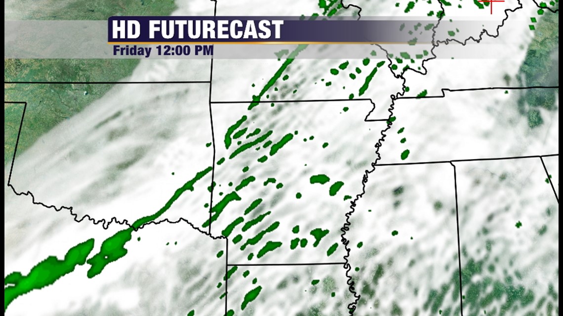
On Friday morning the thin ribbon of green signifies the cold front which is arriving from the northwest. Showers should be scattered with cloudy skies and falling temperatures.

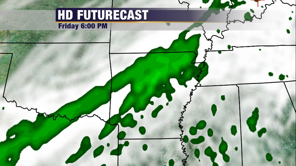
By Friday evening the rain coverage will increase as moisture is forecast over the front.

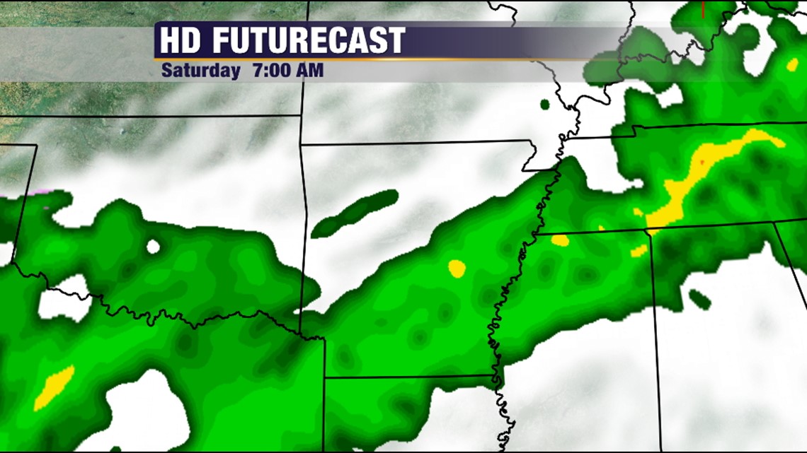
On Saturday morning, the heaviest rain will be lurking in the DFW area and about to press northwards. This will be the big soaking rain.

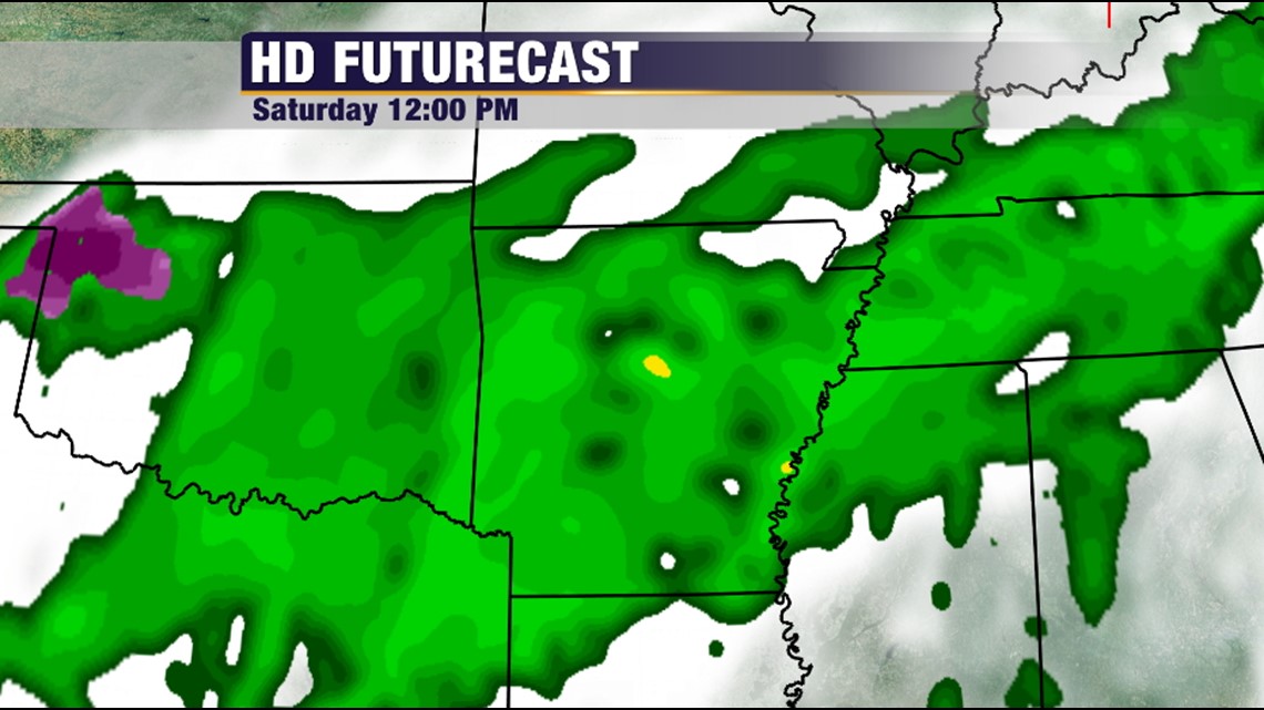
Noon on Saturday will be rainy with the even the possibility of severe weather.

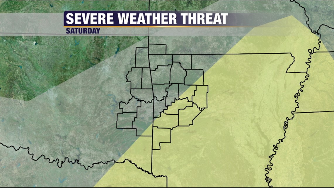
However, the highest severe chances will be in central and south Arkansas.

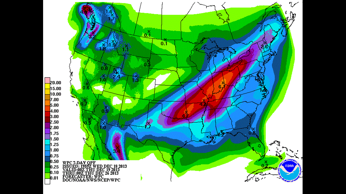
Rain totals could be excessive with some estimates around 4″ or more in our area.

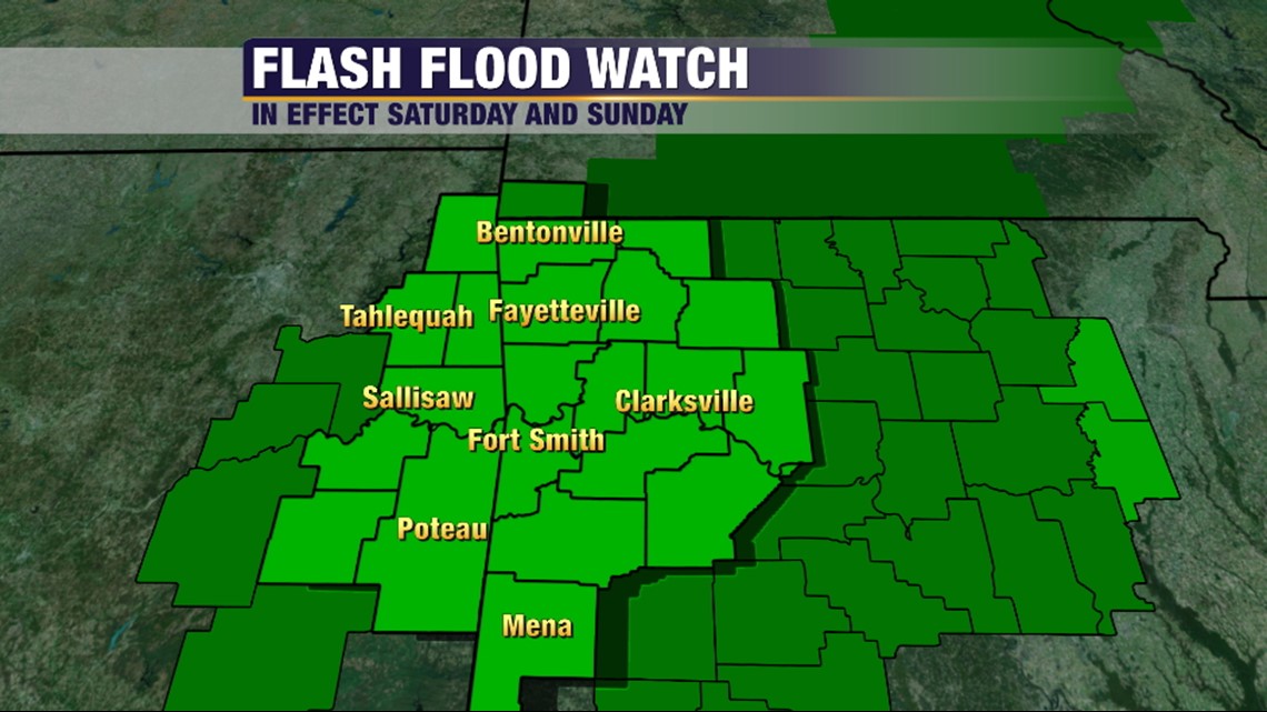
As a result, a Flash Flood Watch is in effect for the entire area.


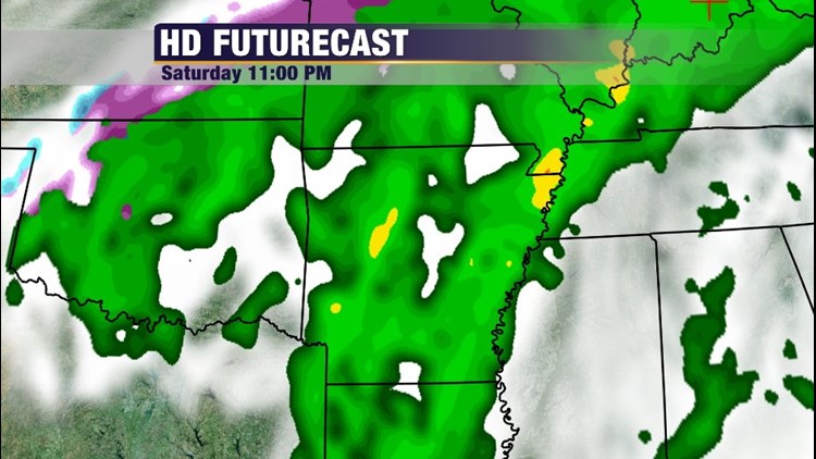
On Saturday night, the rain will be slowly down as dry air works its way into the low creating the dryslot over East Oklahoma and Western Arkansas.

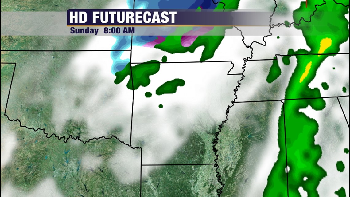
Finally, Sunday morning we’ll see wrap around rain and areas of light snow, it doesn’t appear it’s going to be significant and any accumulations look to be light.
-Garrett