
A strong cold front will move in from the north Saturday night that will bring accumulating snow and a big drop in temperatures.
Rain will develop into the evening and overnight ahead of the front then start to transition to sleet and snow.
Transition should begin around 10PM and midnight first for NWA followed by the River Valley and Ouachitas.
All areas should be transitioned to snow by about 5AM.
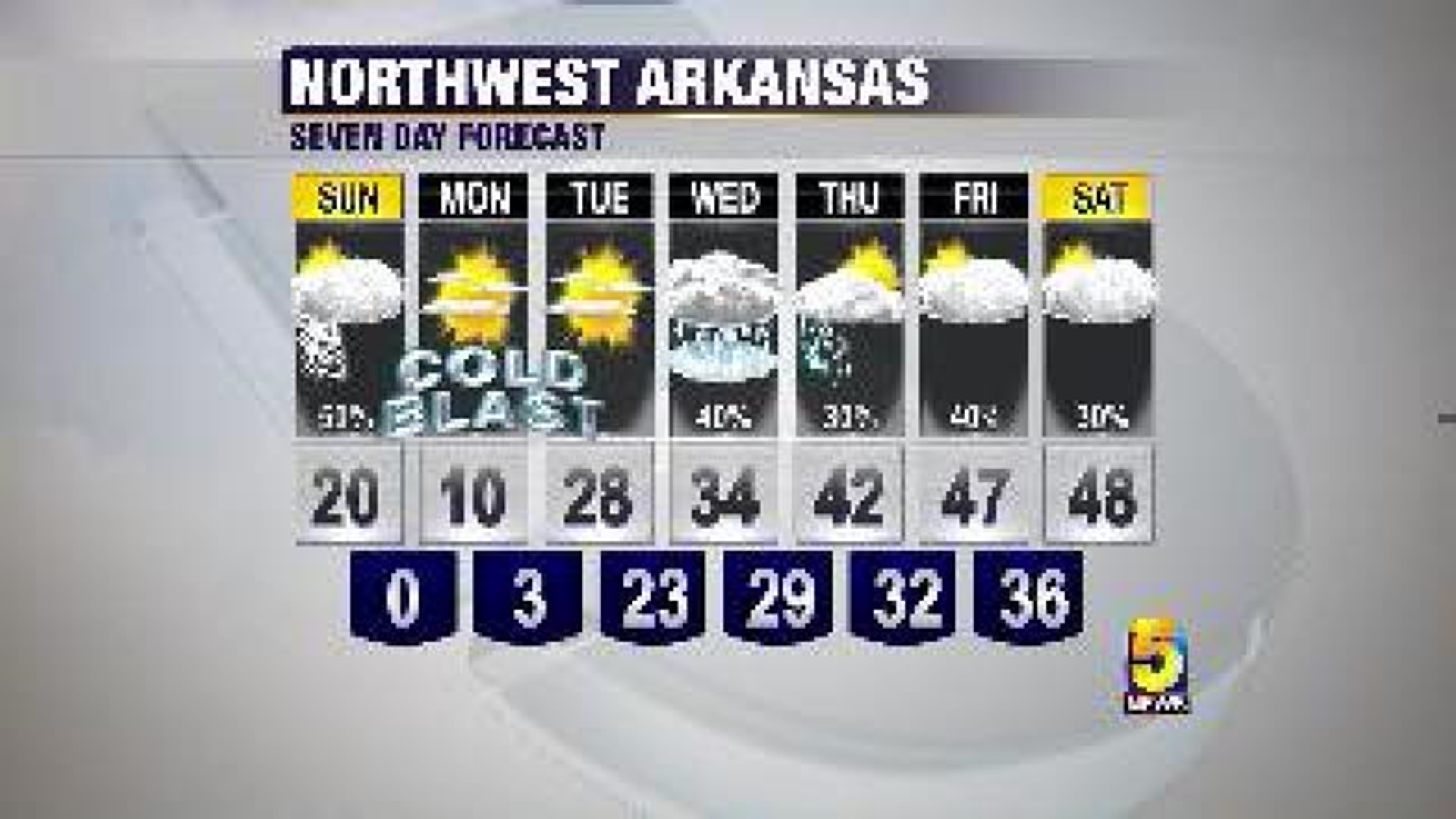
Snow will continue into Sunday morning with a dusting to 1/2" for the Ouachitas, 1/2" to 1" for the River Valley, and 1" to 3" across NWA with the upper amounts in the high terrain, and near the AR/MO border.
Very cold air moves in through Sunday and into early next week dropping lows into the single digits, highs only in the teens, and wind chill values between 0 and -20 at times.
Another chance for winter weather arrives around mid week in the form of freezing rain.