Light freezing rain and drizzle will continue to move across the entire area for the overnight into Thursday morning causing slick and hazardous road conditions.
The worst roads are expected from sunset to sunrise when temperatures will range from 29-33º. Since ice accumulation will be less than .25″ widespread power interruptions are not anticipated.
Temperatures should climb above freezing on Thursday by 10am causing rapid improvment on roads.

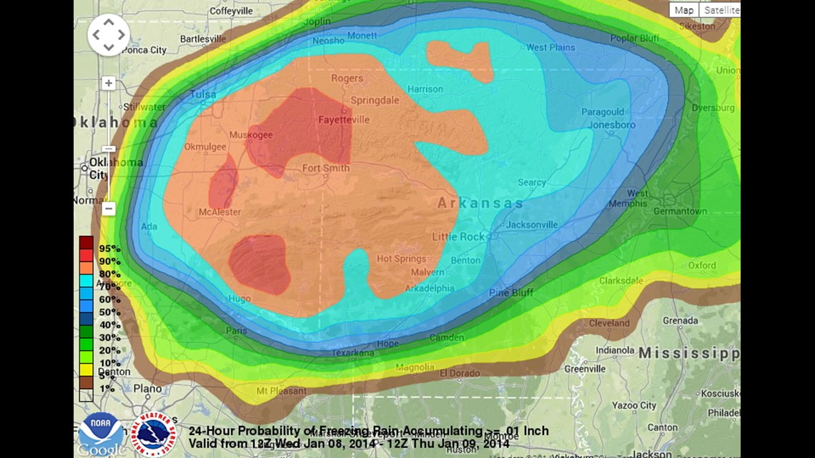
The above graphic shows the probability of around .01″ of ice for Wednesday night into Thursday morning. Note that the likelihood is greater than 80% for much of the area.

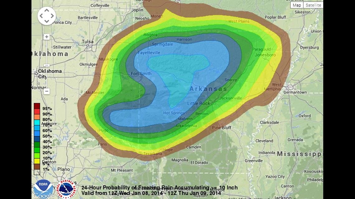
This image shows the probability of ice exceeding .10″ Chances are greater in Fayetteville and Fort Smith… but somewhat lower than Benton County due to sleet or snow mixing in with the freezing rain.

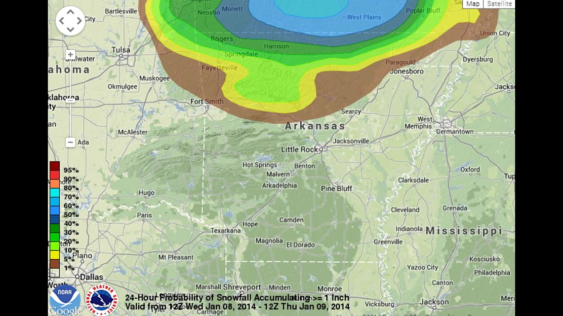
Snow chances are low, but there is a 20-30% chance of a 1″ snow near the Missouri/Arkansas border.

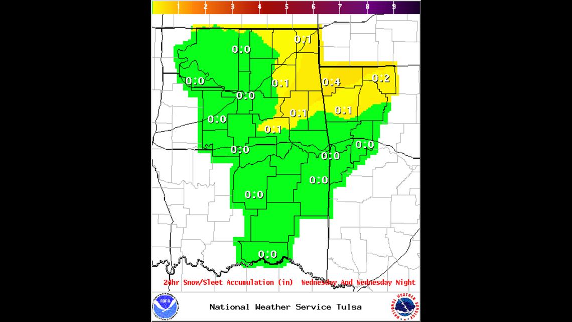
National Weather Service Sleet/Snow totals.


National Weather Service Ice Accumulation Totals.
We expect rapid improvement on area roads on Thursday as high temperatures are expected to climb into the 40s.
-Garrett