Several things to watch in the upcoming days.
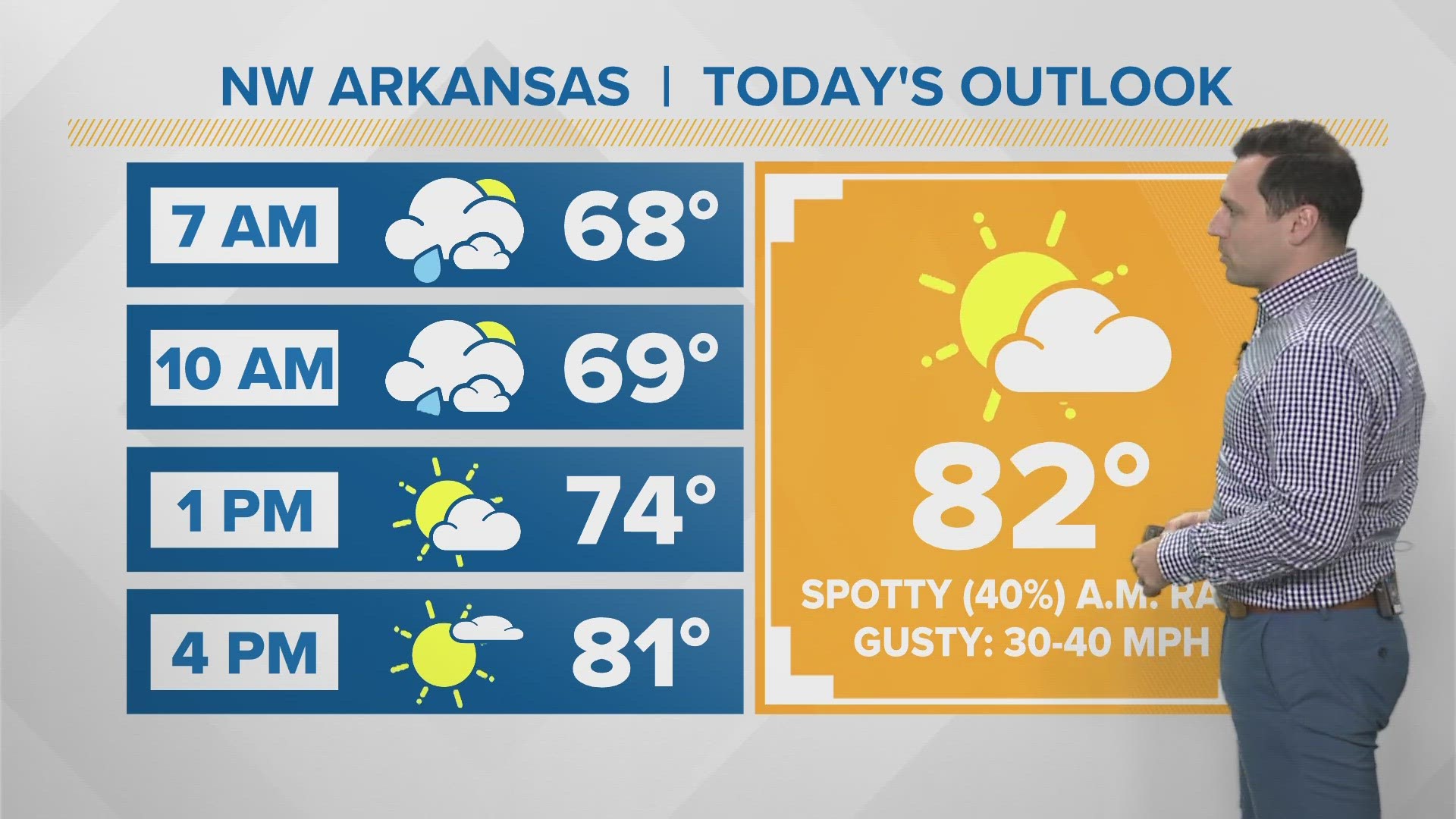
In the near-term, lows will be in the teens and 20s with mostly clear skies. A small warm up will take place from Thu to Saturday.

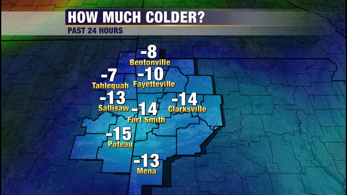
Temperatures are running around 15º lower than this time yesterday.
There first weather trouble could be on Friday morning. There appears to be a window for light freezing drizzle from 6am-9am which could affect morning travel. Temperatures in the afternoon quickly warm above freezing so no more winter weather concerns are expected until Sunday.

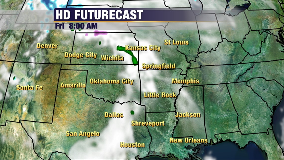
This is Futurecast early on Friday. Not much moisture to work with but temperatures will easily be below freezing so any moisture will cause slick spots on bridges and overpasses.
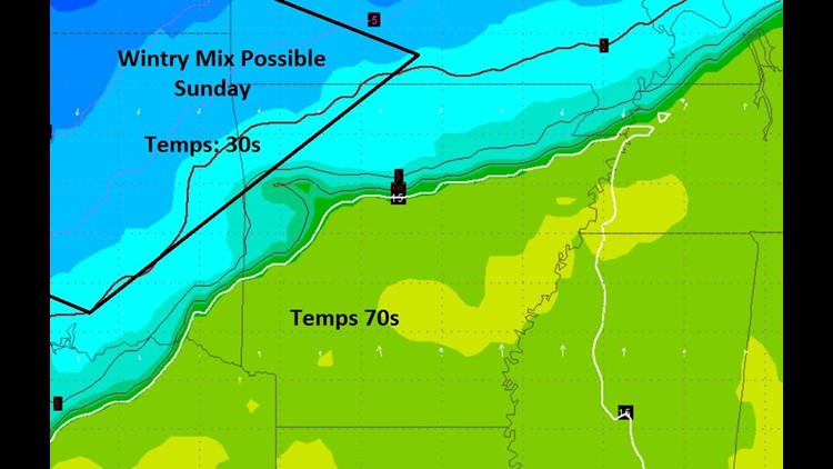
On Sunday, we’ll have a massive temperature gradient set up across the area with 30s in Northwest Arkansas and 70s near Mena. The shallow cold airmass will likely struggle to get over the Ozarks and the models are currently not handling this correctly. Lack of existing snow pack will also cause the airmass to modify before it gets to our area.

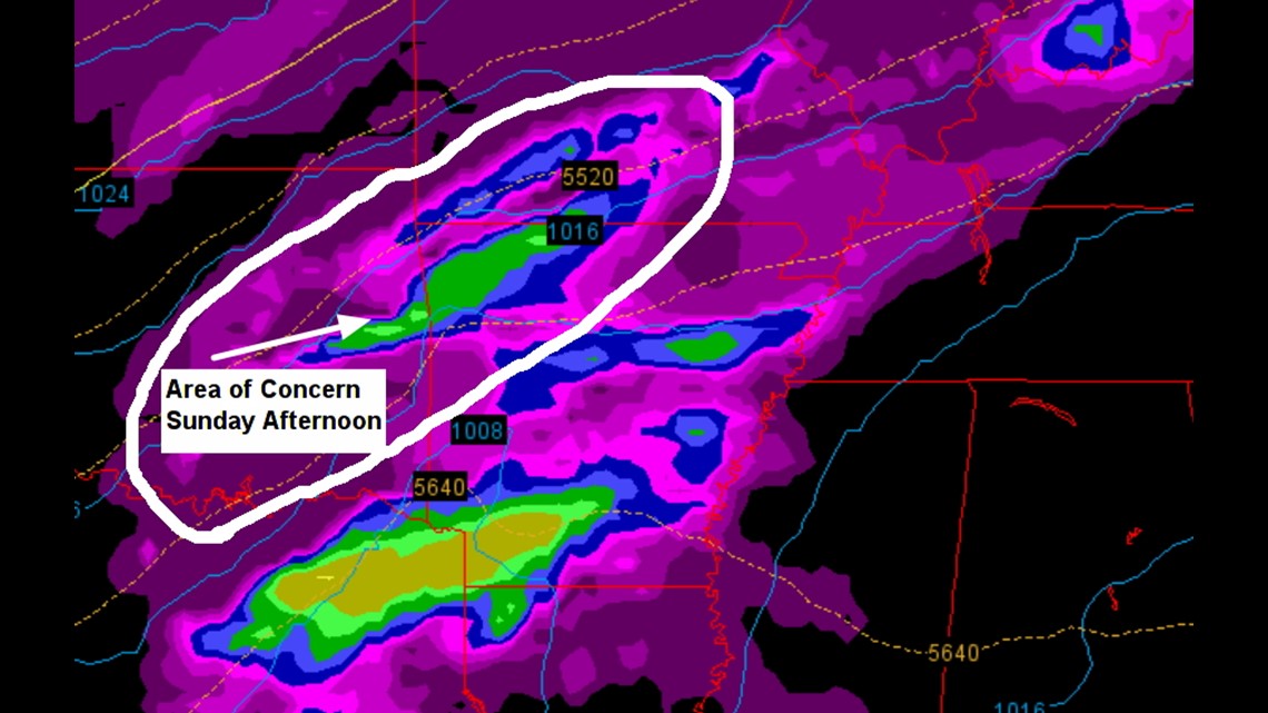
This image shows the area we’re watching for wintry weather. Depending on the depth of the cold air… anything is possible.

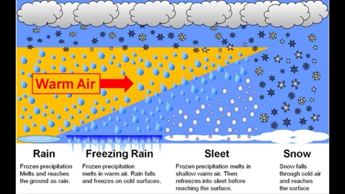
The depth of the warm air and the cold air will ultimately determine the precipitation type at the surface. Because the cold air is so shallow, it usually falls underneath most of the grid resolution for computer model forecasting. Because of that, there is usually very low confidence and high uncertainty regarding what will actually happen until about a day or two away from the event.
That said, it’s still super cold with warm air wedged in aloft which will set the stage for a wintry mix during the day on Sunday. The system now appears a little faster than it did this time yesterday. If you drew a line from Harrison, AR to the southwest to Sallisaw, OK I would expect the highest chance for winter weather impacts to be northwest of that line. This far out, confidence is very, very poor and until the system becomes better defined it’s anyone’s guess exactly how much of each precip type will fall. As of this afternoon, everything is still on the table; including the chance for 30º with freezing rain to occur in Benton County while 70º and thunderstorms are taking place in Scott Co.

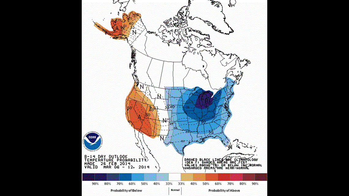
Below normal temperatures will likely continue into at least the first 1/2 of March. Spring officially begins on March 20th.
-Garrett