Another outbreak of cold, arctic will surge south; at the same time, warm moisture will overrun the cold dome of air causing widespread freezing rain and sleet.
The onset of the event will be very early Sunday morning. It should end by 8 or 9pm Sunday night. The heaviest is expected to fall during the afternoon hours on Sunday.
Road problems are anticipated and school cancellations are possible on Monday.
Temperatures may not climb out of the 20s on Monday of next week followed by cold temperatures all week long and another chance for snow around Wednesday or Thursday.
Ice estimates with this storm will range from .10 to .40″. Generally .25″ is the threshold for power outages so power interruptions are possible. Snow/sleet totals will range from trace amounts to 2″. Most locations will see around 1/2 inch.
To help you plan around the weather this weekend, here’s an early look at HD Futurecast. Keep in mind that some of the ‘green colors’ may contain freezing rain and sleet. While nearly all of the purple and pink colors will be frozen precip. The blue colors indicate snow.

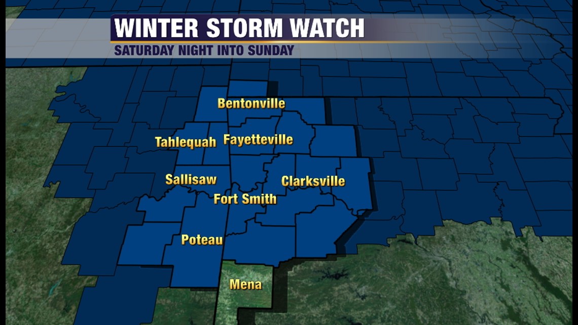
A Winter Storm Watch has been issued for much of the area. If the forecast remains on track, it’s likely this will be upgraded to a warning by Saturday; if not earlier. Notice that the watch has been exanded to include all of the River Valley.

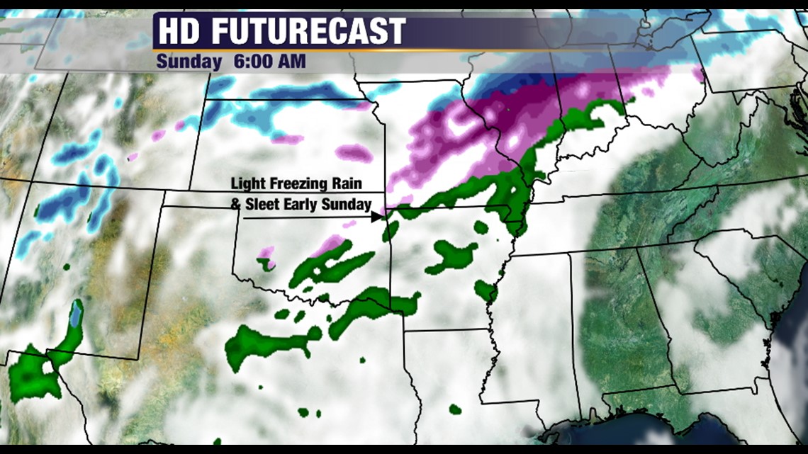
On Sunday morning at 6am we’ll see some of the freezing rain and sleet begin. Northwest Arkansas is favored to see it early.

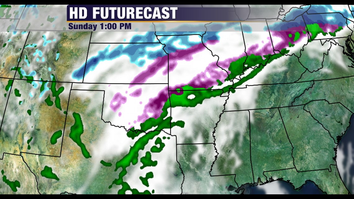
By 1pm, the freezing line will be advancing into SE Oklahoma and should fill up much of Northwest Arkansas. The reason it doesn’t flood into the River Valley is because the Ozarks will stall the shallow cold airmass and prevent it from spilling south into the Fort Smith.

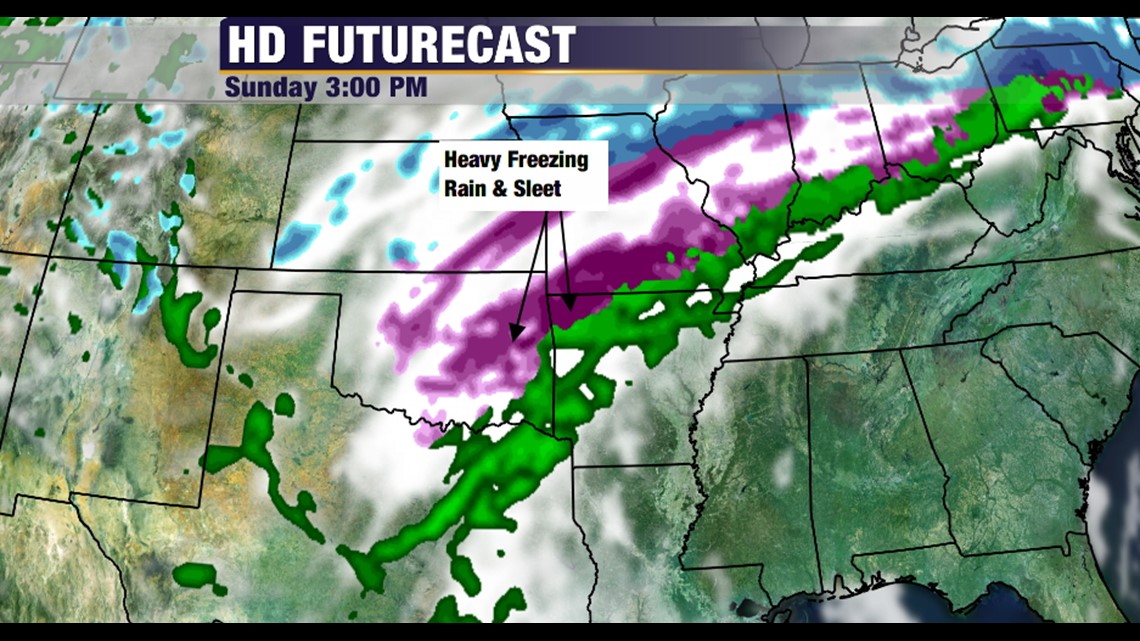
At 3pm: Heavy freezing rain and sleet will be possible across much of Bentonville, Fayetteville, Sallisaw, & Fort Smith. Cold air will struggle to mix into the River Valley and it could mostly be above freezing at Clarksville at this time.

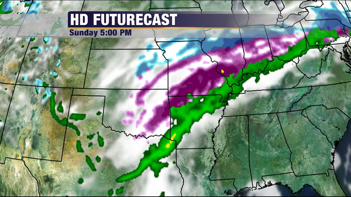
At 5pm: More freezing rain and sleet will be advancing south. Gusty northwest winds could cause power interruptions across the area.

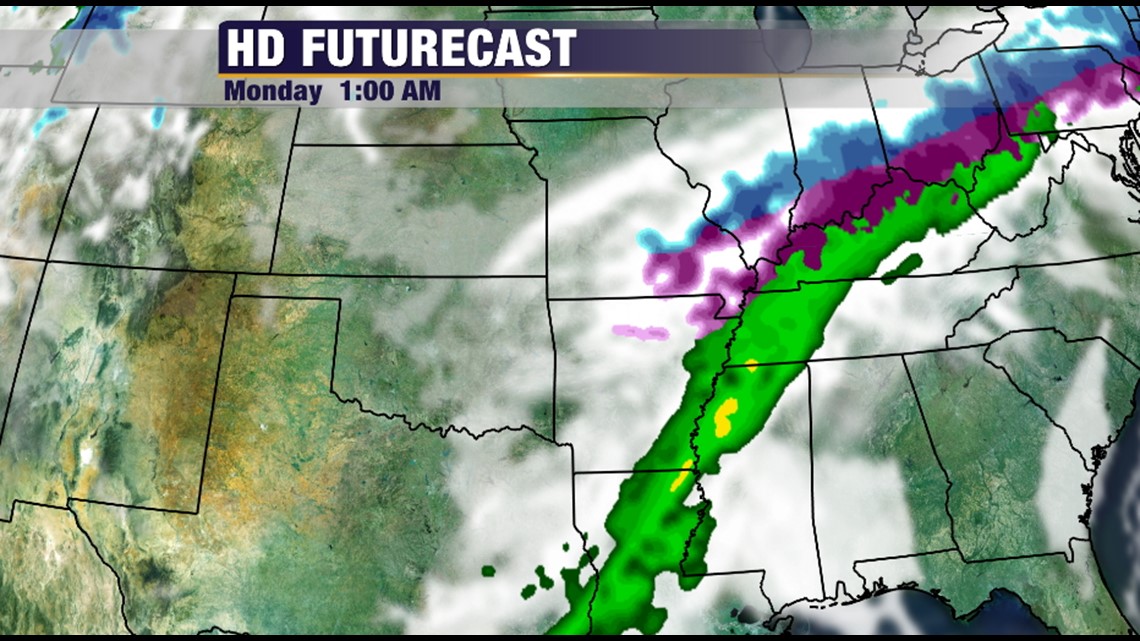
By Monday morning at 1am, all of the wintry precipitation should be out of the area but road conditions are expected to be hazardous into the day on Monday due to subfreezing temperatures. Very little melting will occur and roads could continue to be slick and hazardous into Tuesday.
-Garrett