New data coming in regarding the timeline of the upcoming winter storm. Some of the details may change in the next 24 hours. We’ll have team coverage Sunday morning as the event unfolds with developing updates all day long.

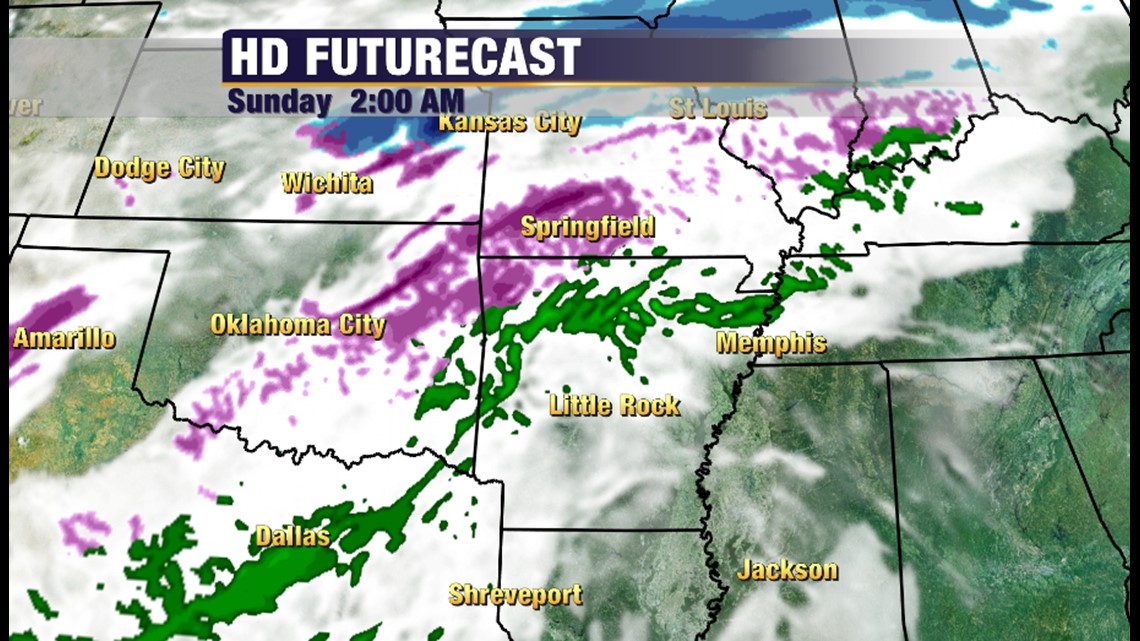
2am Sunday, First round of freezing precipitation moves in. Should be a mixture of sleet and freezing rain in the purple colors.

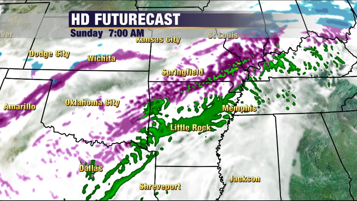
By 7am, Northwest Arkansas should see sleet and freezing rain. In the River Valley it may change back and forth between rain and freezing rain early in the day. This event really ramps up late morning and early afternoon.

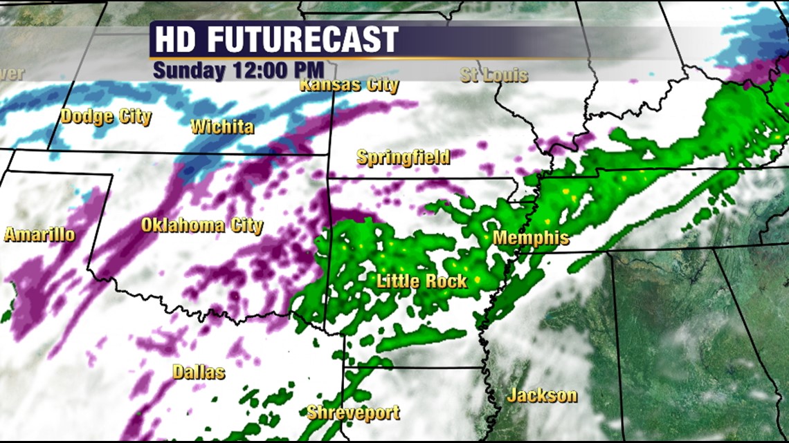
At Noon Sunday, more freezing rain than rain will be falling the in the River Valley with sleet in Northwest Arkansas.

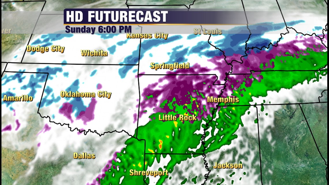
At 6pm Sunday-when the sun is setting-nearly all of the precipitation will be sleet or freezing rain.

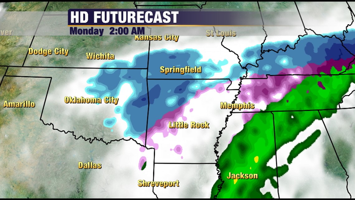
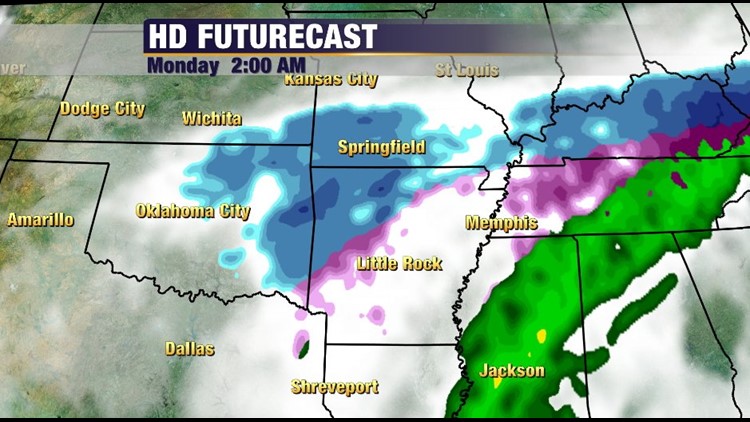
At 2am on Monday morning, a fairly wide area of light snow should blanket the area and exit around by 6am, but snow on top of ice and sleet should make for poor driving conditions areawide.
-Garrett