The ingredients for a multi-state tornado outbreak are coming together for this afternoon and this evening.
Storms will develop along an approaching dryline and will quickly begin to rotate. Any discrete supercell storms will have the potential for large hail, damaging winds, and tornadoes. The tornadoes risk will shift east later this evening.
Timing: Most hi-res data indicates that storm initiation will take place between 2-3pm with storms affecting our area (both Northwest Arkansas and the River Valley) from 3pm-7pm.


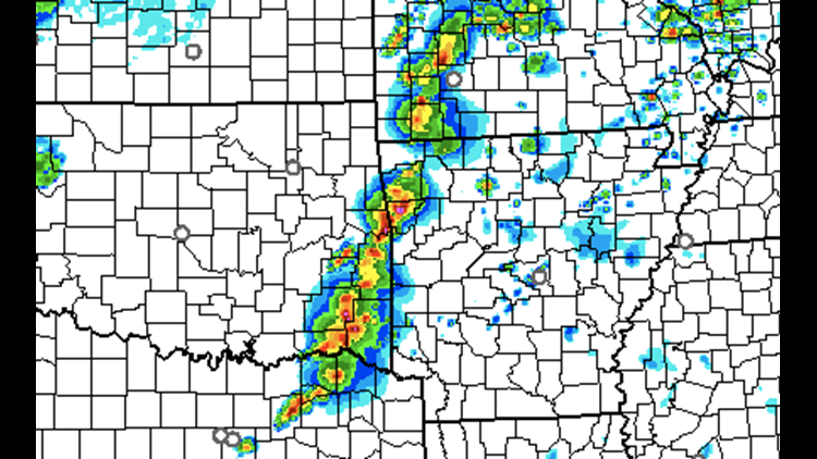
This image shows the HRRR models depiction of supercell storms during the 4pm hour.

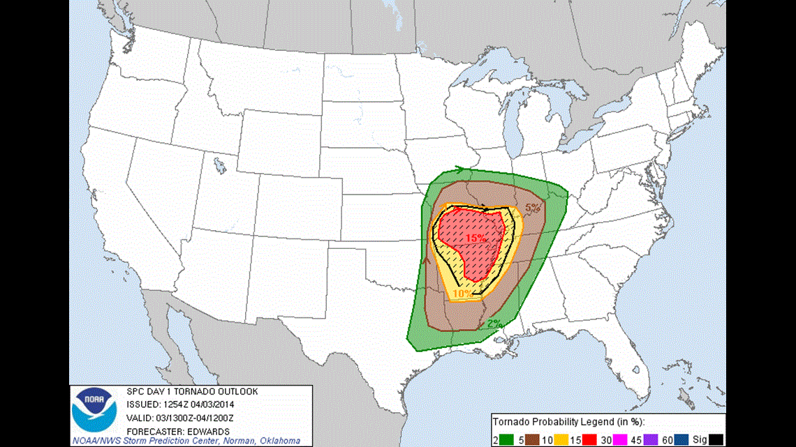
This image shows the Storm Prediction Center’s tornado risk probabilities. Although the highest chances are in NE Arkansas. The outbreak of storms will start in our area and move east from there.
No storms are expected overnight as cooler and drier air moves in from the north.
-Garrett