There is a high-end severe weather event for all of the 5NEWS viewing area as well as most of Arkansas for this afternoon.
This is the highest severe weather risk we’ve seen in the last 2 years.
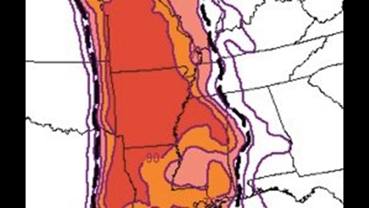
(The image above shows the Significant Tornado Parameter for Sunday late Afternoon; all of Arkansas and most of Extreme Eastern Oklahoma are at risk for strong, long-track tornadoes.)
Large hail, bigger than golfball; and possibly up to baseball size is possible. Winds within thunderstorms could gust up to 90 mph and any tornadoes will not be brief spin-ups; but, instead long-track tornadoes capable of EF2 or larger damage.
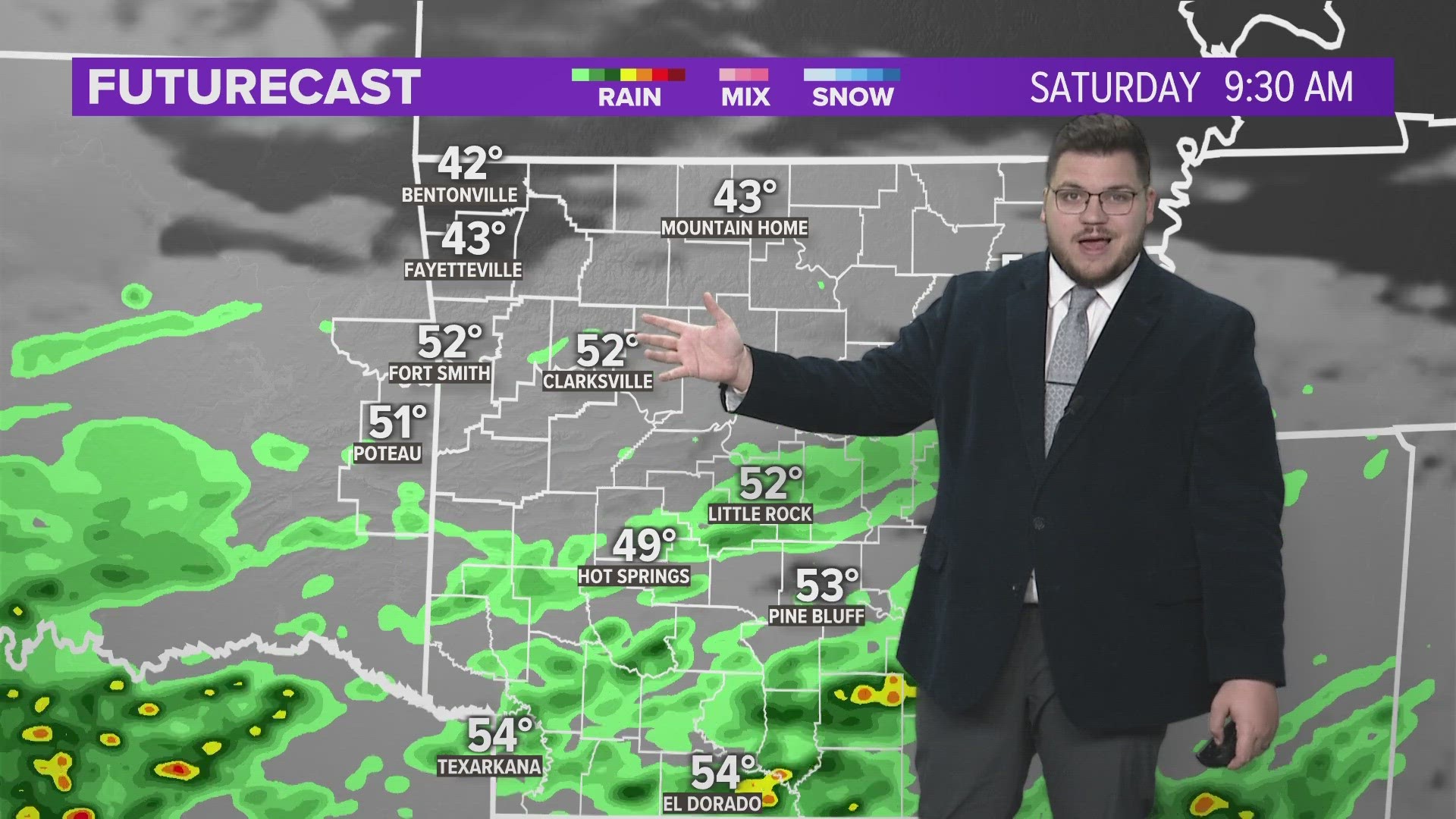
Early on Sunday we may see a few thunderstorms develop in the morning around 8am. These storms could be severe and contain winds up to 70mph and golfball size hail but the larger risk will hold off until Sunday night.
Sometime around 3 p.m., a surface dryline will mix into eastern Oklahoma with an extremely unstable airmass in place (think of a beach ball at the bottom of a swimming pool).
Because of the extreme buoyancy, storms will quickly become severe with large hail likely. As the updrafts of the storm mature, rotation is likely with a few strong to violent tornadoes possible as early as 4pm and lasting through 9pm.
Now is the time to prepare for severe weather. If you wait until a Tornado Warning is issued it’s probably too late.
Mobile homes should be abandoned for more secure shelter. Large open spaces like department stores or gymnasiums should be avoided if warnings are issued. Generally, it is not safe to try to outrun a tornado in a vehicle.
Cell phone streaming has been enabled for you to watch coverage on your phone if you lose power.
5NEWS will air extended coverage as Tornado Warnings are in progress with live reports, & storm chasers gathering images from the field. You can report to by sending your pictures and reports to ipix@kfsm.com or to any of our Twitter pages: @5NEWSGarrett, @5NEWSJoe, @5NEWSTyler, & @5NEWSShelby.
-Garrett