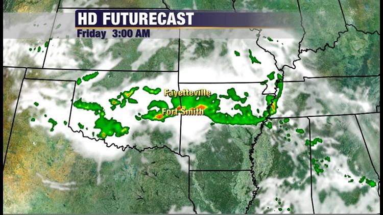
Frequent overnight storm complexes will affect the area for the next several days. The best chance for rain will be overnight and especially from 2am-6am with each of the storm complexes that develop. This pattern will continue for at least the next 3 nights. Damaging winds will be the main risk with at least a small risk for an isolated tornado to develop in the comma shaped northern side of the complex.
The storm complexes develop along a stationary boundary on the northern side of an early summer high pressure ridge. Technically, they can be referred to as an Mesoscale Convective System or Progressive Derecho depending on the spatial extent and intensity. This is very common in June and often provides us with the last heavy rain before the summer months are in full swing. The complex of storms often contains winds of at least 60mph and often quarter size hail. There’s at least a small risk for a tornado, but tornadoes are somewhat uncommon with these systems and typically only occur on the northern edge of the line. They’re usually weak and brief.
The pattern is a terrible to plan around if you’re going to be outside. For those of you attending Wakarusa be aware that severe wind gusts will be common nightly and cell phone reception is poor in the Ozarks.
At least some afternoon development will be possible each day in the late evening but the greatest chance for rain will be overnight and early in the day.
The rain chances will continue until at least the early part of next week with nearly 6″ of rain possible when it’s all said and done.
-Garrett