The jet stream will once again take an unusual plunge to the south sometime early next allowing cooler than normal air to bleed south across the central and Eastern United States. The amplified pattern (with lots of high ridges and deep troughs) has been dominate this summer and it’s kept the heat in check. Neither Fort Smith or Fayetteville have officially hit 100º and depending on the strength of the next front; this could be one of the coldest July’s on record for Northwest Arkansas. The unusually cool weather is due-in part-to the position of landfalling typhoons in the west Pacific which have been phasing with the polar jet and causing a more ‘wavy’ jet stream pattern than in years’ past.


This temperature map is for tomorrow morning. When we forecast temperatures we often look at 850mb which is about 5,000ft above the surface since it’s removed from the localized effects of daily heating and cooling. Notice all of the deep reds and purples across the central part of the country.

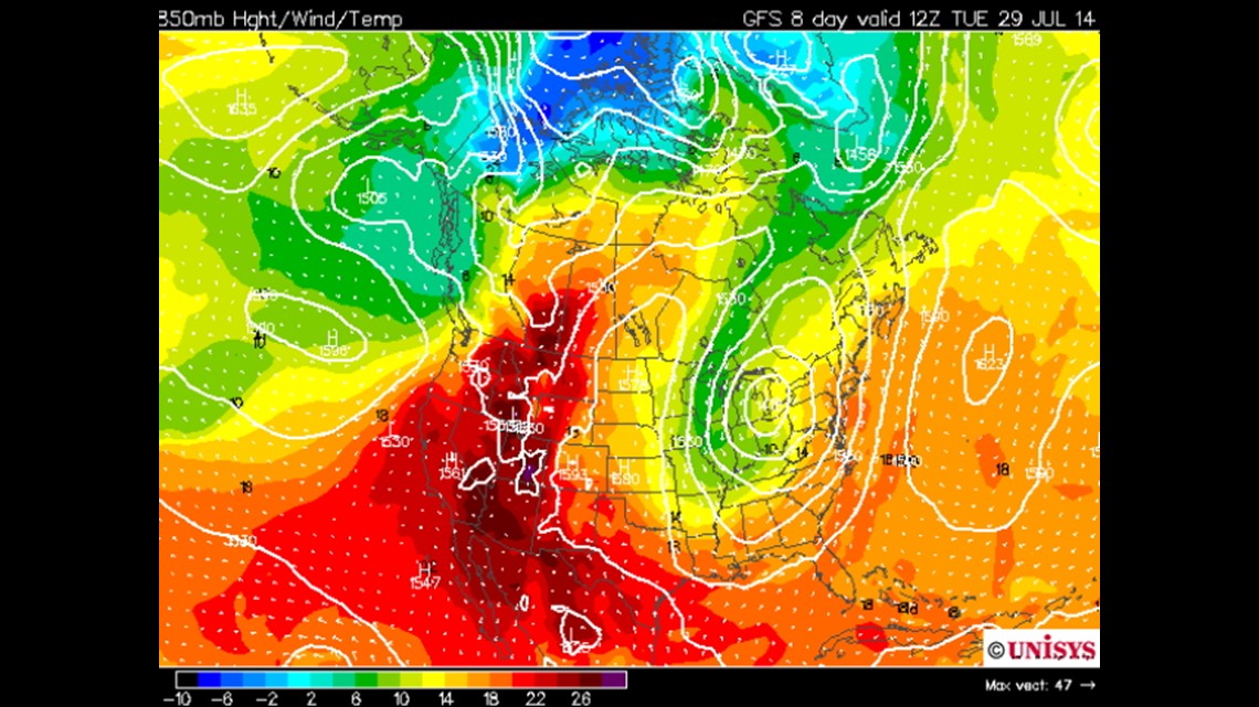
Compare the first image with this image for next Tuesday. Another large trough will move across the Great Lakes and spill the cool air south with cooler than normal air expected to wrap up July. Instead of highs in the 90s, it looks like we’ll see highs back down into the upper 70s and low 80s which is around 10-15º below normal for this time of year.

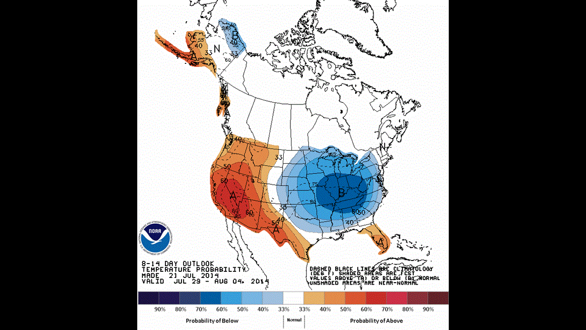
The latest map from the Climate Prediction Center released today (Monday July 21st) is also pointing towards a high probability cold snap for the end of July and early part of August.
-Garrett