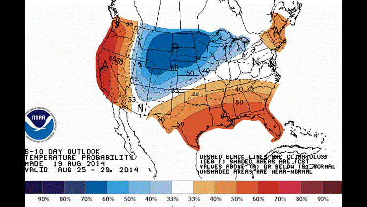
Hot weather will be the dominate weather feature for the next week. The latest Climate Prediction Center forecast shows higher than normal chances for warm weather for the next 6-10 days.

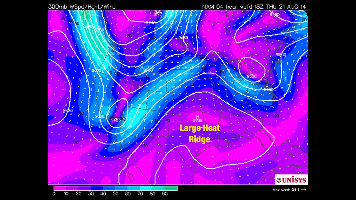
This image is the 300mb chart which represents the jet stream in the upper part of the atmosphere. You can see a large trough digging into the west coast with a ridge extending all the way north into Missouri and Illinois.
Long-range models suggest that the ridge will break down around the first of next week which will lead to rain chances and slightly lower temperatures sometime around August 25/26.
In the meantime, we’ll see highs in the 90s with a heat index in the low 100s. It’s possible a few of us could touch the century mark late this week or this weekend.
-Garrett