There will be two brief windows of freezing temperatures to allow for light freezing rain this weekend. This could affect travel, particularly on Sunday morning with somewhat of a lower chance on Monday morning.
Southwest winds will return above us this weekend from about 900 to 5,200ft. In that layer, temperatures will get as warm as 45º. Closer to the surface, temperatures will be from 29-31º. This is borderline for ice accumulation, but cold enough that any liquid (no matter how small) will cause traffic issues.

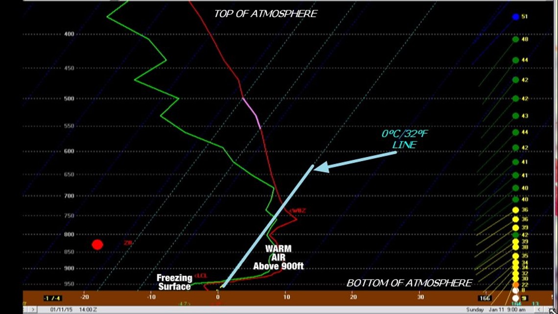
(This diagram shows the vertical profile of the atmosphere for 9am on Sunday. Freezing temperatures will be at the surface with a warm layer of air aloft.)
As far as the timeline goes, temperatures could be below freezing with light icing possible in Northwest Arkansas from 3am to 11am Sunday.
In Fort Smith, the time to watch is 5am to 9am.

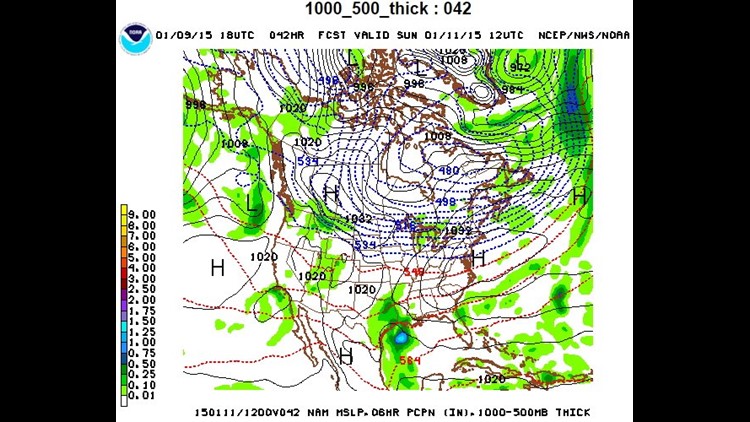
(This map shows the amount of precipitation. Thankfully, if we do see ice, it’ll be very light. Somewhere in the .10″ or less range)

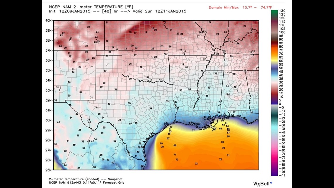
(Temperatures Sunday morning at 6am will be very close to freezing)

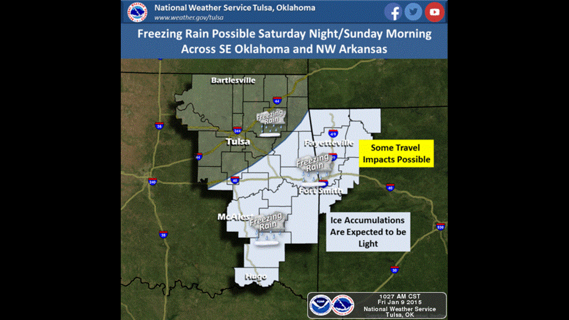
(This graphic from the NWS Tulsa shows the favored locations for light ice accumulation, it is likely a “Winter Weather Advisory” will be issued)

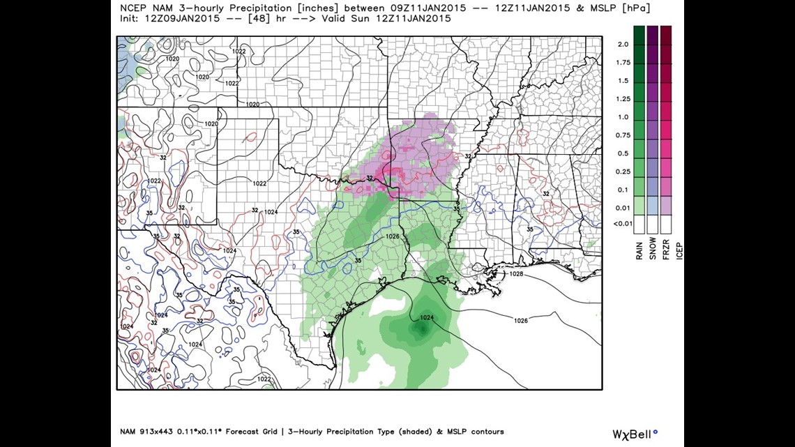
(This map shows precipitation type and location. Sunday morning strongly favors freezing rain with the best chances in SE Oklahoma/West Central Arkansas)
Another chance for light freezing rain will be possible early Monday but temperatures should be a bit warmer which will limit any ice accumulation. However, any ice, no matter how small could cause a few slick spots.
-Garrett