**A Winter Storm Warning is now in effect for the entire area**
The timing has not changed much; most of the precipitation should start around 6-8pm Sunday and continue until Monday morning at sunrise. Widespread slick and slow roads are expected. School cancellations will be possible Monday morning. Road conditions will improve by Monday afternoon with sunshine and slightly warmer conditions. Rural areas may continue to see slick roads into Tuesday.
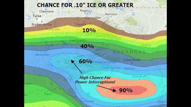
Here is a look at the most favored areas for accumulation including power outages.

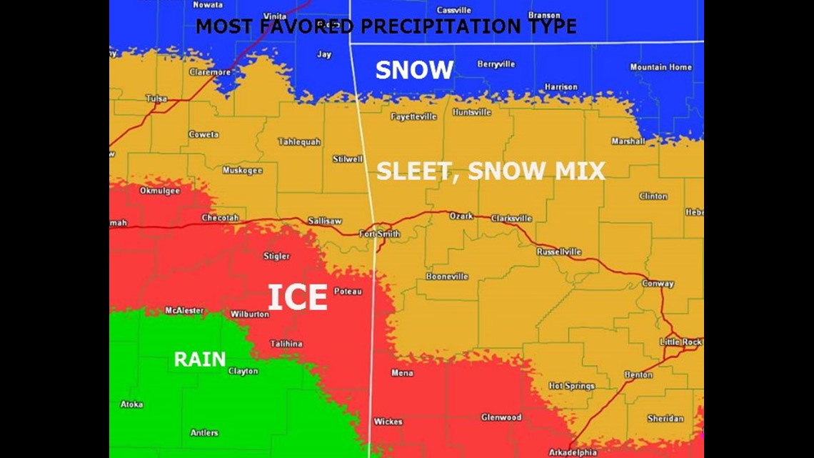
Early model runs this morning suggested the dominate precipitation type in Benton Co to be snow. From Fayetteville to Fort Smith expect a sleet-snow mix. In Poteau, expect mostly ice.

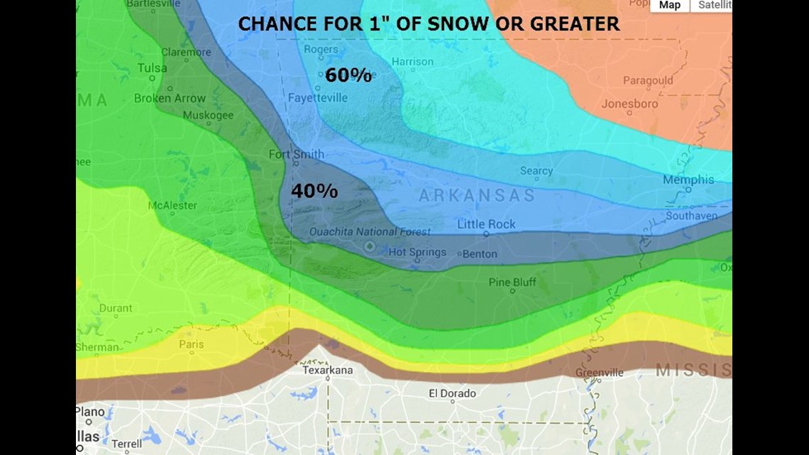
Here are the probabilities for 1″ of accumulating snow or greater. The greatest chance is in Eastern Benton & Washington Co. Sleet will most likely dominate in the Fort Smith area. Benton County will see the most snow.


Power interruptions will be likely in south Arkansas. The greatest chance locally is in south Sebastian Co, Leflore Co, Logan Co, & Scott Co. This includes: Poteau, Mansfield, Greenwood, Booneville, & Waldron. There are some indications that the ice may need to be adjusted farther north.

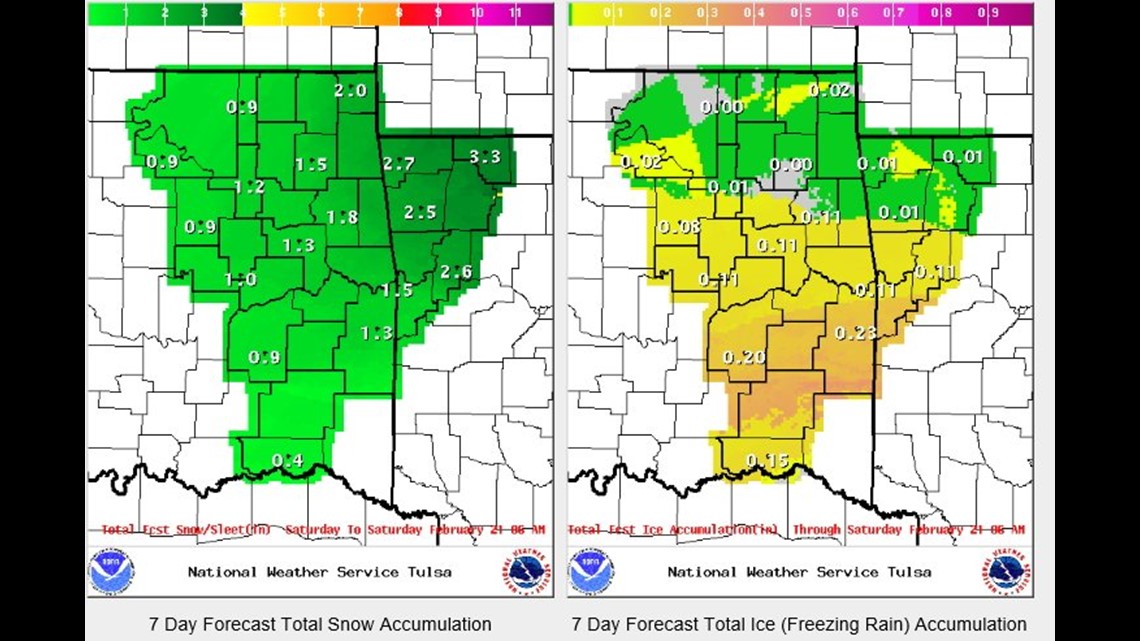
Several things affect accumulations, this is the estimate from the NWS Tulsa. Note how ice accumulations increase south of Fort Smith with the greatest snow potential in Benton Co.
More updates coming as the winter storm gets closer…
-Garrett