The cold front has swept across the entire area with temperatures much colder than yesterday. Overnight, lows are expected to be in the 30s and may get as low a freezing from I40 and north. Expect sunny skies on Saturday with highs in the 60s and high pressure overhead. After a pleasant and dry Easter sunrise, another quick system will arrive on Sunday bringing some rain chances in the afternoon and evening but no severe weather is expected. Here’s a look at how the weekend will unfold.

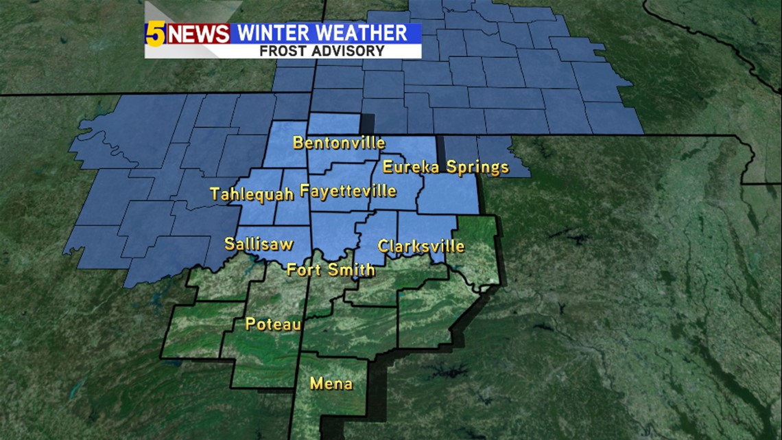
A Frost Advisory is in effect for the most of Northwest Arkansas. Temperatures will range from 31º-37º around sunrise. Not a hard freeze but if you’ve planted some annuals, it’s probably a good idea to cover them tonight.

Saturday: High pressure will be directly overhead with light winds and full sunshine expected. Highs will range from 61º-66º. It will be an excellent day!

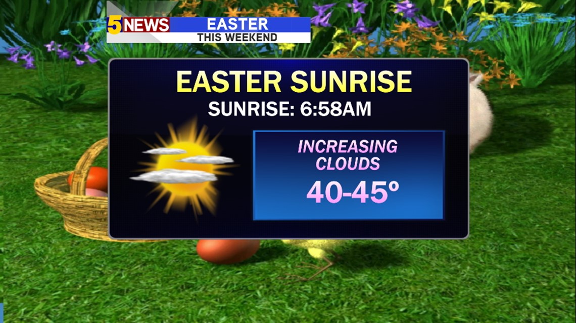
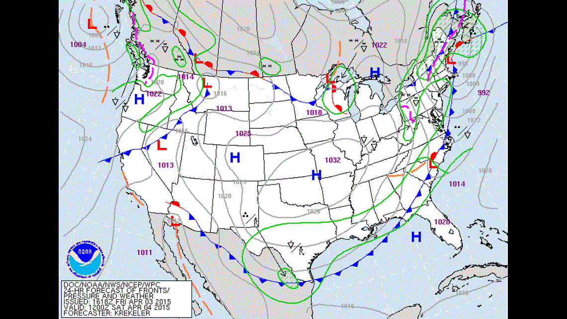
Easter Sunrise: The upper air system will be passing across Texas with increasing clouds across the area. Temperatures will be cool in the 40s. Rain will hold off into the afternoon.

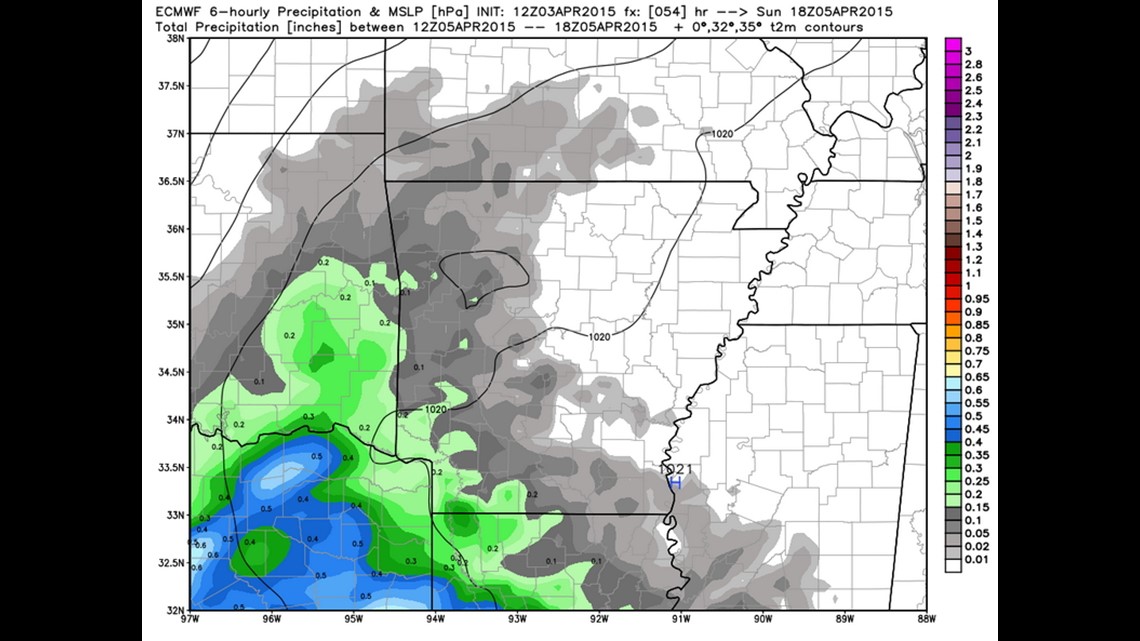
Sunday: Rain is likely around early afternoon and into the evening. This image shows where the rain could be located at 1pm on Sunday. The heaviest will be to the south with lighter amounts to the north. Expect cloudy skies into the evening with temperatures in the upper 50s to near 60.
Frequent rain chances will continue into next week with more a stronger system towards the end of the week.