
A large upper low pressure system that is cut-off from the jet stream continues to give us below normal temperatures, cloudy skies, and frequent rain chances. This low will leave the area on Wednesday with a break in the rain on Thursday before another (and similar low) arrives over the weekend.
The weekend system will be similar with overcast skies, low severe weather risk, cool temperatures, & occasional heavy rain. This system will exit around Monday of the upcoming week.
The next risk for widespread severe weather could be around April 23rd; around the end of next week.
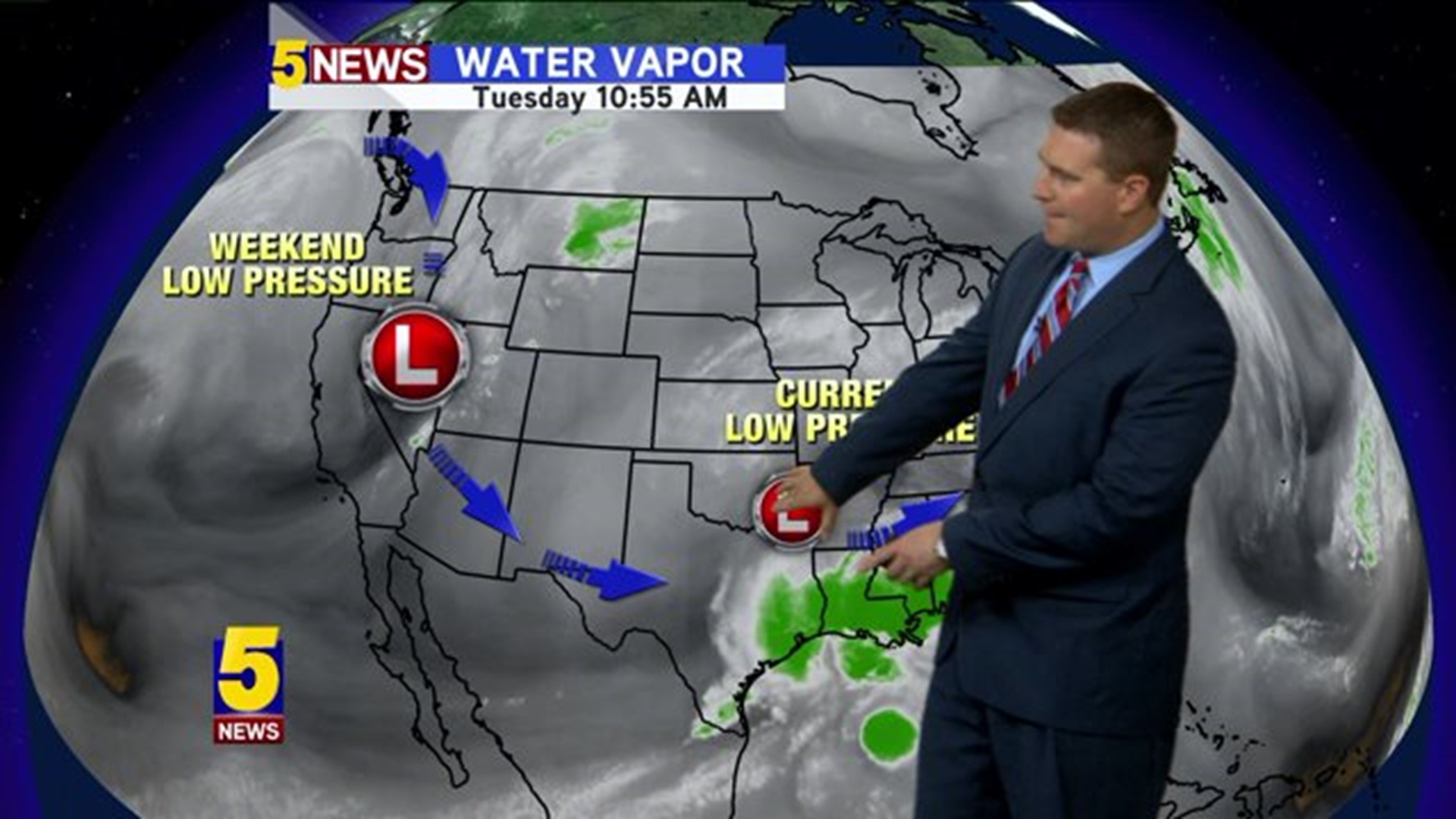
Here's a look at what's happening;

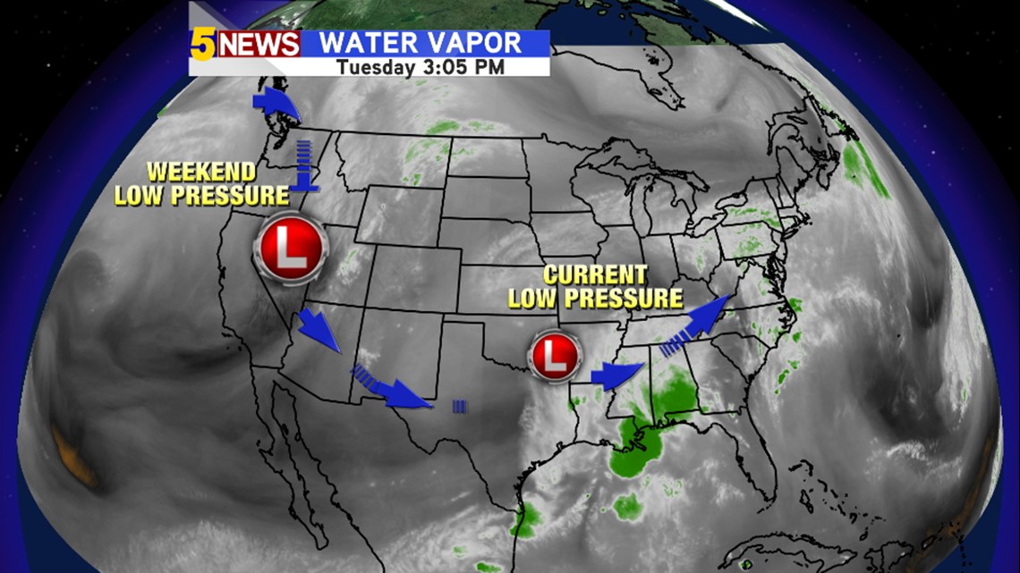
You can see the current low pressure system continues to drift east, because it's detached from the main flow... the movement has been slow. Another system is already developing in the Pacific Northwest and will affect us for the weekend.


This snapshot is for Friday night. Notice the jet stream down at the bottom of the image. This is the subtropical jet and it's pumping rich moisture from the Pacific Ocean over our area. The low pressure is also removed again from the Polar Jet to the north. The result will be heavy rain, cloudy skies, and more cold temperatures. For severe weather, it would make more sense for the low to be attached to the polar jet (as is usually the case in Spring). Because it's not, the risk of severe weather will be low again for the weekend.

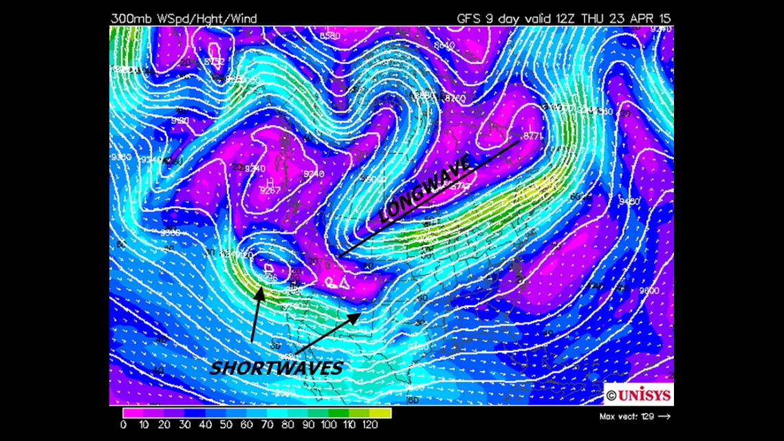
This image represents what the jet stream winds could look like around April 23rd. Notice that the influence of the subtropical jet us less and the polar jet is positioned farther south. The longwave trough would indicate a cold front is likely. The shortwaves moving across the southwest would likely aide in the development of surface low pressure and the upper flow is more favorable for severe storms around this time with the longwave eventually ushering in some cooler air around the end of the week.
-Garrett