In the short-term, summer like weather will continue with highs nearing 90º across much of our area. The heat index will be in the mid 90s.
This weekend, expect a few scattered showers Saturday from a disturbance moving in from the east. The better rain chances will be closer to Little Rock & Jonesboro and even then the rain chances are small. Chances of rain will be fewer on Sunday.
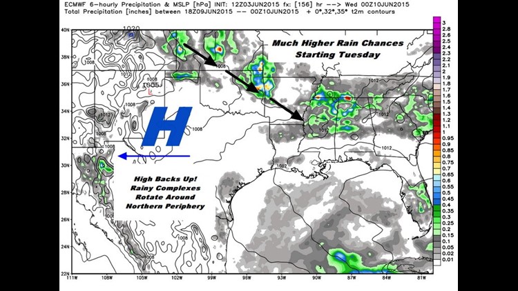
Long-term, the high pressure center will shift to the west and back peddle to the four corners area. Since the showers and storms will follow the periphery of the high, our area will have a much much better chance of showers and thunderstorms.
Here’s a look at some of the model data I’m looking at tonight as well as how the pattern looks from the big picture.

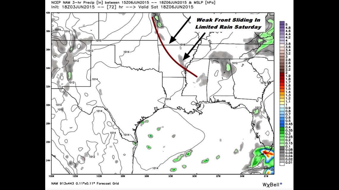
Saturday: There’s a weak disturbance moving in from the east. You can see how the models are generating a little bit of precipitation and with high humidity and ample daytime heating… it’s a good bet showers and thunderstorms will be developing in the afternoon/evening by late evening.

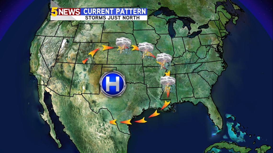
The current position of the high will favor showers and thunderstorms rotating around the high in Missouri and Kansas.

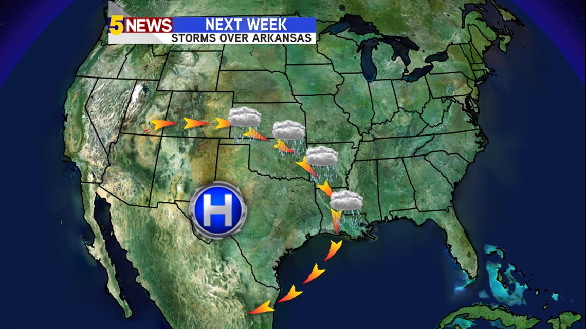
Next week, the high will move west and we’ll see far greater chances of storms in our area.

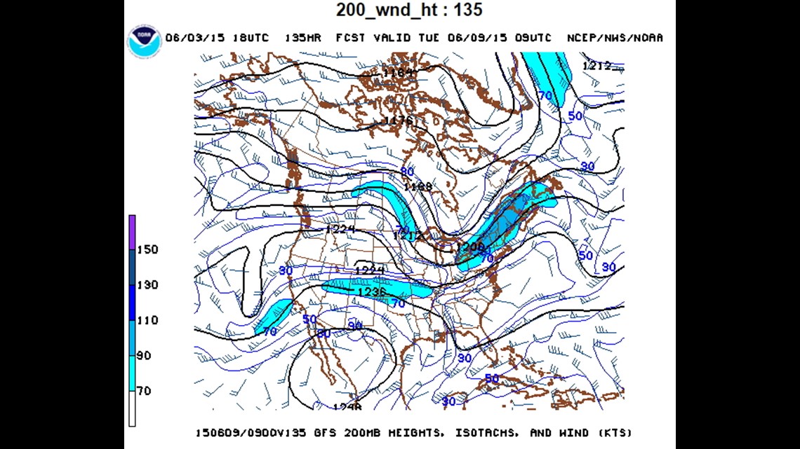
This is a model forecast for next week. You can see some stronger upper level winds rotating around the northern part of the high. We may actually see at least a small chance for severe weather with the greatest risk being damaging winds.


This is next Tuesday evening (June 9th). You can see the showers taking aim on our area as the high retrogrades westward.
In short, summer like now, rain next week, and a mostly clear weekend.
-Garrett