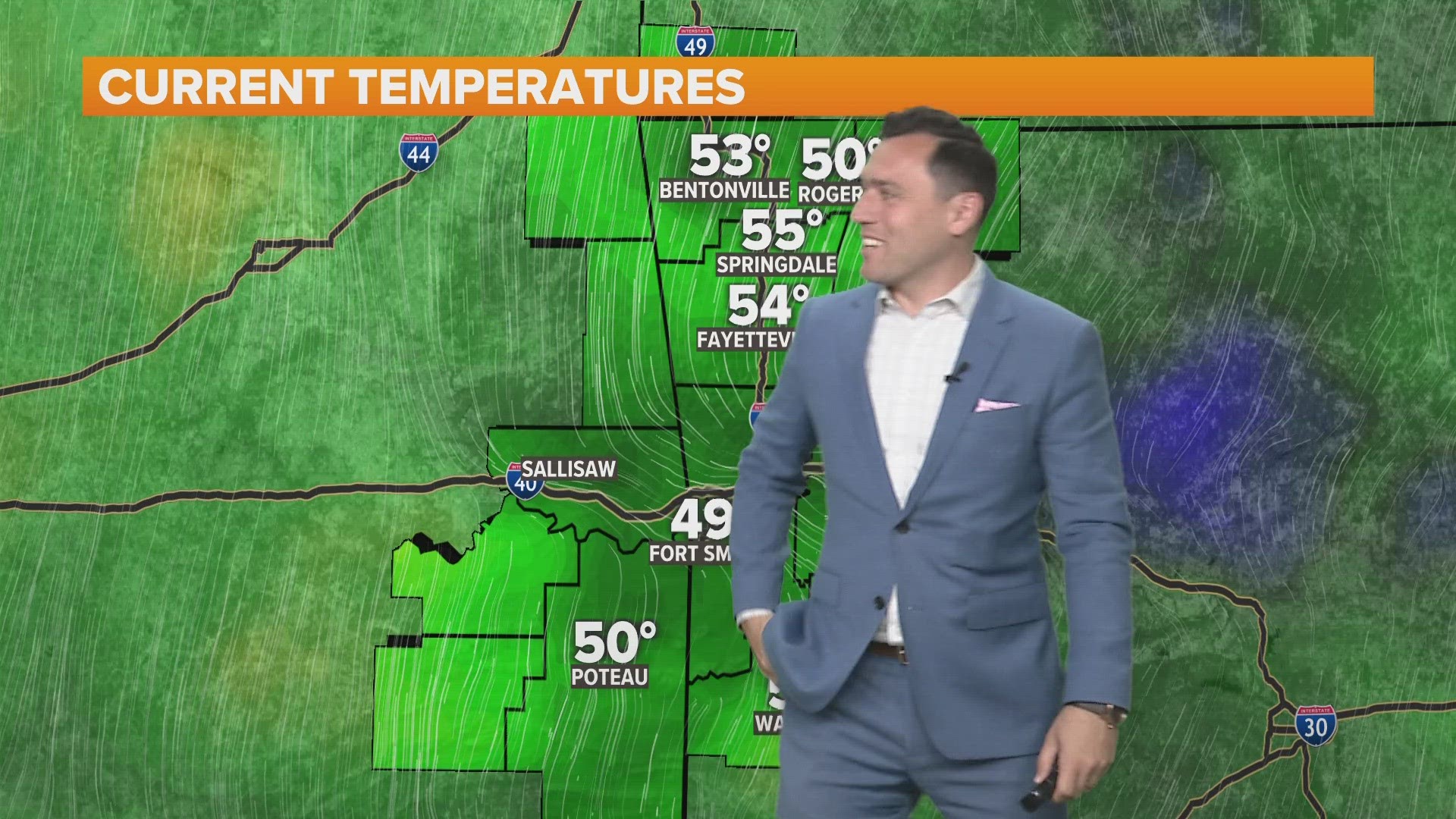


After a week of sunny weather and warm temperatures, the weather pattern is about to be active again for several days.
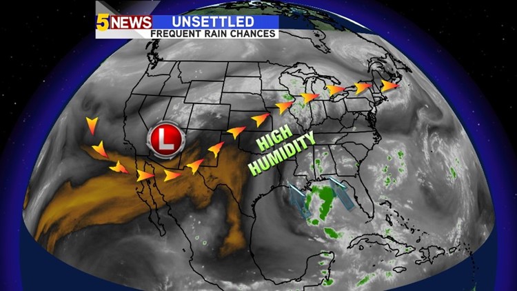
A slow moving upper low will press into the south-central plains over the weekend. The heaviest rain will remain along path of the jet stream and on the northern edge of the ridge of high pressure.
A large influx of moisture will be moving in from the Gulf of Mexico. The combined result will be frequent rounds of showers of thunderstorms each day with the highest concentration in the late afternoon and early evening.
The risk of severe weather will be limited but a few strong wind gusts will be possible with the more intense storms. Hail to dime or possibly quarter size is a possibility but most of them will be below severe limits. Rain will be very heavy rain with all of the storms due to the tropical nature of the airmass.
Expect cooler afternoon highs due to the cloud cover and afternoon temperatures pushed down into the upper 80s.
The rain chances will continue into at least Wednesday of next week with another hot ridge of high pressure building in shortly thereafter.
-Garrett