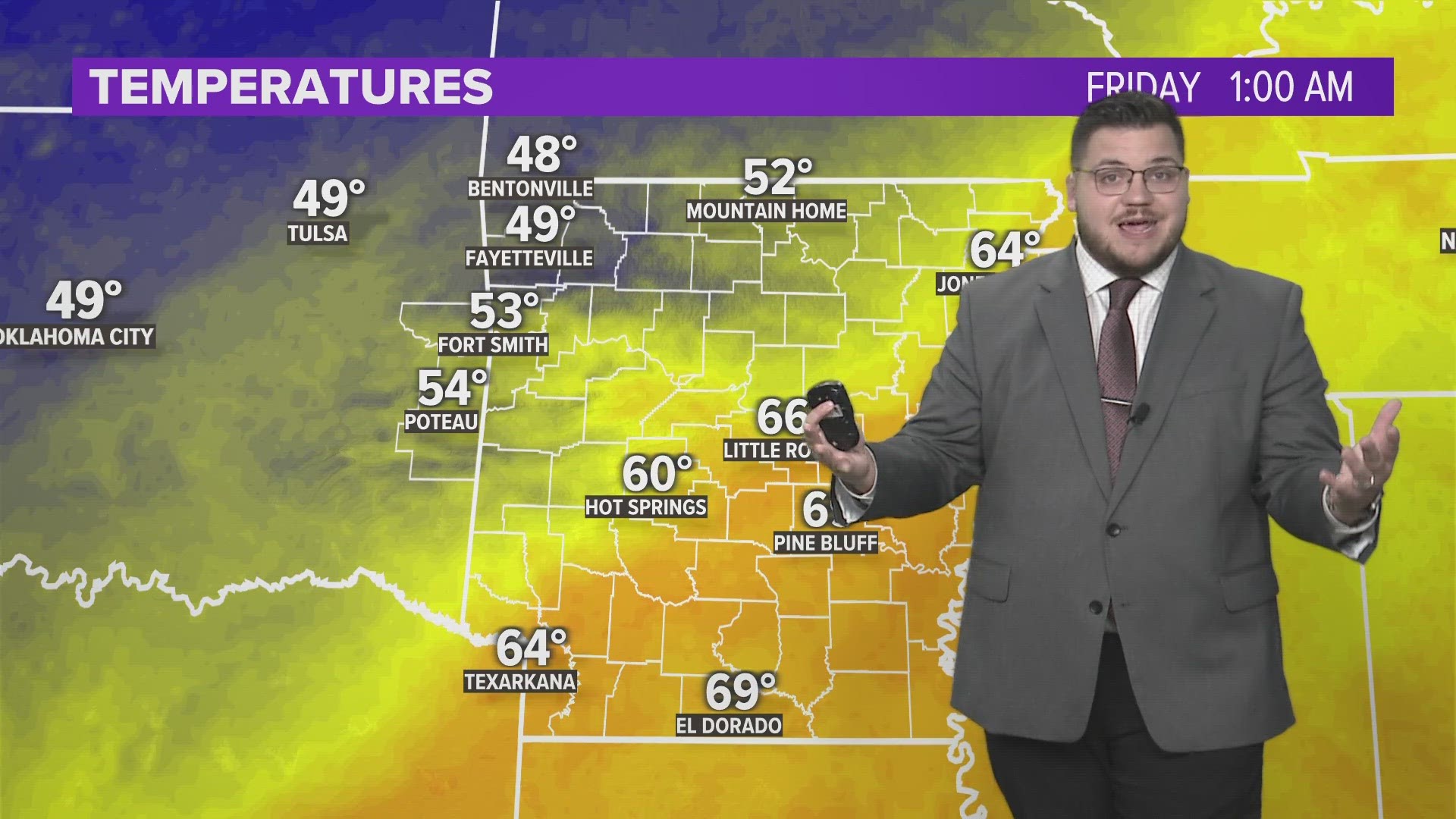
A strong cold front will move into the area over the weekend with widespread showers and thunderstorms bringing a halt to the above normal weather and a return to more seasonable temperatures.
A limited severe weather risk is possible on Saturday night due to high amounts of wind shear. The threat would be damaging winds and isolated pockets of rotation. Currently, the highest severe weather risk looks to remain in central Oklahoma where instability and shear are greatest.
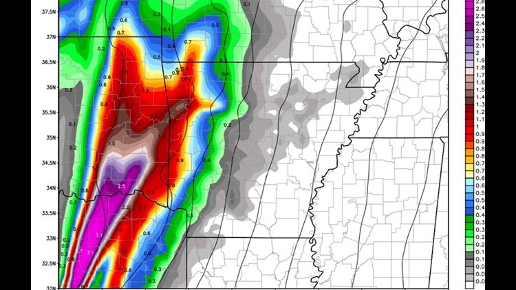
The rainiest weather will occur Saturday night into Sunday. Scattered showers will develop ahead of the cold front as warm air is pulled north with breezy south winds.
The bulk of the rain will be after midnight late Saturday into the early morning hours Sunday.
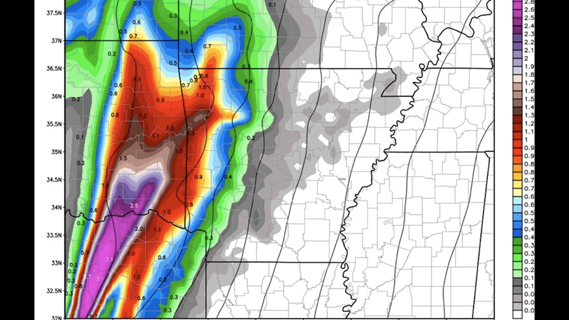
Rainfall totals will once again be excess with a wide-spread 3-4″ likely.
Here’s a look at the timing and highest risk areas:

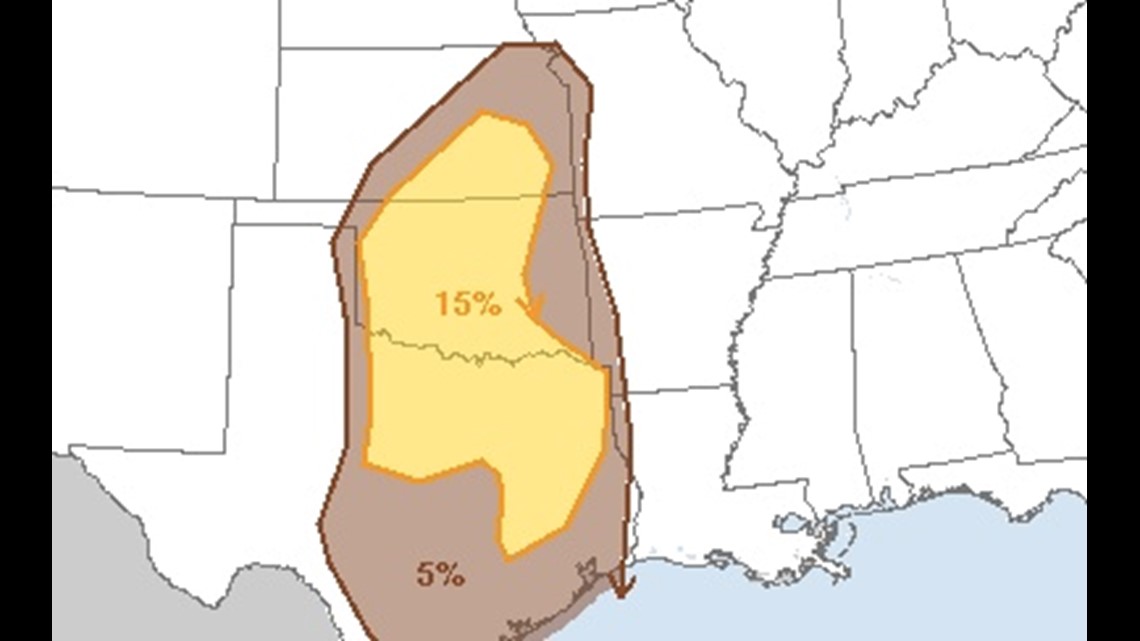
The highest severe weather probabilities are in central Oklahoma with storms generally weakening as they near the Arkansas/Oklahoma state line.

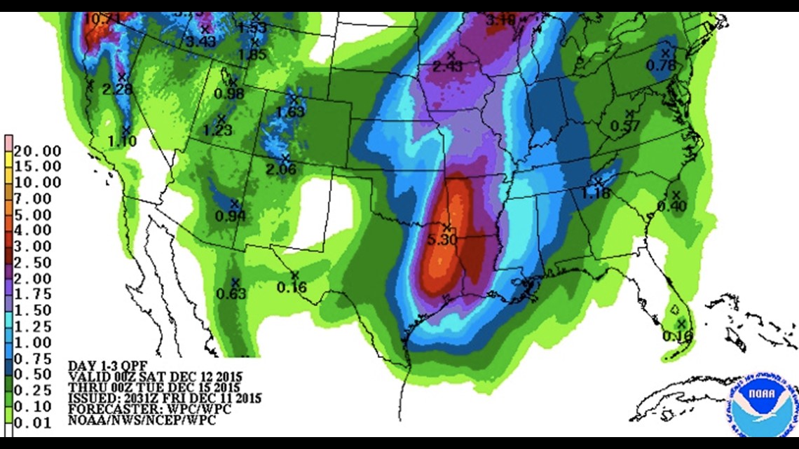
Rain totals across Arkansas, Oklahoma, & Texas will be excessive and some flash flooding is likely. Isolated amounts near 5″ are possible near the ArkLaTex.

From 11pm to 1am Saturday the line of heavy showers with embedded strong storms will move into Arkansas.

By 3pm Sunday, most of the rain will be exiting the area.
The winds will be blustery late Sunday with gusts over 30mph and temperatures falling into the 40s with chilly weather expected for the upcoming workweek.
-Garrett