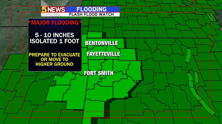
**Major, and potentially life-threatening flooding will occur this weekend**
A widespread 5″-10″ of rain will fall across the area. Some locations may see totals as high as 1-foot of rain.
Creeks, streams, and most rivers will approach moderate or major flood stage. Many rural or low-lying roads will become impassable and will be extremely dangerous for motorists who drive into flooded areas. Water rescues will occur with vehicles that venture into swollen creeks and streams.
The usual flood prone areas will experience major flooding with water entering homes and businesses. Prepare now. If you live in a flood prone area, be prepared to move to higher ground or to evacuate as water levels rise.
Additionally, severe weather will be a possibility on Saturday afternoon with hail, wind, & isolated tornadoes all a risk.
The back side of the system might see a quick change from rain to snow on Monday but accumulations appear to minimal, if any.
Here is a look at the timeline:

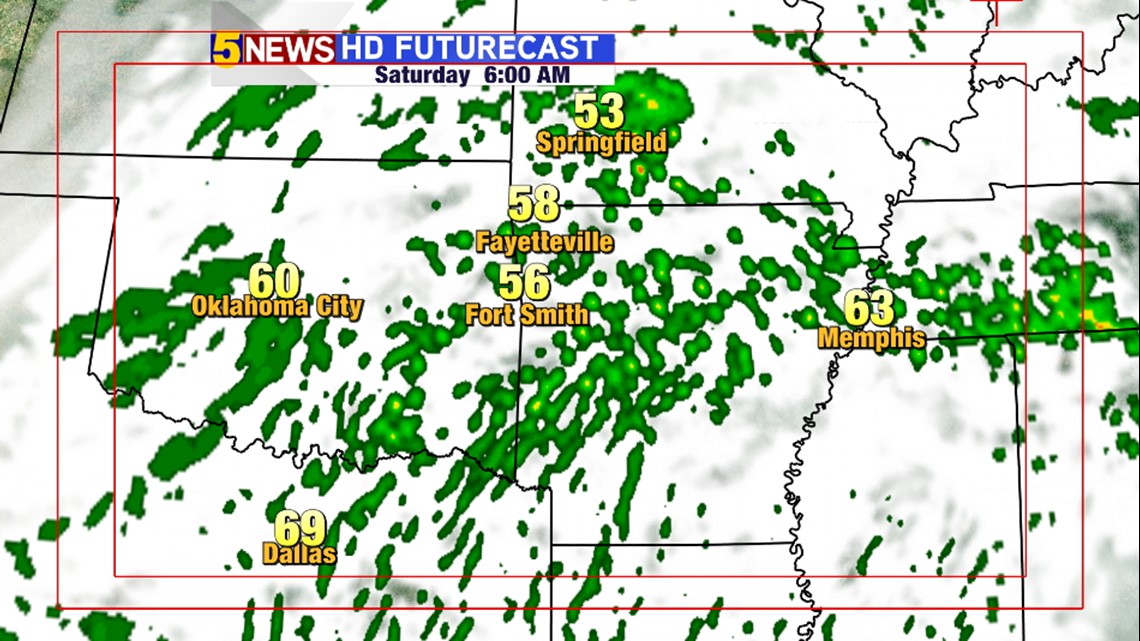
6AM SATURDAY: Overcast early with scattered showers and warm weather.

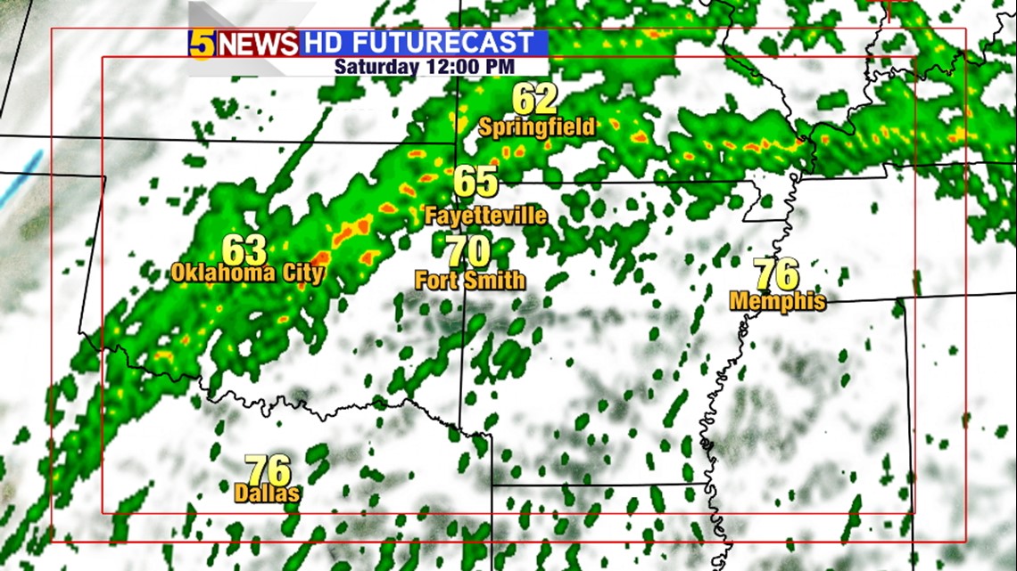
NOON SATURDAY: The heaviest band of rain begins to take shape first across NE Oklahoma before drooping south into our area.

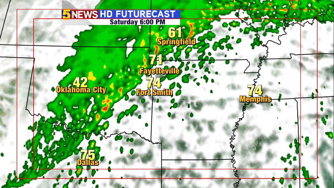
6PM SATURDAY: **SEVERE WEATHER POSSIBLE** Severe storms will be possible in SE Oklahoma and SW Arkansas, including Fort Smith due to unusually warm air.

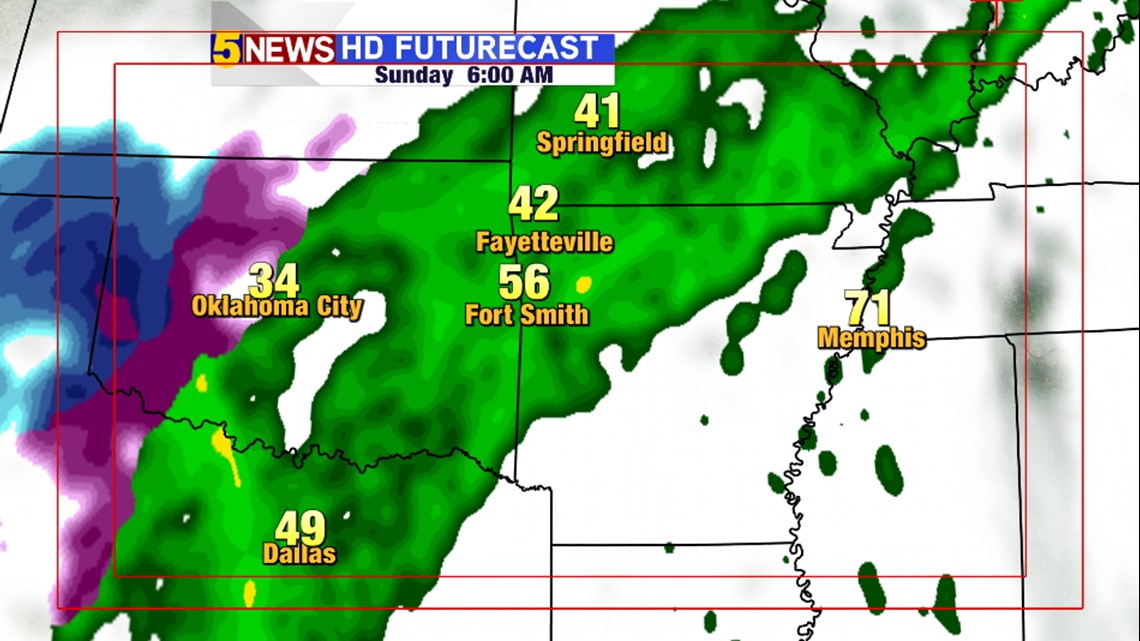
6AM SUNDAY: Raining.

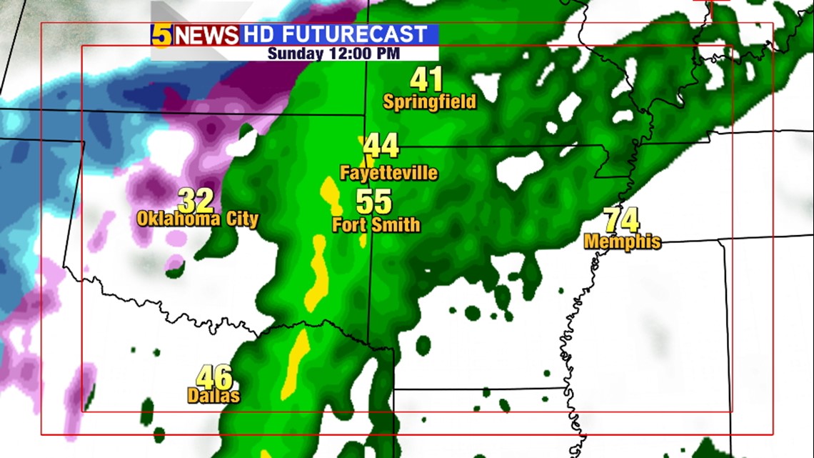
NOON SUNDAY: Still raining. **FLOODING EXPECTED TO BE WIDESPREAD**

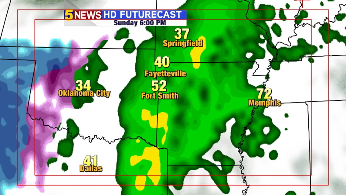
6PM SUNDAY: Turning colder. Still raining. **FLOODING EXPECTED TO BE WIDESPREAD**

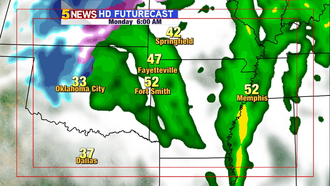
6AM MONDAY: Still raining.

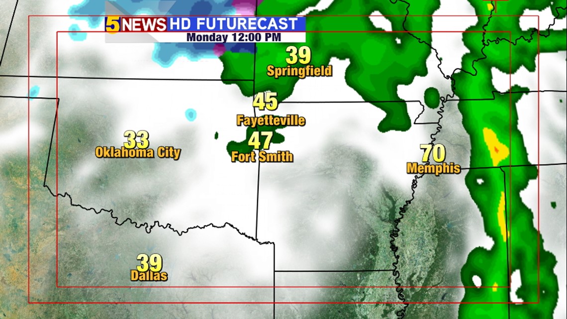
NOON MONDAY: Rain ending. It may briefly mix with snow with minimal, if any, accumulation expected.

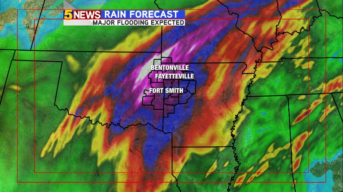
Please be careful. Flooding will be extensive and could be historic for some rivers and streams.
-Garrett