A fast-moving system will bring the chance for light wintry precipitation to our area early on Wednesday. While amounts will be minimal, light accumulations on bridges and overpasses in Northwest Arkansas could cause a few slick spots for the morning drive. In the Fort Smith area, temperatures will be near or above freezing so the potential for slick spots is far lower. The overall travel impact is expected to be minimal.
The ground temperature just beneath the surface is 38º in Northwest Arkansas and 42º in the Fort Smith area. This should prevent any issues on road surfaces, since the air temperature will be below freezing the only concerns will be held to elevated things like bridges and overpasses.
The timeline for any potentially winter weather is from 5am to 9am.
Amounts of precipitation will be low; generally less than 1/10th of an inch.
Here is a look at the system and the timing.

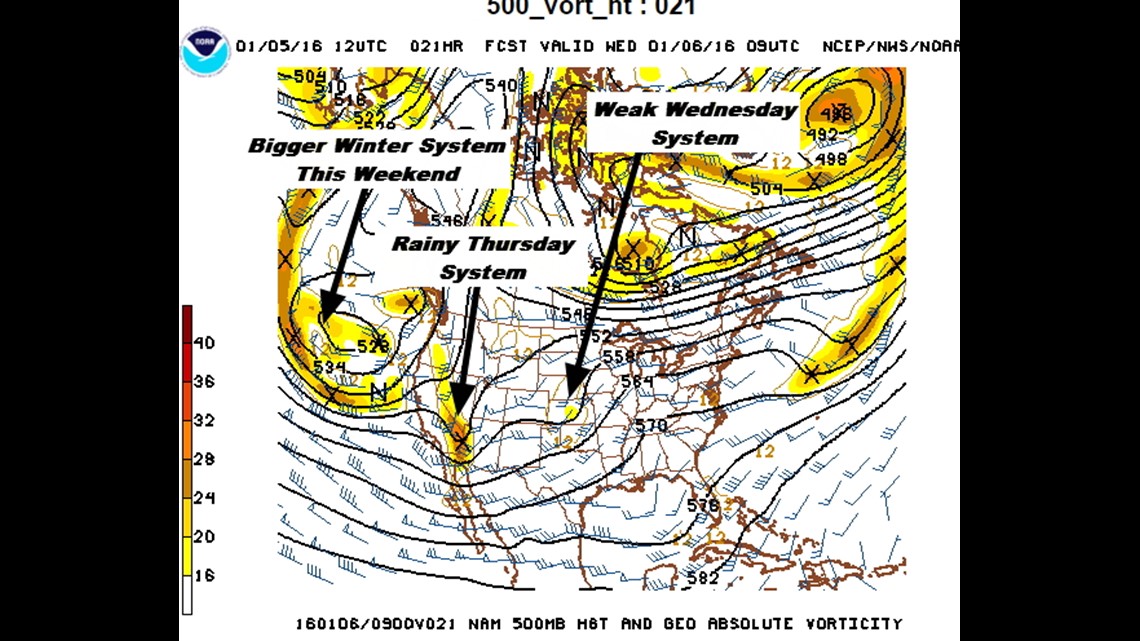
There are 3 systems lining up to affect our area:
- Wednesday: Light wintry precipitation early
- Thursday: Rain expected; around .50″ to 1.00″
- Weekend system: Cold blast, possibly some snow late Saturday into Sunday?

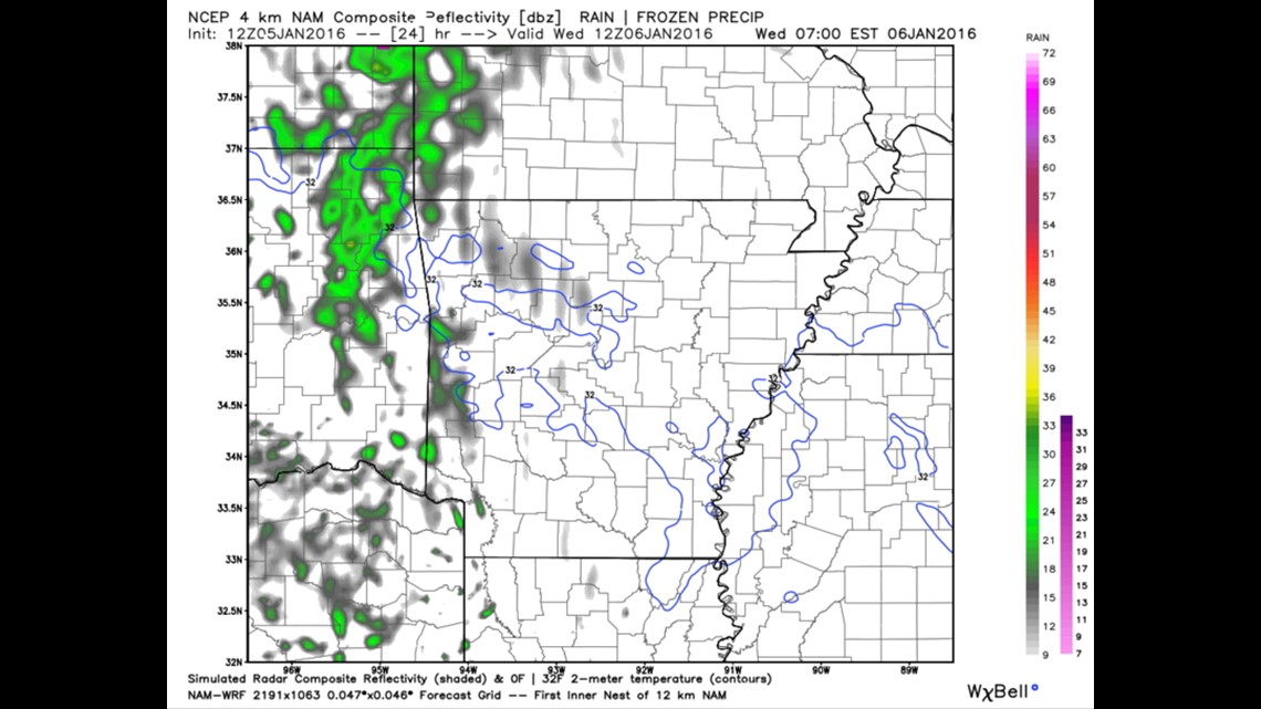
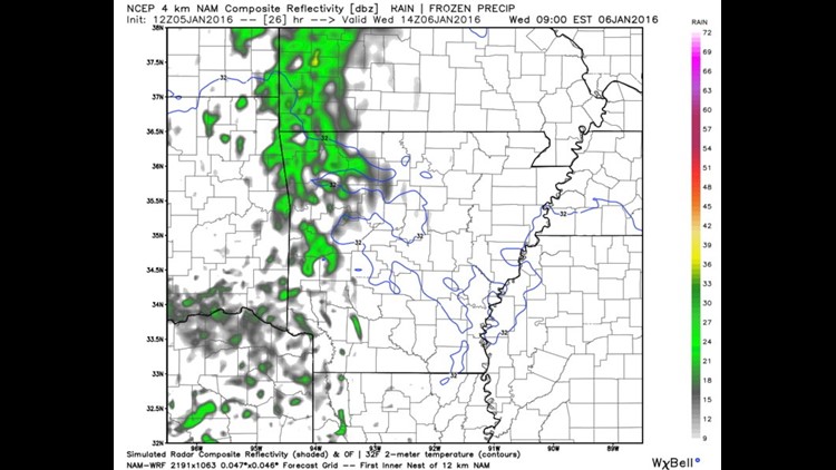
6AM Wednesday: The blue freezing line is across the area with spotty areas of freezing drizzle or a light wintry mix possible.

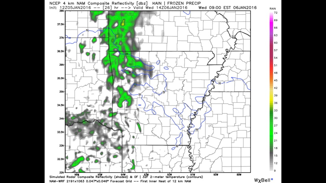
8AM WEDNESDAY: Light drizzle or rain possible. Temperatures warming

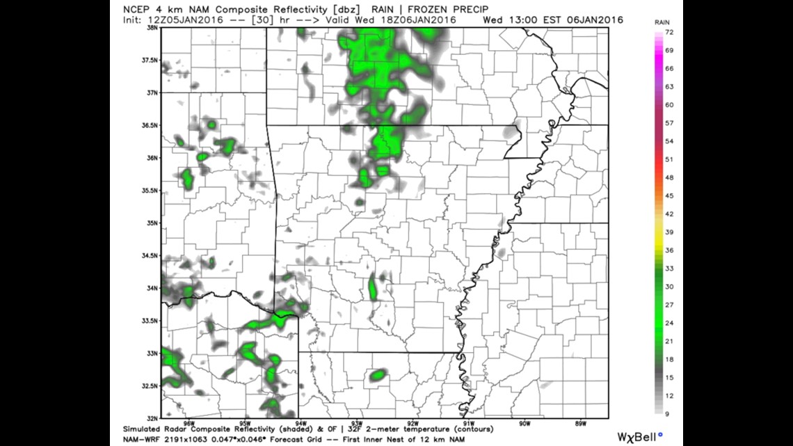
Noon Wednesday: All locations above freezing; rain gone.

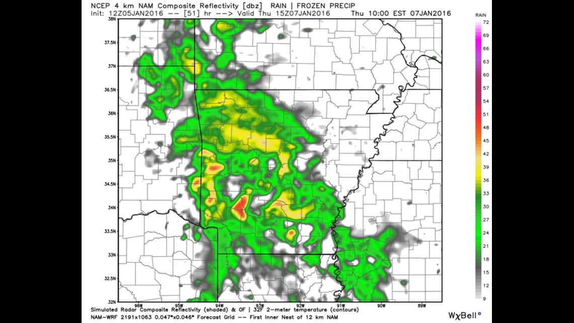
Thursday Morning: Widespread rain with temperatures above freezing.

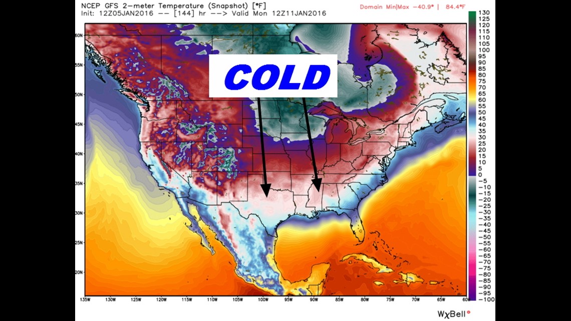
Next Monday, January 11th: Major cold blast with below normal temperatures for the middle of the month.
-Garrett