A fast moving system will give us a chance for light snow along and south of I40 early in the day Saturday before sunny skies prevail in the afternoon.
Temperatures will remain chilly and any travel issues should be quickly resolved by early afternoon. Highway 71 south and roads in the Ouachitas are most likely to see some areas of light snow or a rain/snow mix.
Saturday will be chilly for everyone with highs only in the 30s.

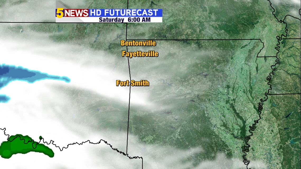
6AM Saturday: Expect increasing clouds and very cold weather. Snow spreading into SE Oklahoma & SW Arkansas


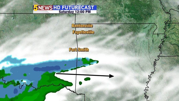
Noon Saturday: Mid-morning thru Noon Saturday will be the best time to pick up some light snow across locations I40 & south.

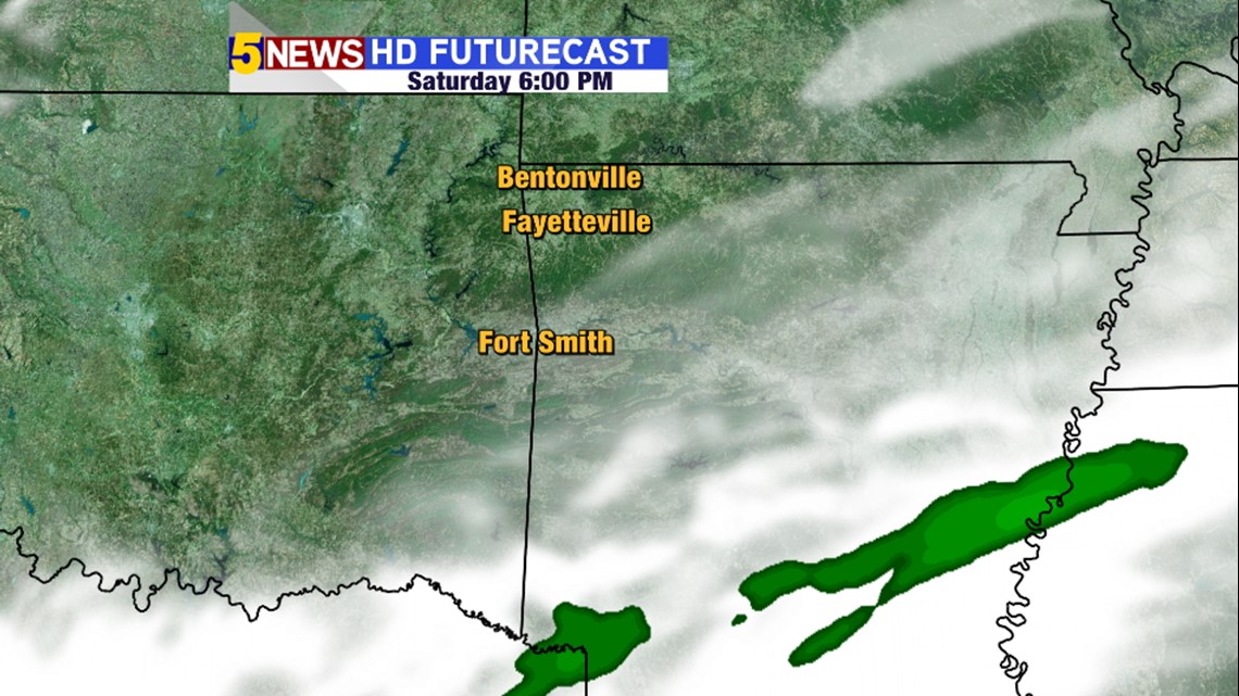
6PM Saturday: That system is long gone with cold weather continuing into the overnight. Might even see some sunshine Saturday evening.

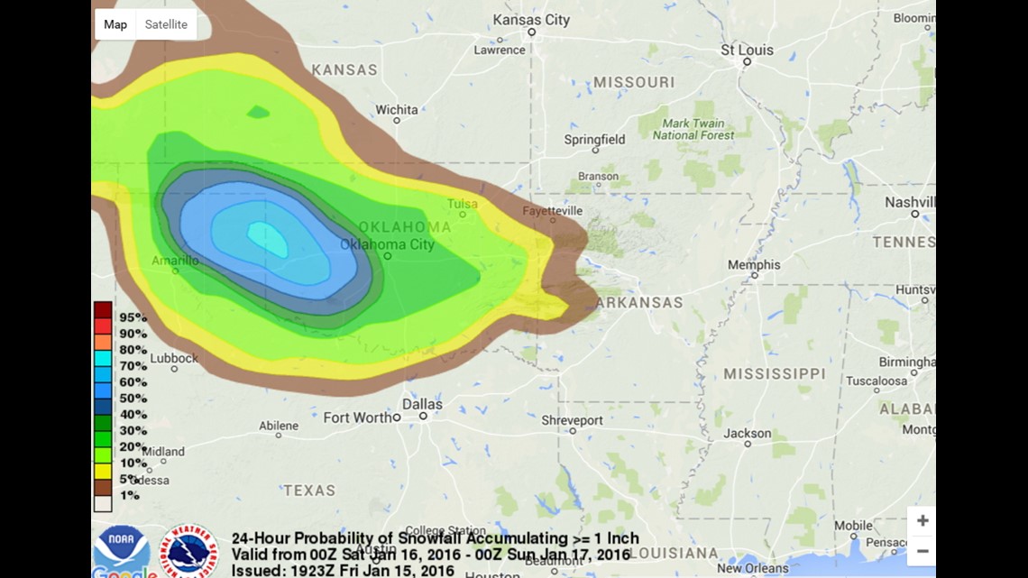
Probabilities of 1″ or more are low for our area.

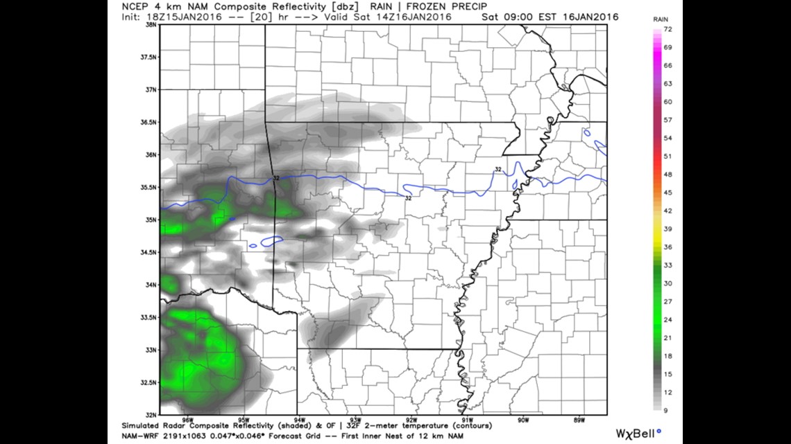
8am Saturday showing the blue freezing line across the River Valley. This will likely cause a mix of rain & snow.
Another fast-moving weak system arrives late Sunday night into Monday with light accumulation possible across the area. It also looks like a low impact system.
-Garrett