A strong cold front will move into the area late tonight and drastically drop temperatures for the weekend.
Saturday will be mostly clear after some morning clouds with highs near 40º.
On Sunday, skies will become overcast with light rain or freezing rain possible. Overall precipitation amounts appear light but slick spots could develop on bridges or overpasses.
The most likely time for ice to develop would be in the morning or early afternoon hours. Later in the day, highs are expected to warm into the upper 30s or low 40s. Still cold, but above freezing.

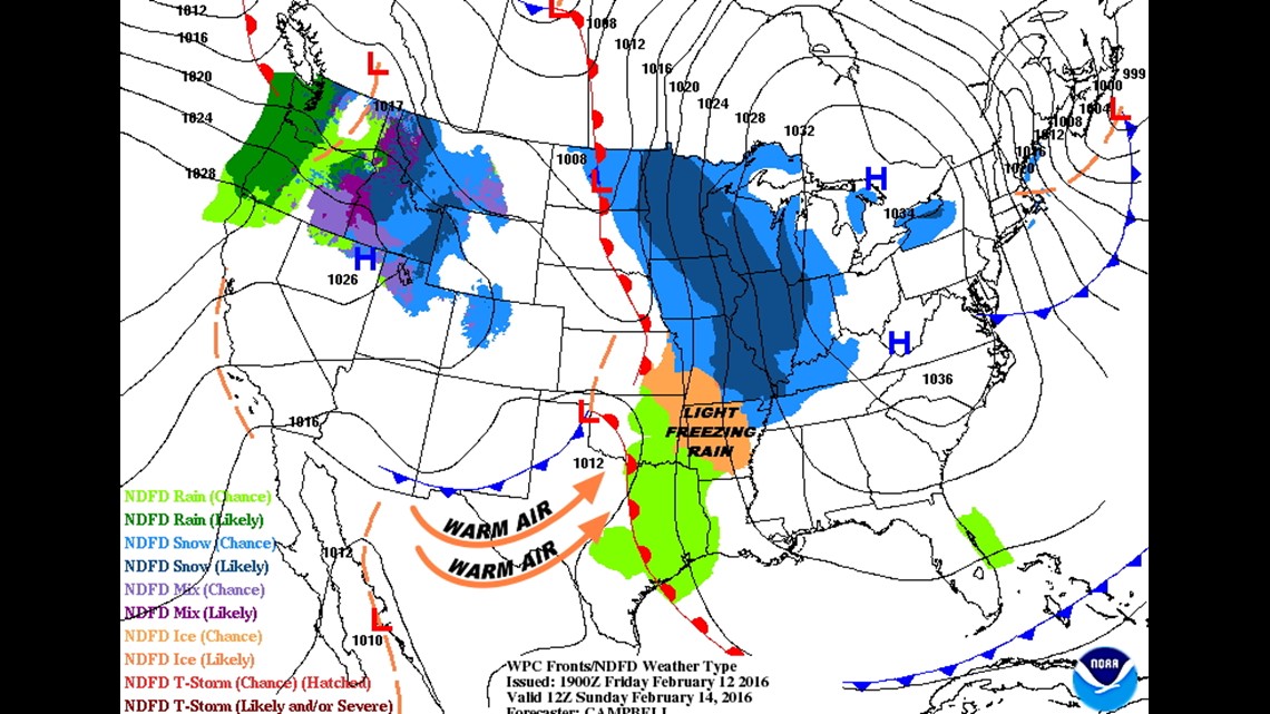
Here’s the setup on Sunday morning. High pressure on the East Coast keeps the NE wind active which in turn keep the surface temperatures cold.
The warm front in Texas will begin moving north. As the warm air glides over the cold air, rain will develop. The rain will fall into a dry airmass and evaporate at first; the evaporation should cool the air a few degrees, possibly below freezing. It’s during this time that the freezing rain could develop. This would be somewhere between 8am and 2pm.


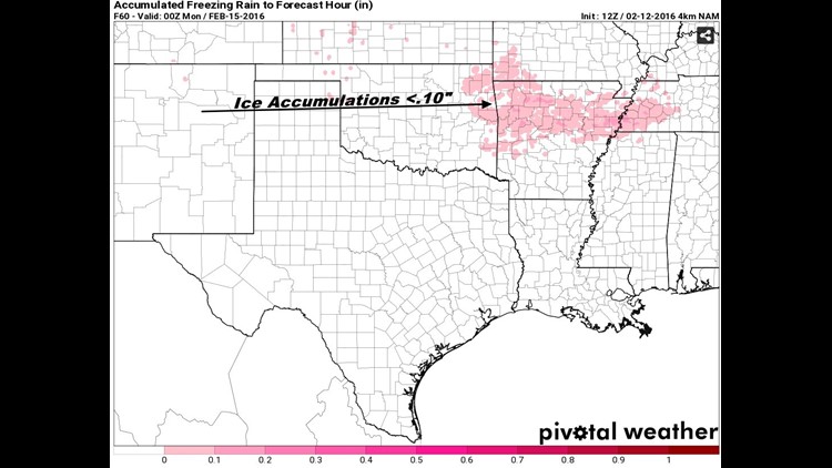
Ice amounts look to be light; probably less than .10″ of an inch or less. This means mostly elevated surfaces could see light icing.
This is not an ice storm and power outages are not anticipated.

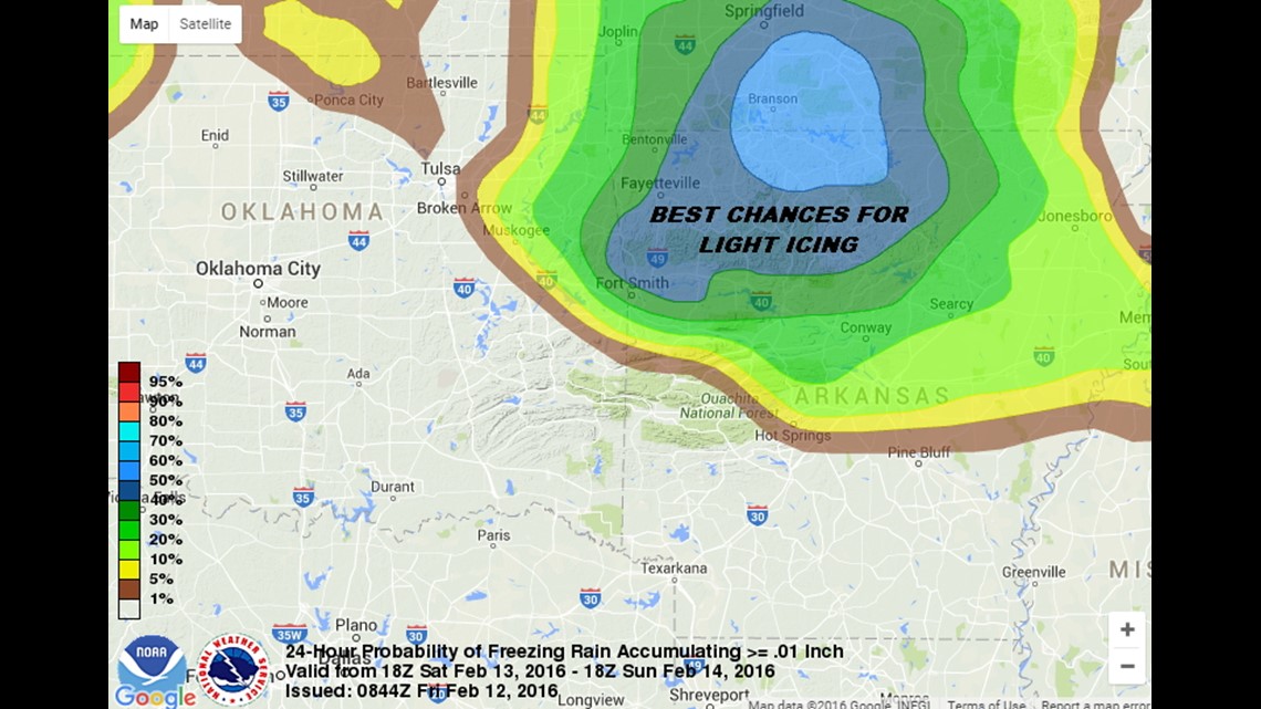
This map show the highest probability for ice accumulation over .01″. The best chance is in N Arkansas and S. Missouri. Remember that .01″ is essentially trace amounts of ice; widespread ice accumulations are not expected.

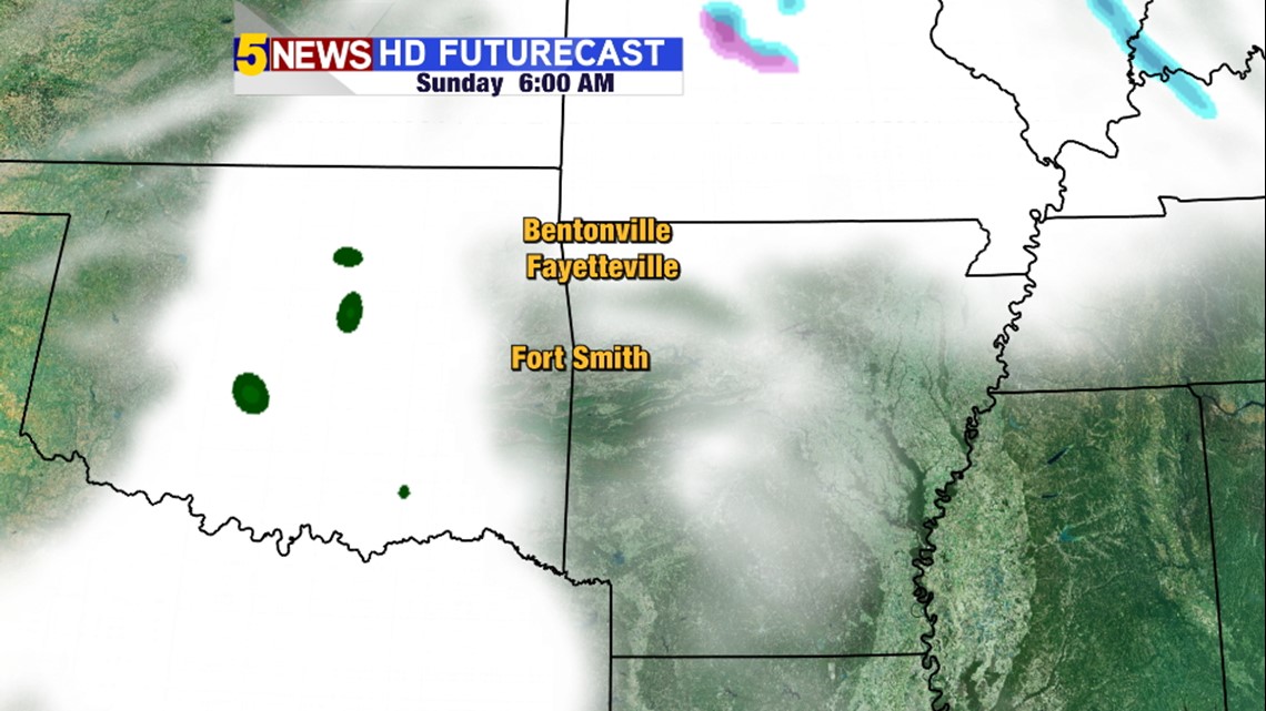
Sunday morning at 6am, Futurecast shows overcast skies with some rain to the west and some light ice and snow to the north. Our area should remain fairly dry unless some light drizzle develops under the low cloud cover.

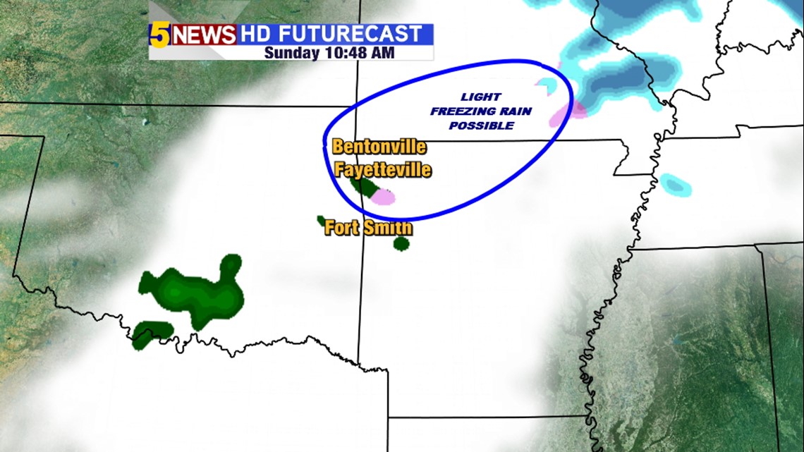
Around 10 or 11am on Sunday, Futurecast shows light rain or light ice amounts in our area.
I’ve drawn a blue circle indicated the best location for light ice amounts.
Next week is trending very warm with highs in the 70s and possible near 80º in some areas by Thursday or Friday.
-Garrett