The winter that wasn’t will continue this week with high temperatures climbing to near record levels.
Temperatures will reach the mid 70s with some locations possibly as warm as 80º by this Thursday or Friday.
Fire danger will be very high this week with low relative humidity and breezy southwest winds.
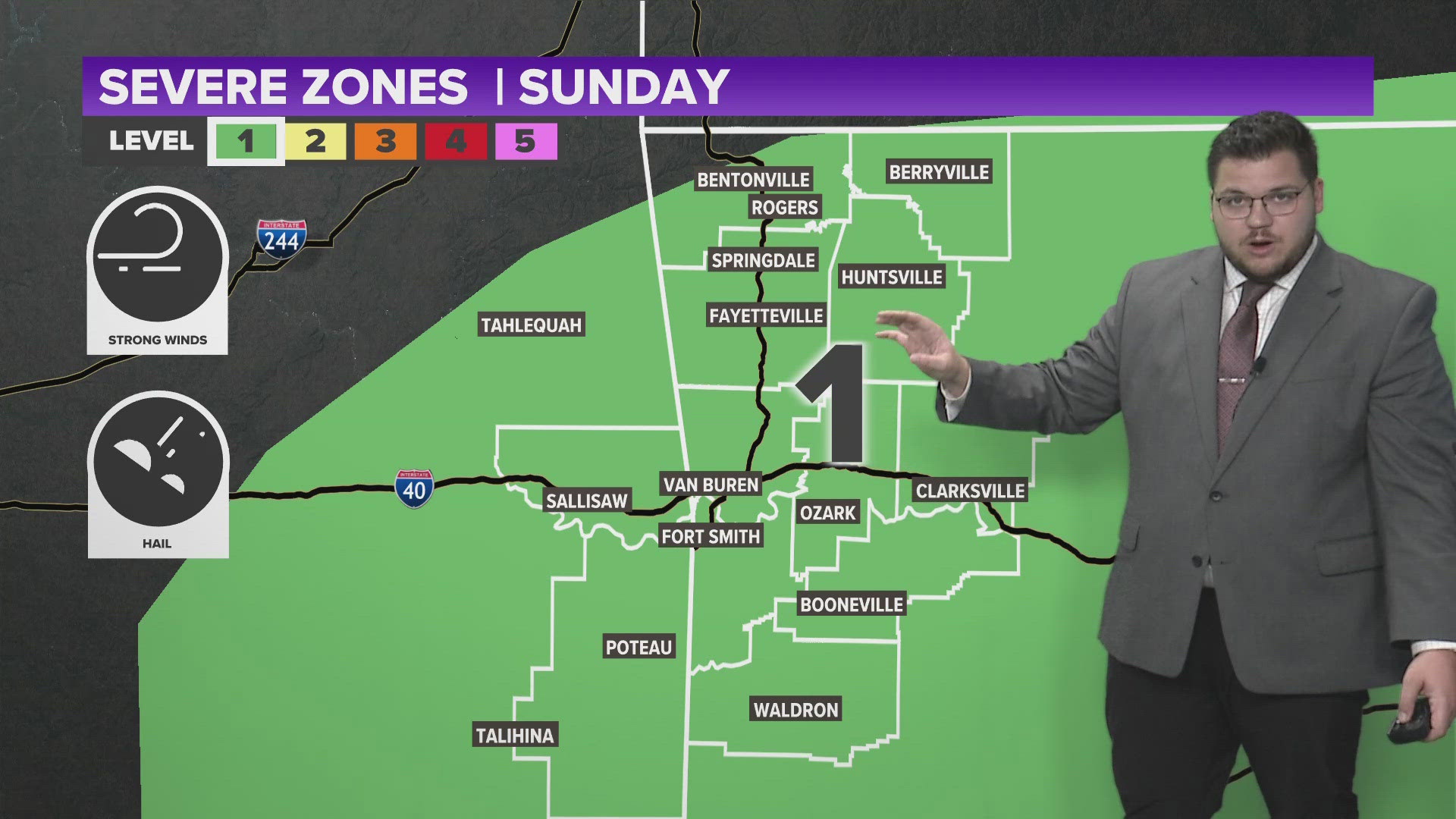
The next rain chance might arrive this weekend, perhaps on Sunday. Here’s a look at what I’m watching.

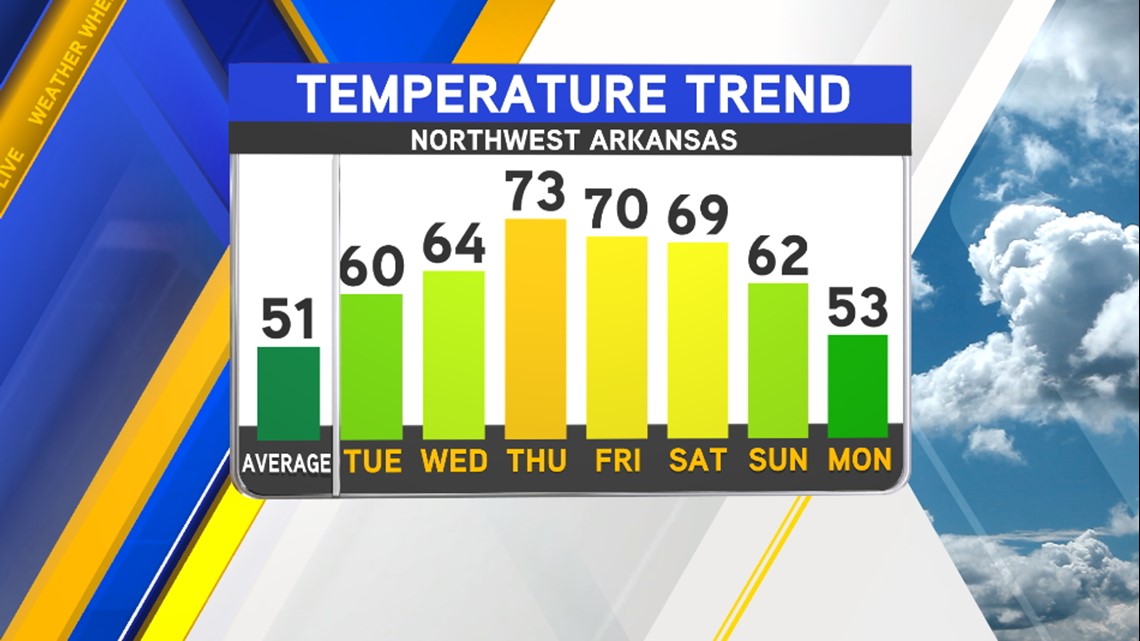
In Northwest Arkansas, the warmest days this week will occur on Thursday and Friday and should be close to record temperatures set back in 1986 of 79 & 76.

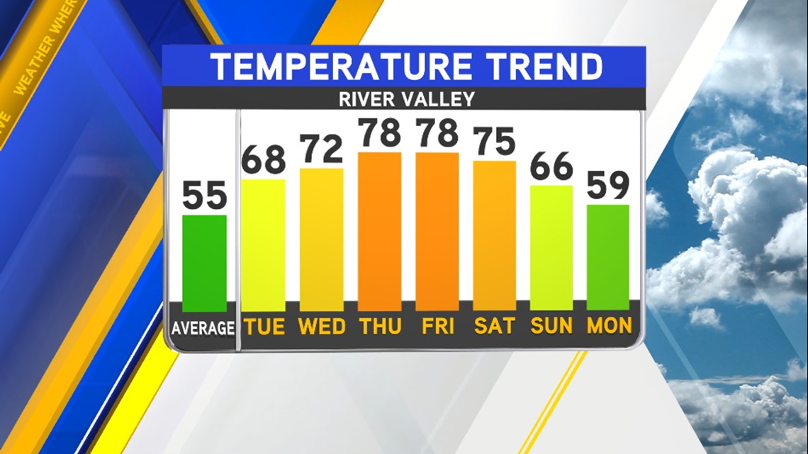
The Fort Smith records might be close to break. The records for Thursday and Friday are 79º & 80º both set in 1986 as well.

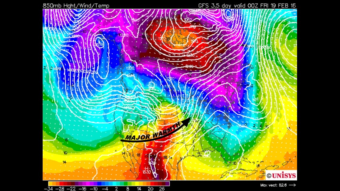
The warm will occur across much of the Southern Plains this week with dry downsloping winds off the Rockies. This usually leads to low relative humidity and gusty winds which fuel brush fires.

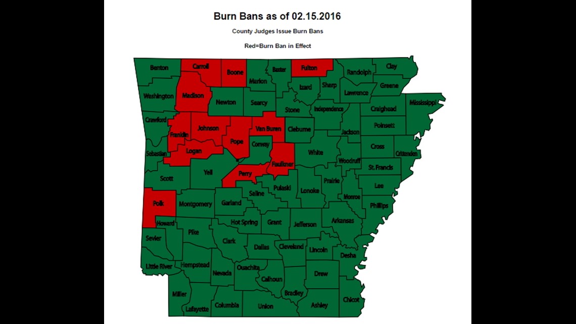
These are the current counties with Burn Bans. Oklahoma has no burn bans in effect as of Monday February 15th.

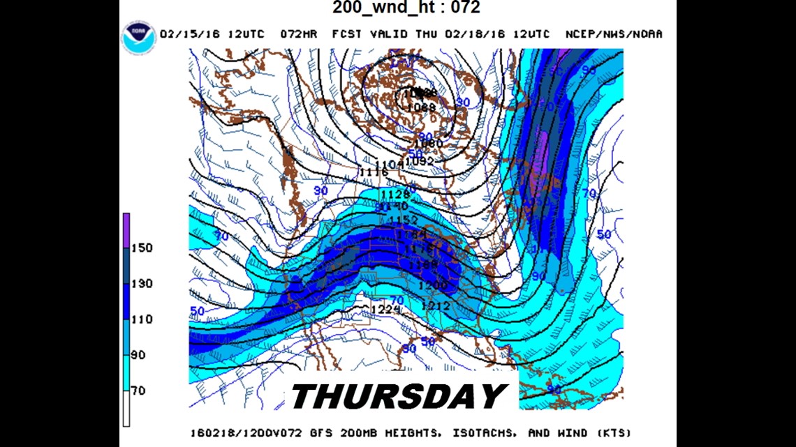
The upper level pattern late week showing a large ridge across the central portion of the U.S. which will lead to widespread warmth.

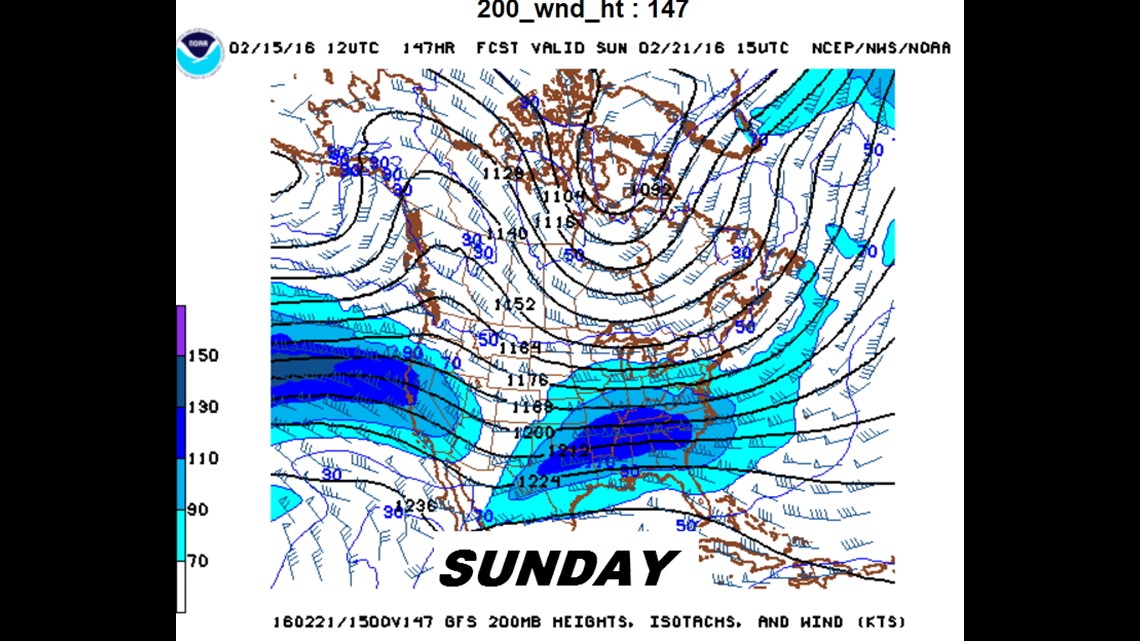
By late weekend, the ridge breaks down and should allow for a cold front to sweep in the area with rain chances and cooler temperatures arriving for the start of next week.
There still doesn’t appear to be many winter weather events in the near future; we’ll probably be snowless in February unless something happens just beyond the edge of the data around the 27-29th.
-Garrett