A strong low pressure system is tracking across Texas with severe weather likely in the Gulf states and probably some tornadoes to our south.
Here at home, expect blustery northeast winds all day on Tuesday. Some gusts will be over 30mph.
The heaviest rain will fall across SW Arkansas and SE Oklahoma where 2-3″ of rain is possible.
Expect around 1-2″ of rain in Fort Smith.
Around 1″ of rain in Bentonville, Fayetteville, Springdale, & Rogers.
Late in the evening, cold air will mix into the rain changing some of it to snow. Elevation will be a huge factor with most of the accumulating snow falling across the high terrain of the Ozarks and Ouachitas.
Temperatures in the metros of NW Arkansas and the Greater Fort Smith area might not even fall below freezing; so while some snow is possible, it’s unlikely going to stick to roads.
The best chance for snow nearest us is around Harrison and Mountain Home.

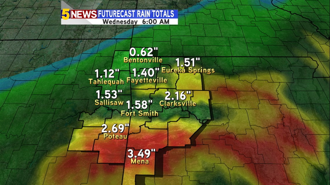
Rain totals will be very high in Central and SW Arkansas. Probably in the 2-3″ range.

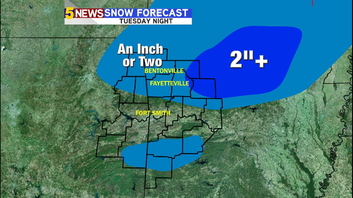
Snow totals will be elevation dependent as most locations will remain just above freezing.

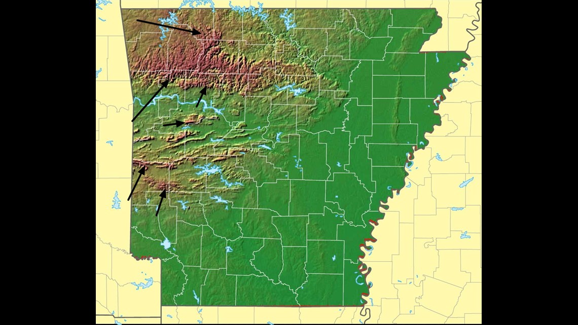
An elevation map of Arkansas. Generally the higher elevations will have the best chance for accumulating wet snow.

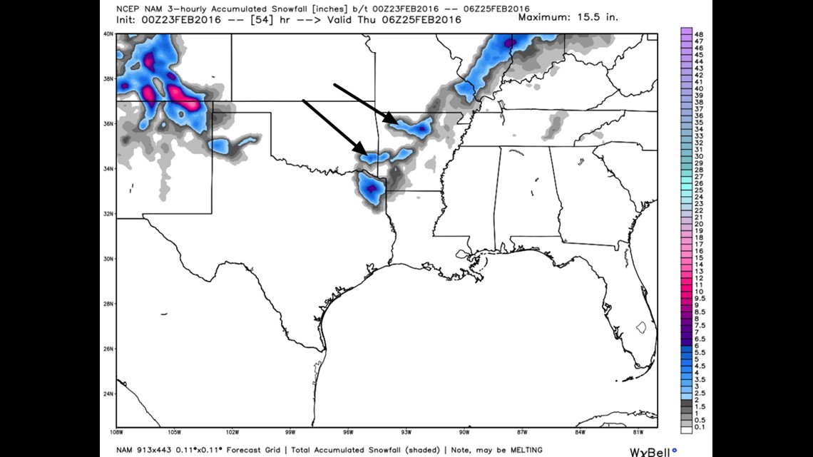
Model data late Monday night is also picking up on the elevation trend.

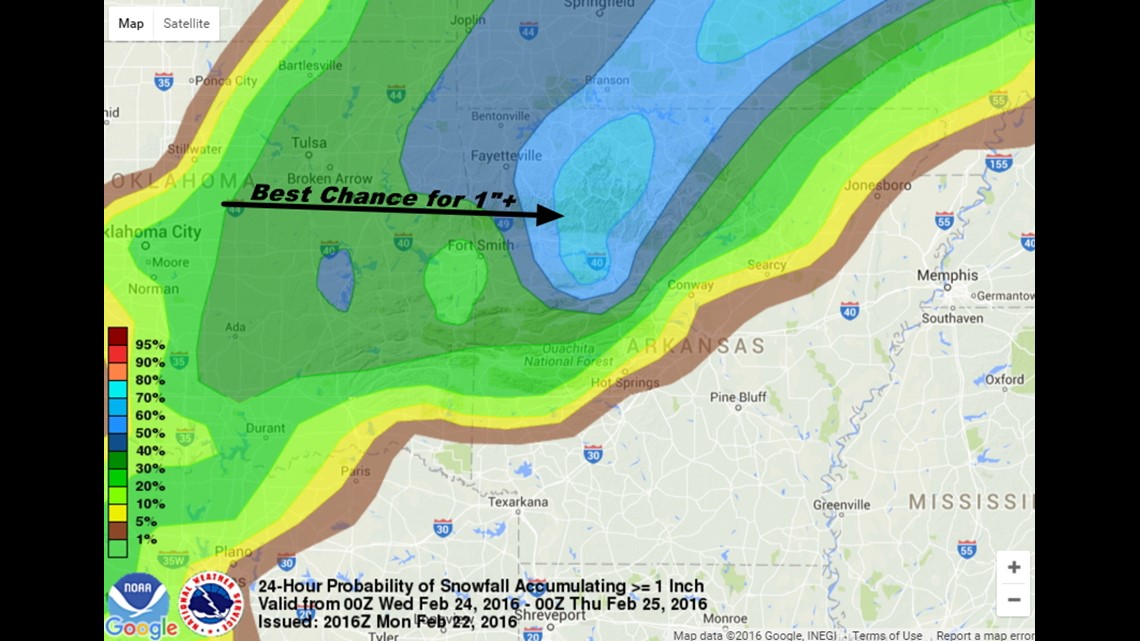
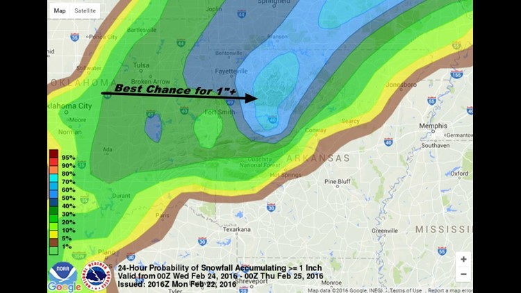
The best chance for 1″ or more will be in N Central Arkansas.
I imagine some places could pick up around 2-4″ in the higher elevations.

6AM TUESDAY: Overcast with rain moving in, temperatures above freezing, windy.

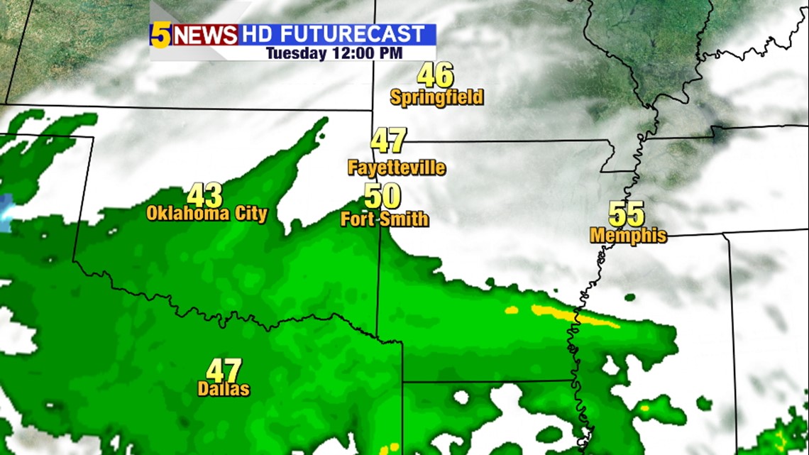
NOON TUESDAY: Overcast, windy, rain spreading across the area.

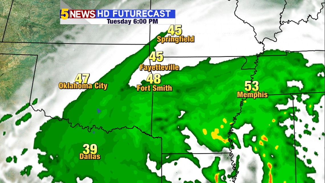
6PM TUESDAY: Rain falling across most of the area with temperatures above freezing. Heaviest rain south of I40.

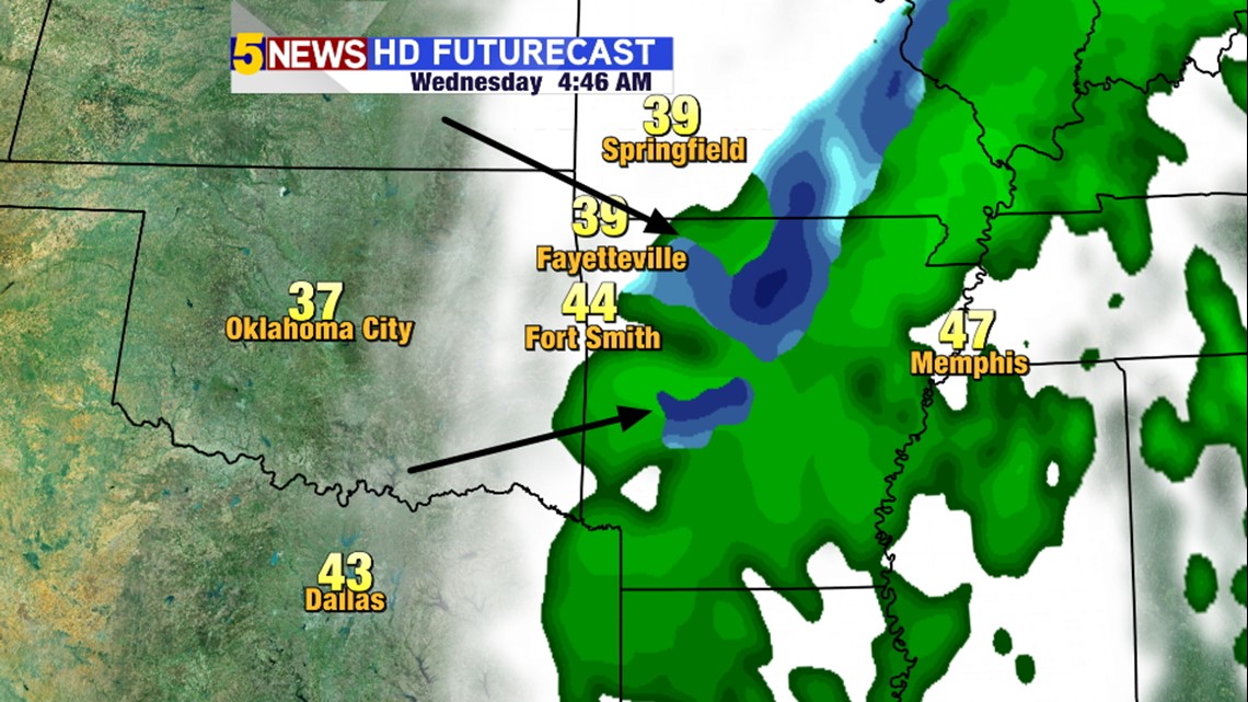
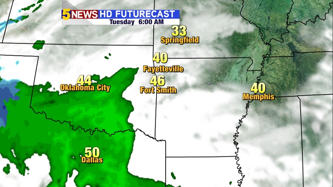
4AM WEDNESDAY: Futurecast is picking up on the rain to snow change over in the middle of the night with the heaviest in N Central Arkansas. Temperatures in our area might be too warm for any snow to stick around.
Bottom line: Heavy rain, cold blustery winds, and a brief changeover to snow. Travel affects locally should be minimal. Might be a few more issues in the higher terrain of the Ozarks and the Ouachitas.
-Garrett