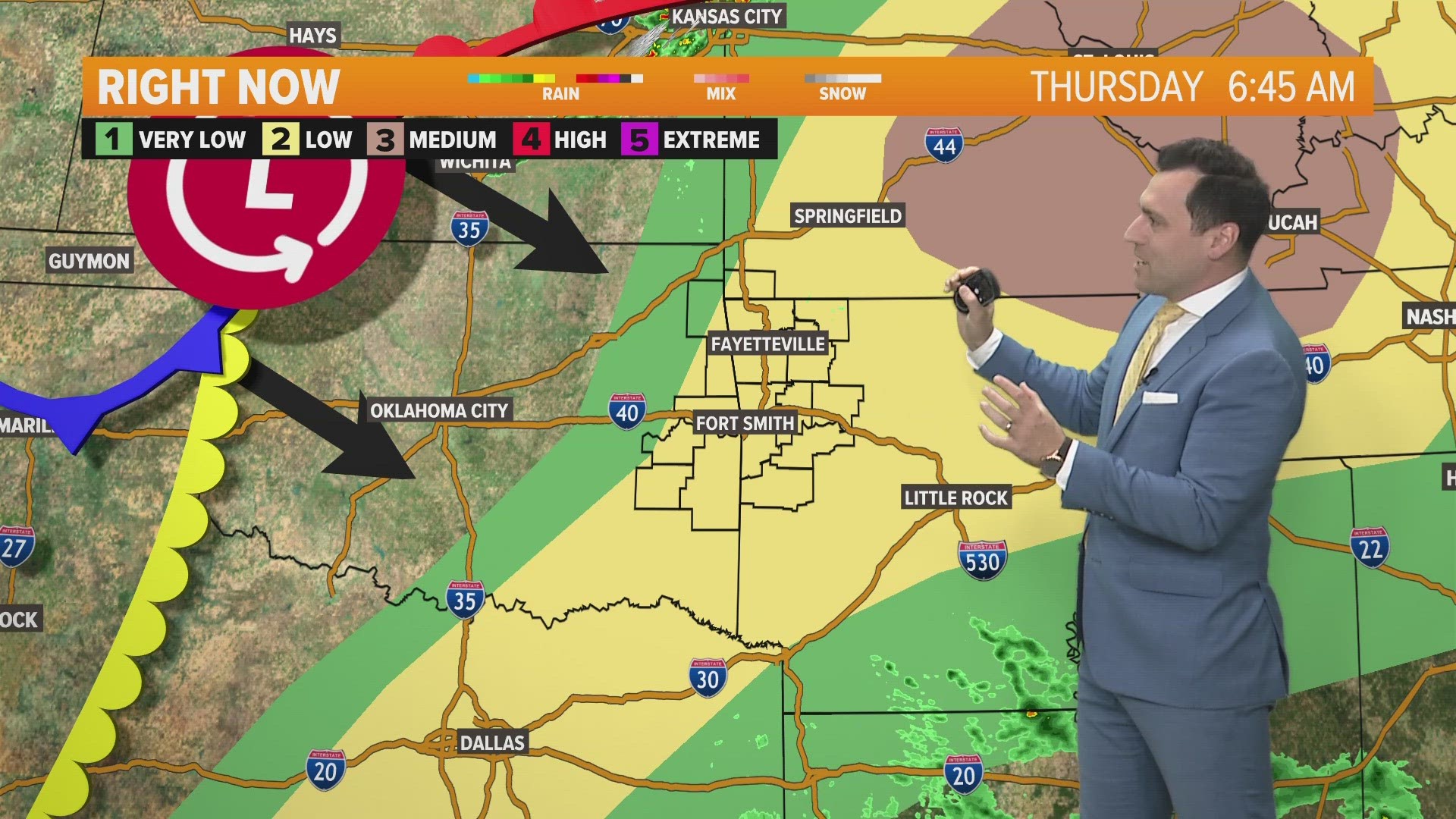
The low pressure to our southeast continues to churn higher humidity our way along with a few spotty showers.
Rain chances are small this weekend with only a handful of spotty showers expected.

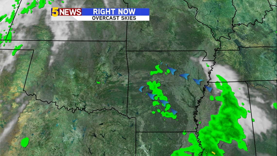
The dark gray shading of the clouds indicates “warmer” clouds which are lower to the Earth. The lower clouds look and feel like “it’s about to rain”. Most of our area is overcast but showers are limited.

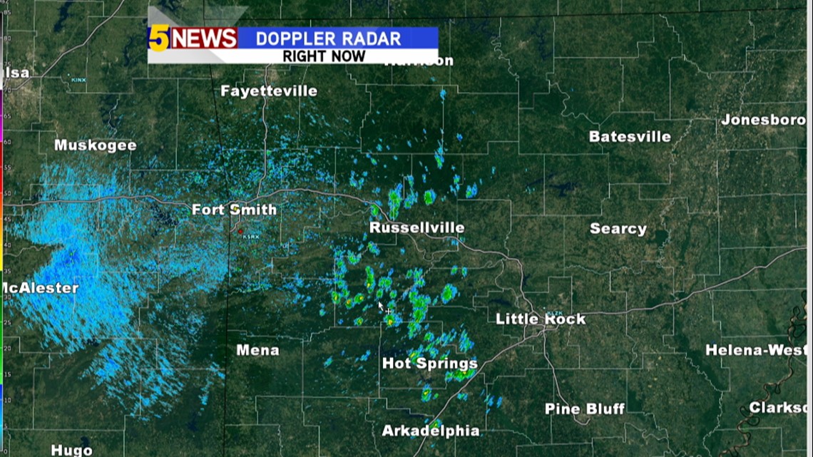
As of 2:30pm Friday, there were a few scattered areas of rain tracking to the northwest.
Much of this will fall apart this evening with the loss of daytime heating.

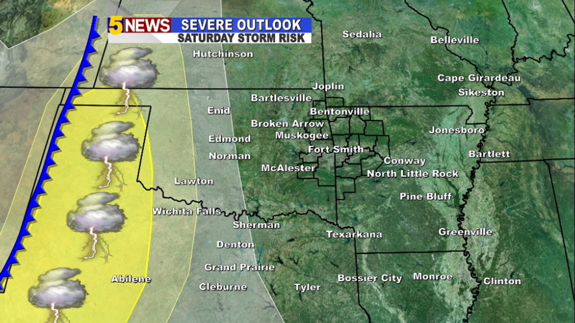
The best chance for Severe Thunderstorms on Saturday will be across the panhandles.

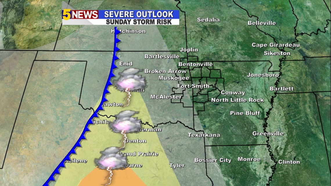
On Sunday, the threat shifts farther east as the cold front slowly moves our direction. Storms will likely hold off in our area until Monday.

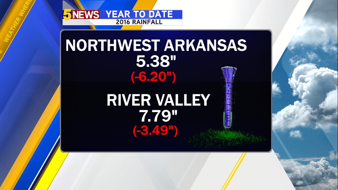
We could actually use the rainfall. So far, 2016 has been off to a drier than normal start.

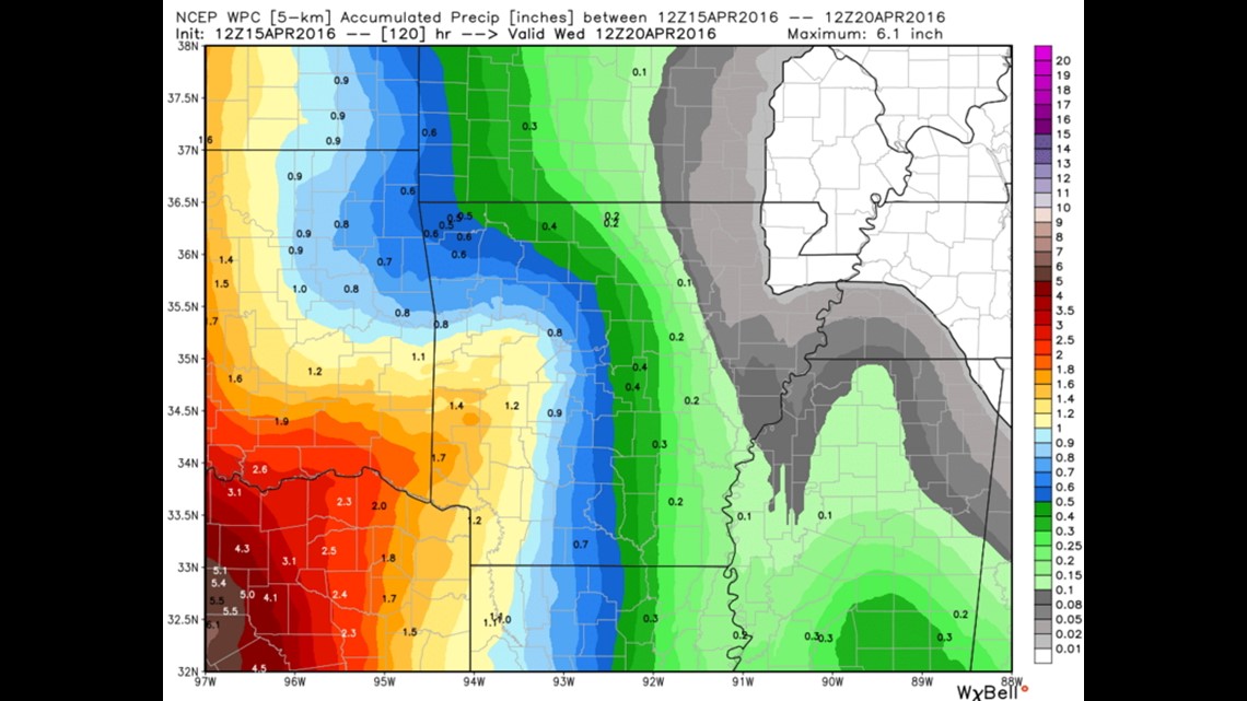
Rain totals Monday – Wednesday will be in the 1-2″ range with the heaviest falling on Monday and Tuesday.
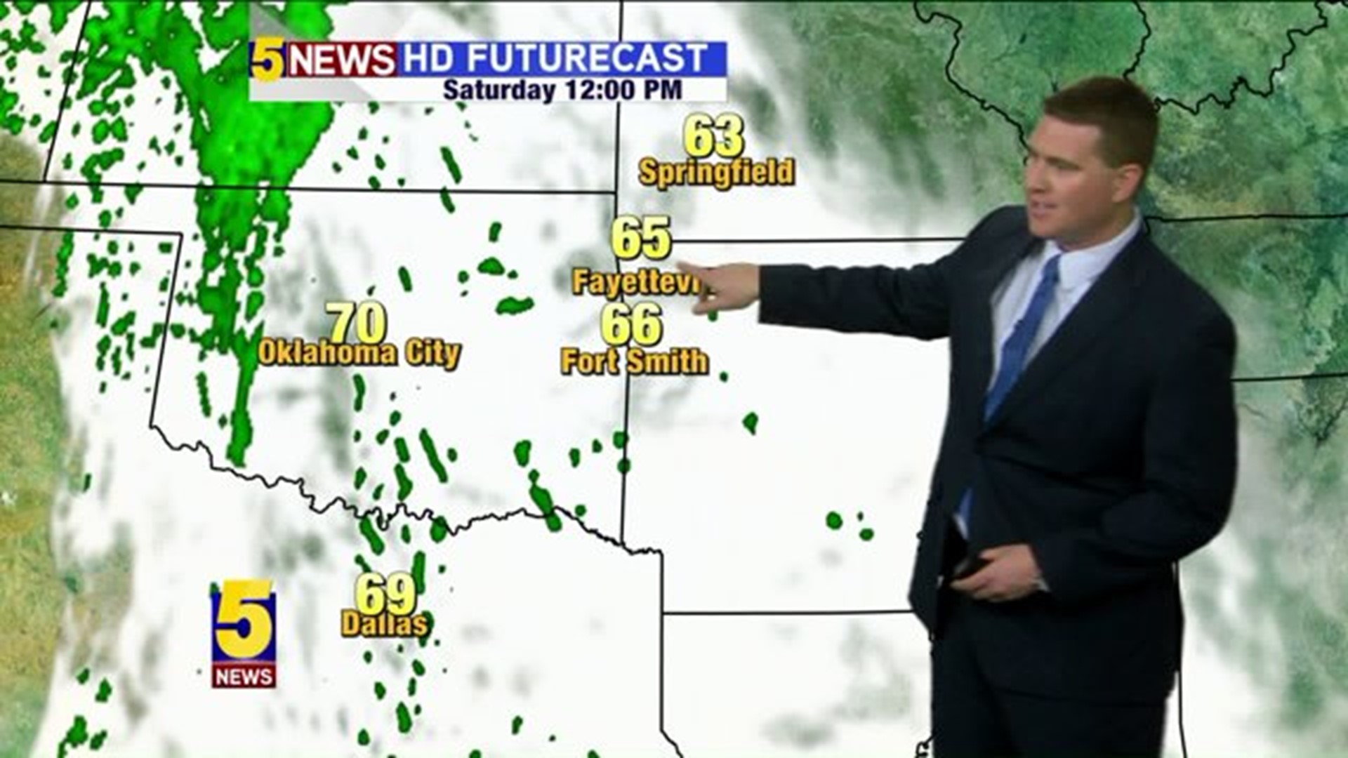
Here’s the weekend hour-by-hour

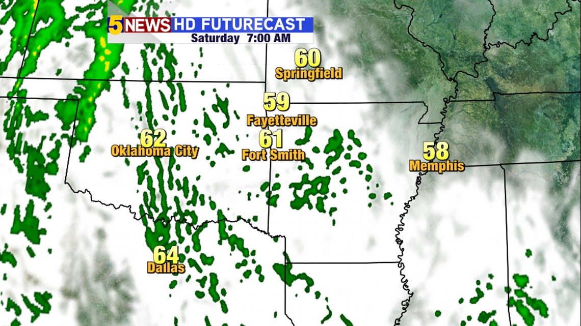
Saturday 7AM: Overcast, a few spotty showers

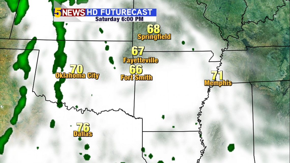
Saturday 6PM: Overcast with less than a 10% chance for rain.

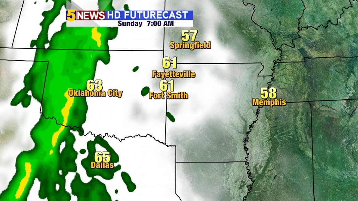
Sunday 7AM: Still overcast, breezy south winds. Rain out west.

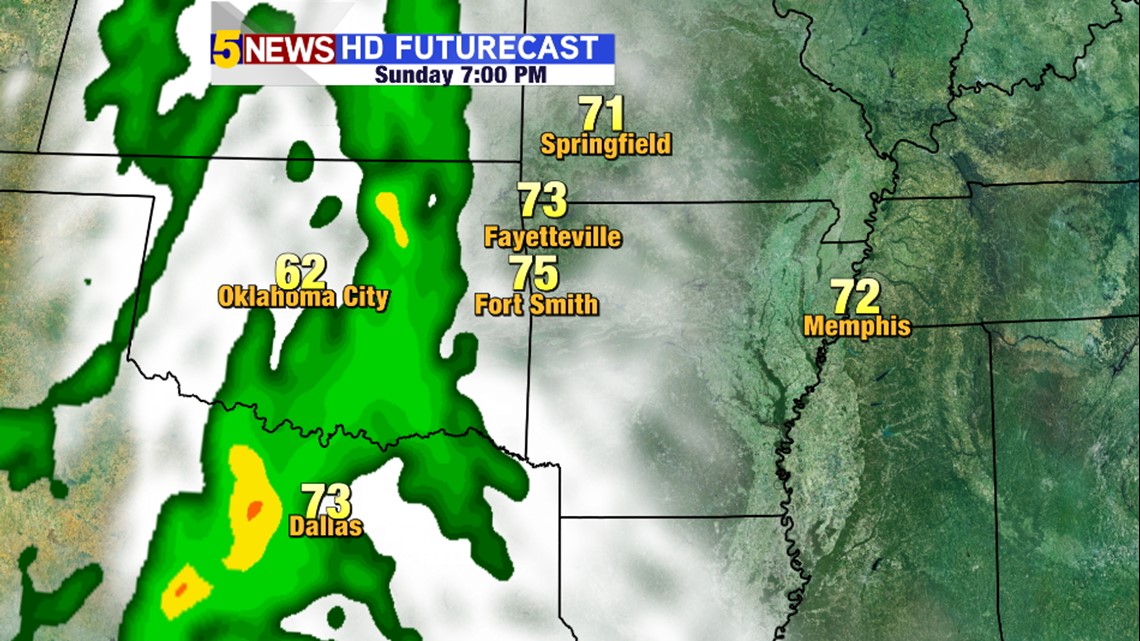
Sunday 7PM: Cloudy, warmer, breezy south winds with rain arriving from out west.

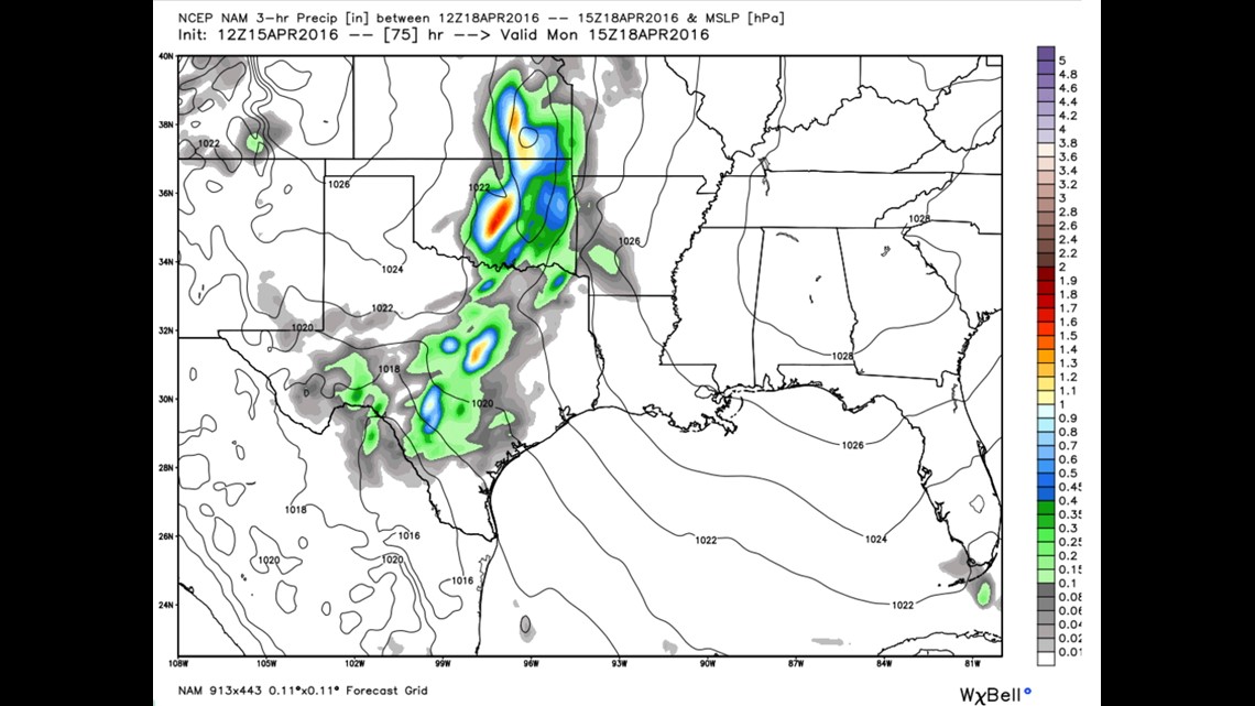
This is forecast data for Monday at 10am. Showers with a few thunderstorms are expected to move in from the west to east across the area.
-Garrett