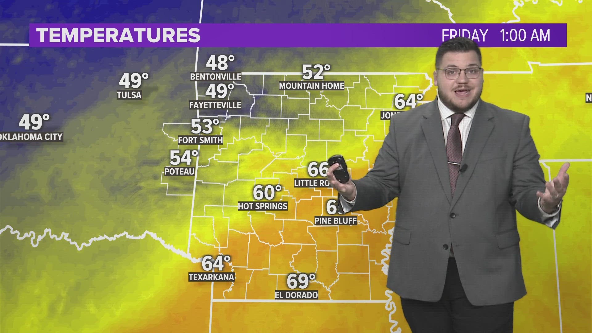
Heavy rain greeted us this morning across NW Arkansas and portions of the River Valley. We have more chances of rain and possibly some stronger storms later on this evening.

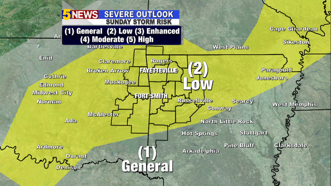
The Storm Prediction Center has NW Arkansas, the River Valley and E Oklahoma under a Slight Risk for strong to severe storms this evening. Strong winds are the main threat, but some storms could produce hail. The tornado threat is very low.


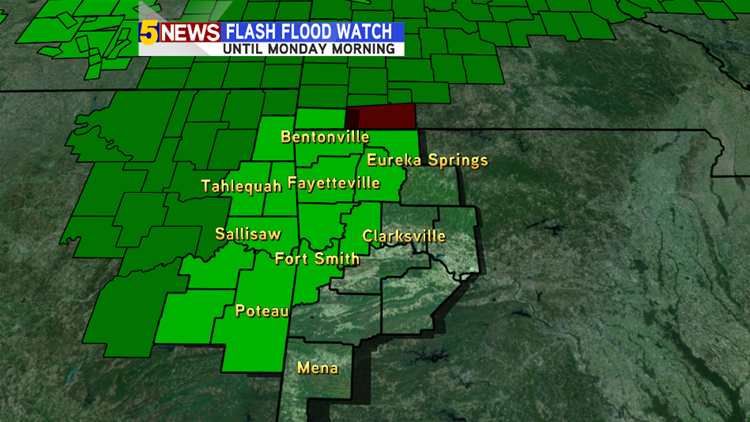
Heavy rain also has us under a Flash Flood WATCH until Monday morning. Be careful of flooded roads especially if you are driving this evening.
Some areas across Benton County, including Rogers and Bentonville, have seen upwards of 3 inches of rain already this morning.
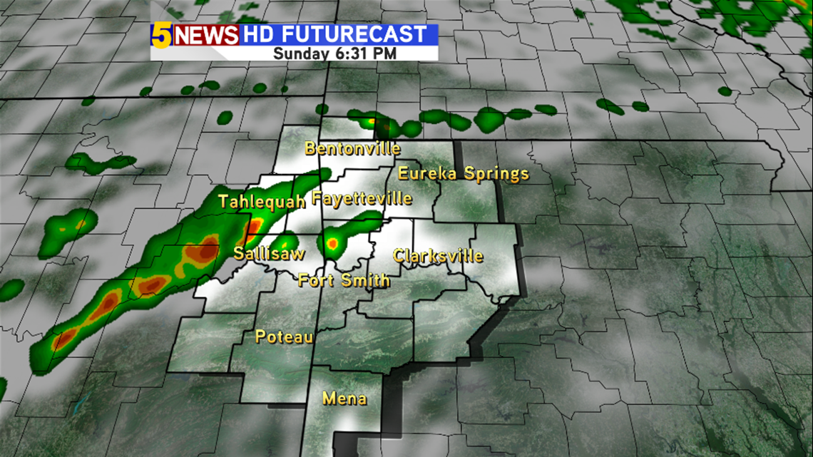
This afternoon, we should be mostly dry until after 5pm

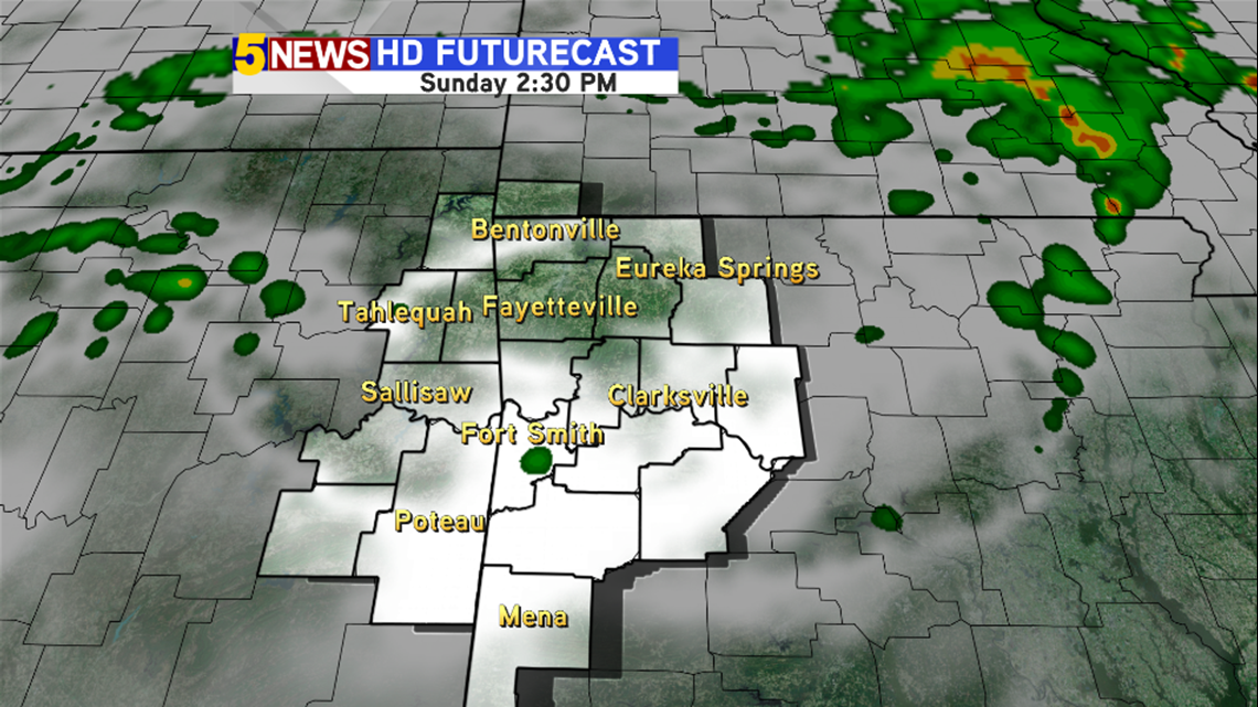
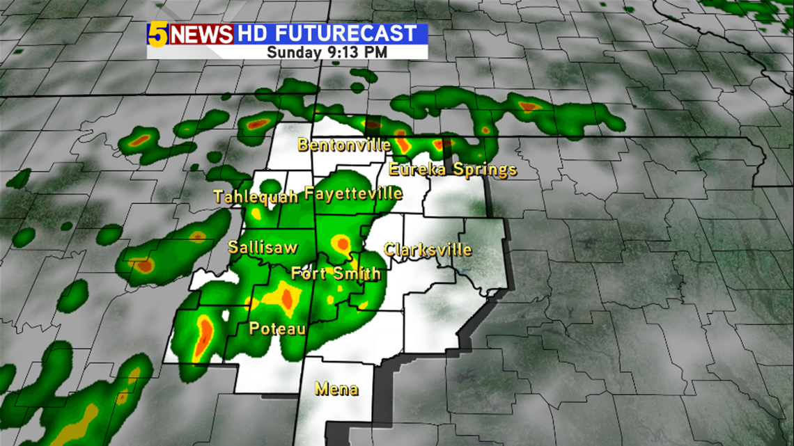
Storms start firing up closer to 6pm. Some of these storms at this time could be strong to severe.

And then they expand across the rest of the area between 7pm and midnight.


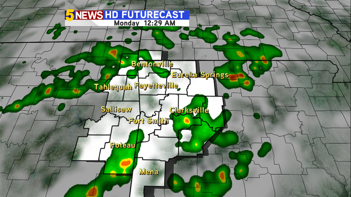
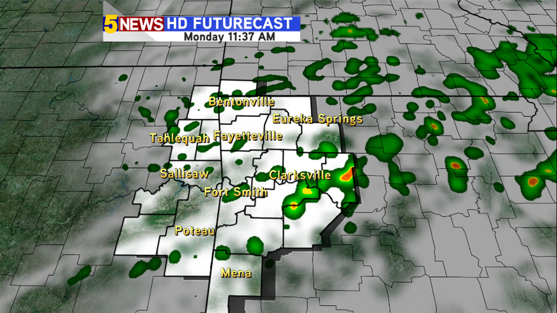
We still have a soggy start to the 4th of July Monday morning, but we should clear out by later in the afternoon in time for fireworks.

The clearing trend continues into the rest of the week. However as the rain chances go down, the thermometer goes up as we could see 100s by the end of the week in the River Valley.
-Sean