
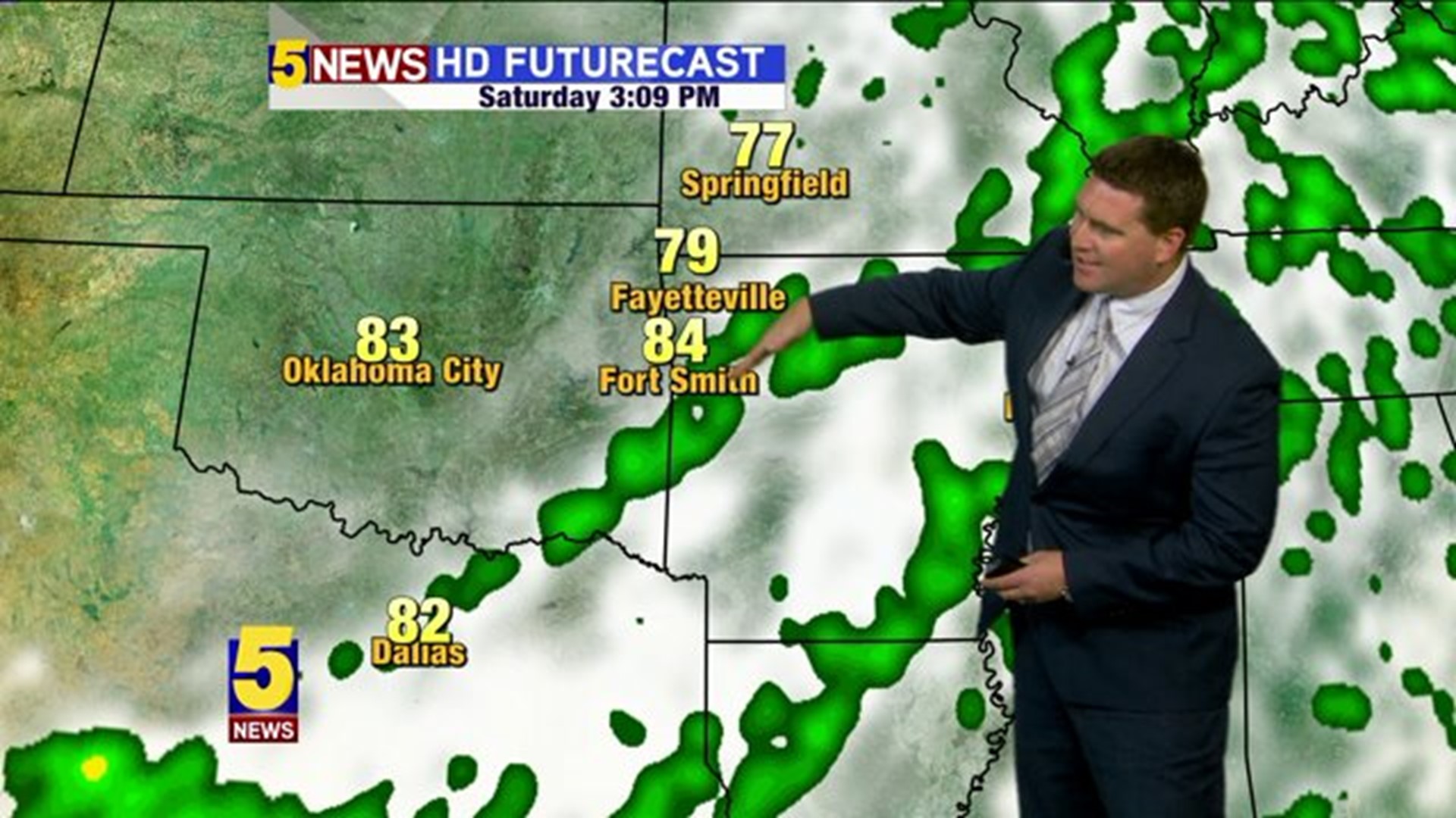
A cold front will move into the area this weekend with the best chances of rain on Friday night and especially Saturday morning. The front is fast-moving and be clear of the area in the early afternoon with clearing skies, northwest winds, and drier/cooler air filtering into the area. Sunday and Monday will feature some of the coolest mornings we've seen in a while with lows in the 50s followed by comfortable afternoons with highs in the 70s & low 80s with mostly sunny skies.
Here's how it plays out...

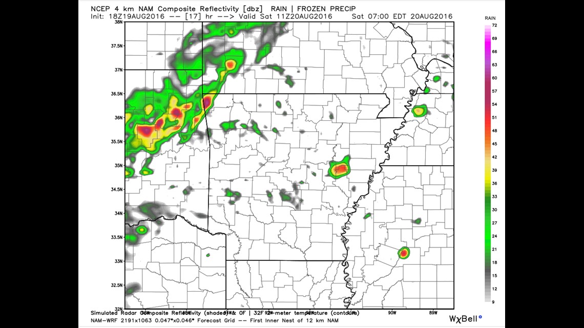
6AM SATURDAY: Rain will continue to be located along and ahead of the cold front as it arrives from Oklahoma and Kansas


9AM SATURDAY: Scattered areas of rain continue across the region. Some of the rain could be heavy at times.

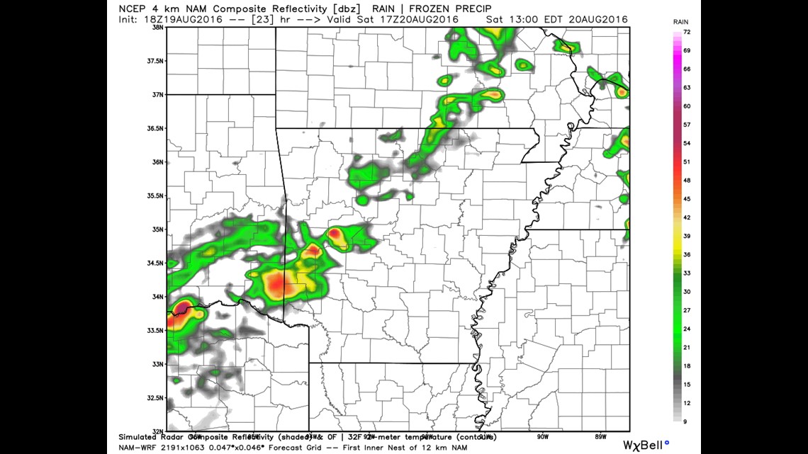
NOON SATURDAY: Most of the heaviest rain begins to shift to the southeast into central and south Arkansas with slowly clearing skies for our area. The bulk of the heavy rain should be over by this time.

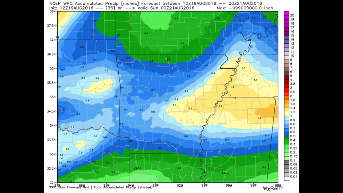
Estimated rain totals are around .75"=1.00" of rain.

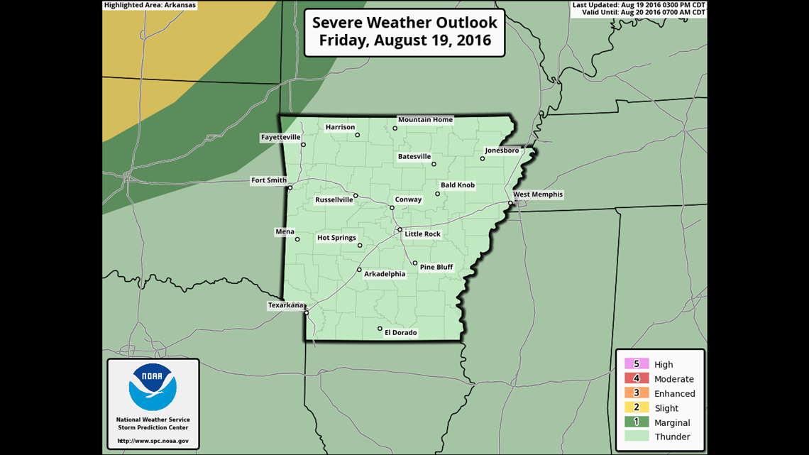
The severe weather risk late Friday is mostly across Kansas and Oklahoma. The storms should weaken as they move southeast into our area but they will likely still contain lots of lightning and brief gusty winds.

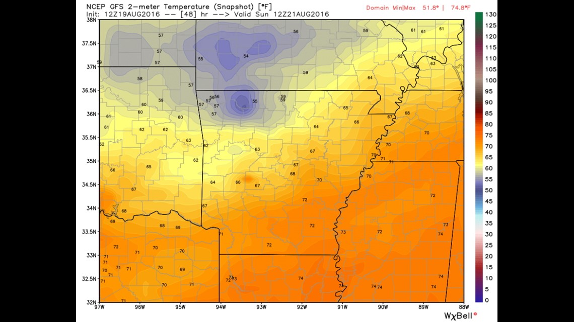
On Sunday morning, we'll wake up to some of the coolest temperatures we've seen yet with mid 50s in NW Arkansas and lows near 60 in the Greater Fort Smith area. More hints that Fall is just around the corner!
-Garrett