There are two big weather stories heading into the next week.
- A chilly, overcast weekend with occasional light rain
- A major Arctic cold front next Thursday
This Weekend:
An area of low pressure will cause overcast skies all weekend with chilly temperatures in the mid to upper 40s with rain possible.

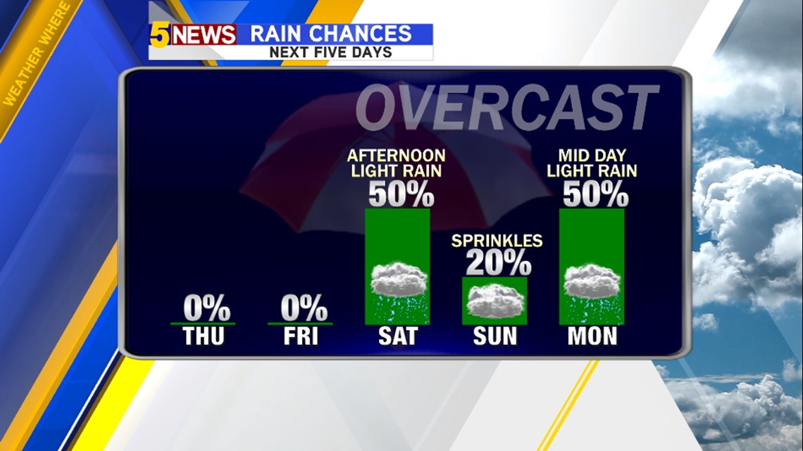
The highest rain totals will be to the south of our area.
- Saturday Rain: Best chance afternoon/evening. Heaviest from Mena and south. Less than 1″ for NW Arkansas & Fort Smith.
- Sunday Rain: Overcast with occasional drizzle areawide. Low rainfall totals; raw, chilly day.
- Monday Rain: Chance chance around Noon areawide. Heaivest still favors south of our area.

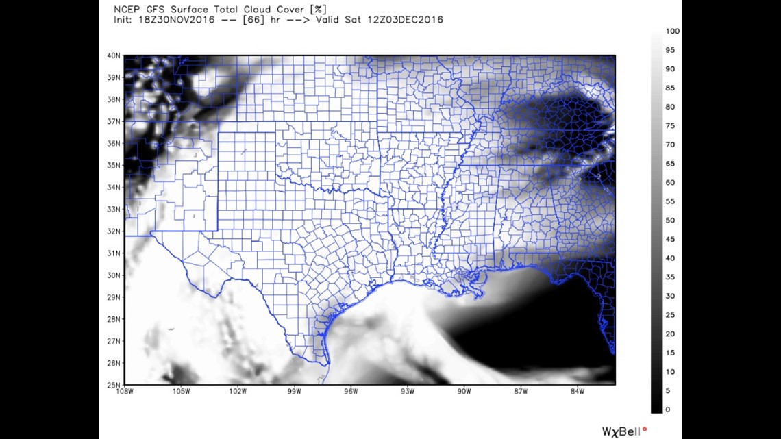
This is a look at cloud cover for Saturday morning. The clouds will be extensive with very little warming from the sun both Saturday & Sunday.

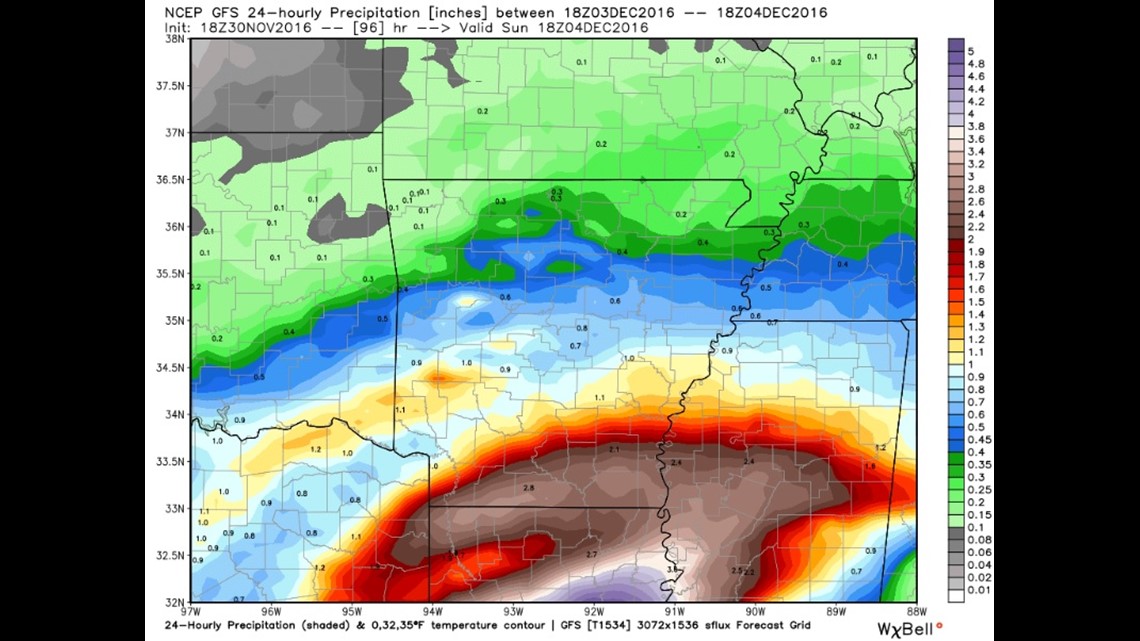
When it comes to rainfall, the best chance is Saturday afternoon/night. Rain totals will be light in NW Arkansas with some of us barely seeing around 1/10th of an inch. Fort Smith may see around 1/2″ of rain with over an inch possible down towards Mena/SW Arkansas and SE Oklahoma. Severe weather is not likely.

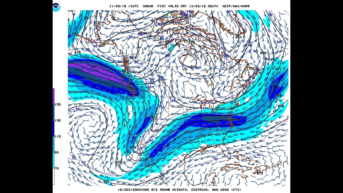
This is a look at the jet stream on Saturday. The SW to NE orientation of the trough means the system will be slow moving and could yield a big soaking around Texas and Louisiana.

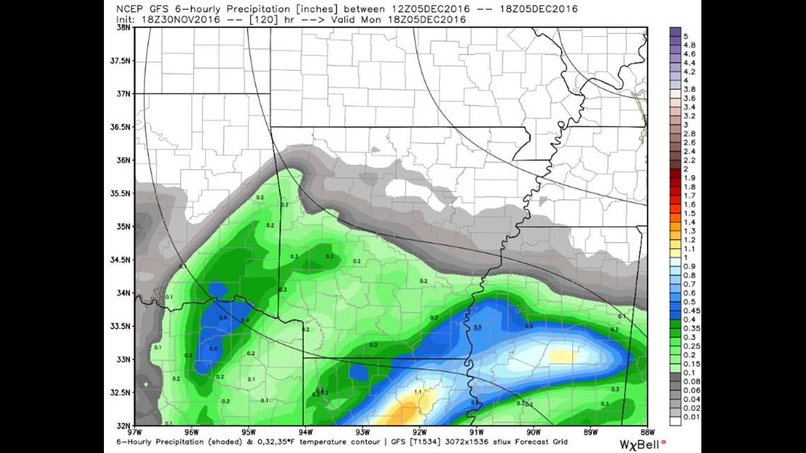
Monday: Another wave of rain will move across the area on Monday with the highest rain chances again focused across SW Arkansas and SE Oklahoma.
Next Arctic Front

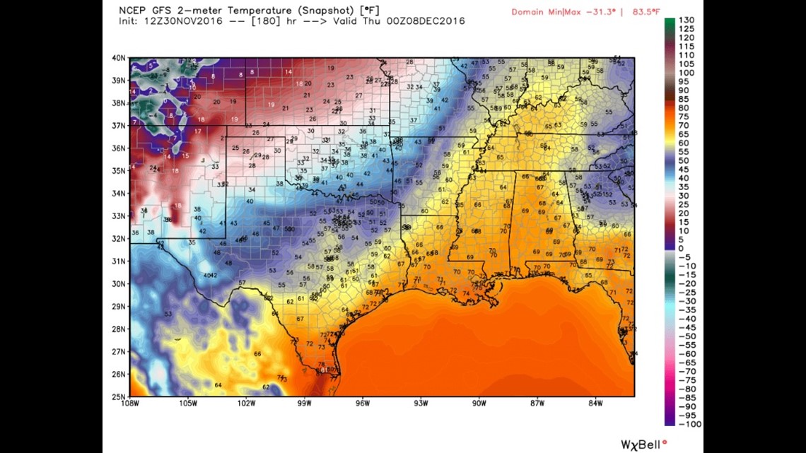
This image shows next Wednesday night. The Arctic front will rip across across the area Wednesday evening with the coldest temperatures of the season.

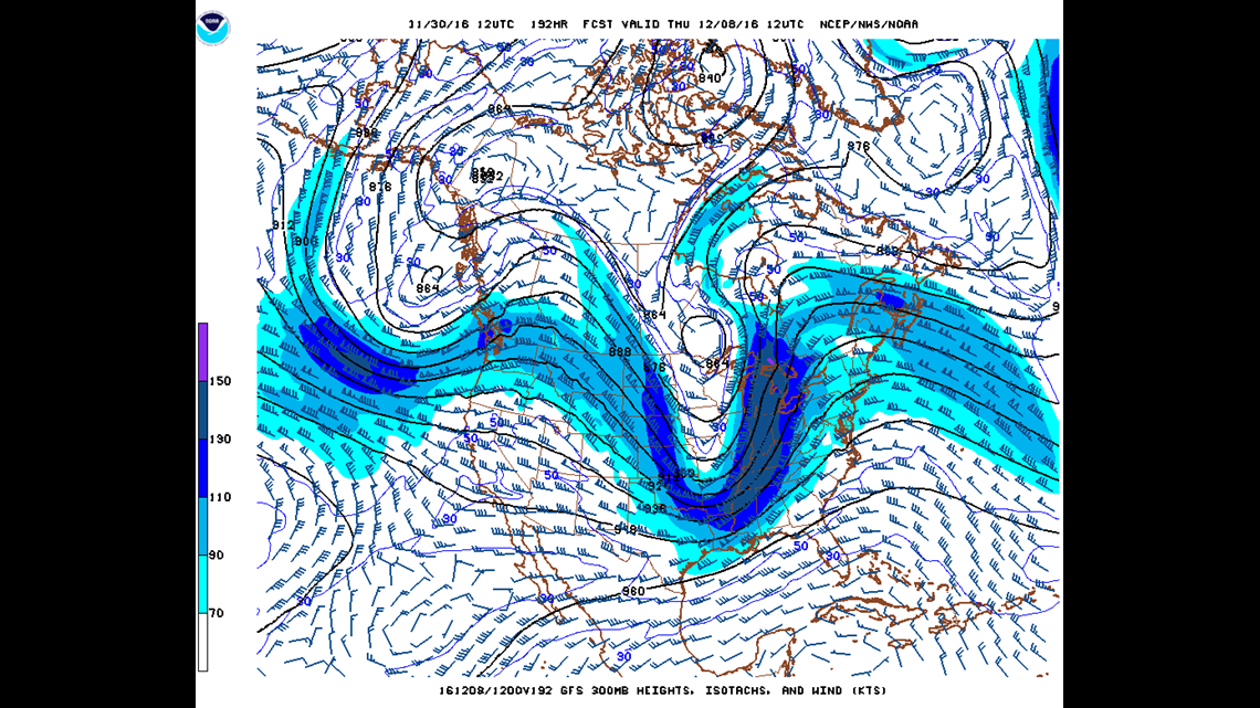
This is the jet stream next Thursday. The trough is very deep into Arkansas allowing the brutally cold arctic air to drain south into Arkansas and Oklahoma. Snow will develop underneath the low pressure and to the northwest of the surface low. Currently, the best chances for snow will be in Missouri and Kansas as well as possibly NW Oklahoma.
There’s a chance some rain could briefly mix with snow as the system leaves but at this point is doesn’t look like a major winter weather maker. It does, however, look like the coldest temperatures we’ve see all season.
-Garrett