The weather will stay active for the next few days with both an opportunity for rain as well as a risk of thunderstorms.
These are the two rain chances:
- Friday Afternoon: Rain
- Christmas Afternoon/Evening: Thunderstorms

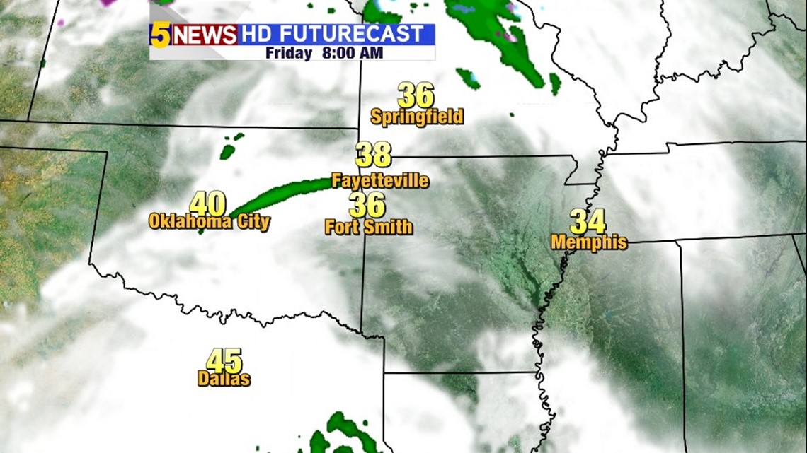
8AM FRIDAY: Cloudy skies early Friday with the best rain chances later in the day

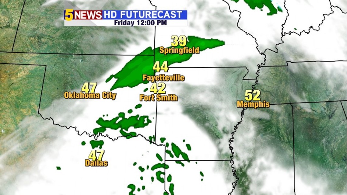
NOON FRIDAY: A few showers will break out in Oklahoma and move east. The best chance for rain Friday will be after Noon and into the early evening.

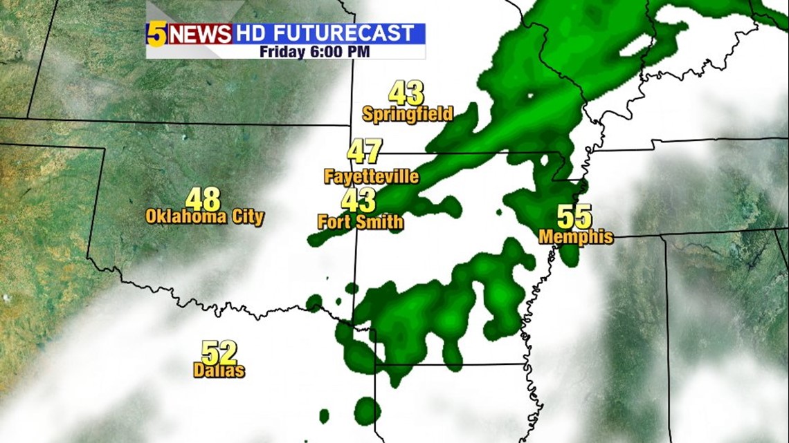
6PM FRIDAY: By late evening the rain will move out of the area.

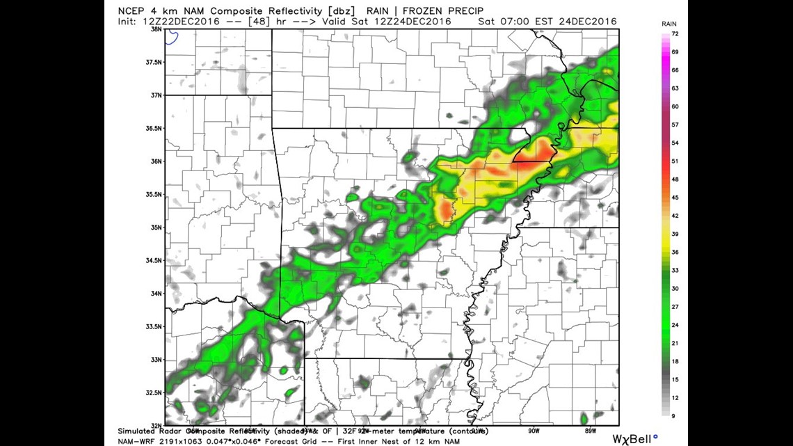
Christmas Eve: The highest rain chances on Saturday will be just to the south of our area in central and southwest Arkansas. There’s at least a minimal chance for showers on Saturday as a warm front lingers around I40 eventually advancing north overnight.

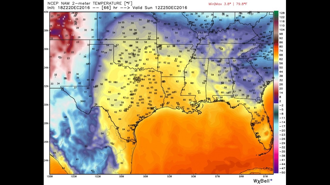
CHRISTMAS MORNING 6AM: It’s going to be warm. Temperatures in the 50s across NW Arkansas and low 60s in the Fort Smith area.

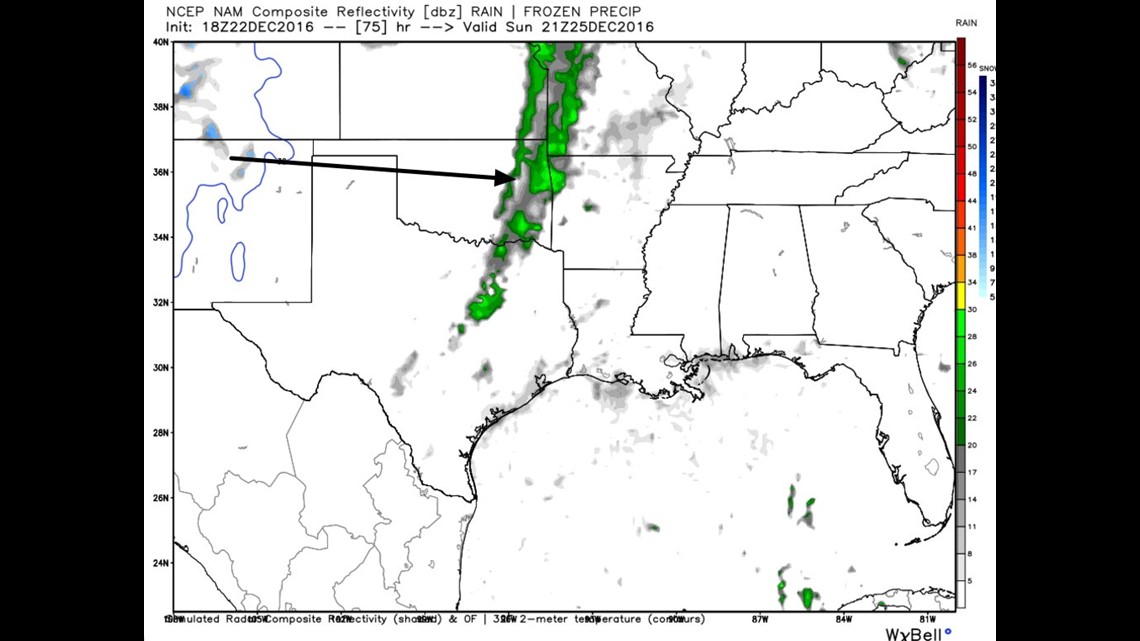
CHRISTMAS 3PM: A line of thunderstorms will move across the area with at least a minimal risk of severe weather. With low instability and high wind shear; damaging winds would be the most likely risk followed by at least a small risk of tornadoes. The threat will end Christmas evening.
-Garrett