Christmas 2016 will go down as one of the warmest on record for our area with temperatures nearly 30º above normal.
The unseasonably warmth will end this week with a cool down expected. Over the next two weeks, temperatures will be more in line with what we would expect for January with highs in the 40s and lows in the 20s.
The next major arctic blast looks to arrive just after the New Year; probably around January 4th.

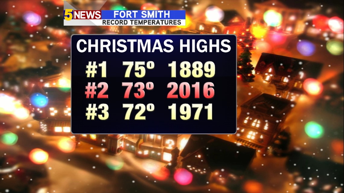

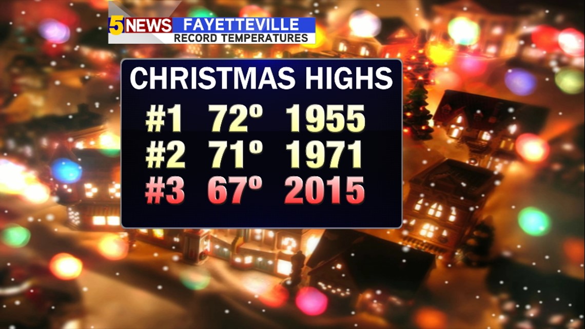
This Christmas was the 2nd warmest on record for Fort Smith and the 3rd warmest on record for Fayetteville.

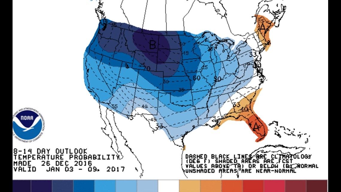
The trend for the next two weeks calls for a higher probability of below normal temperatures across most of the United States.

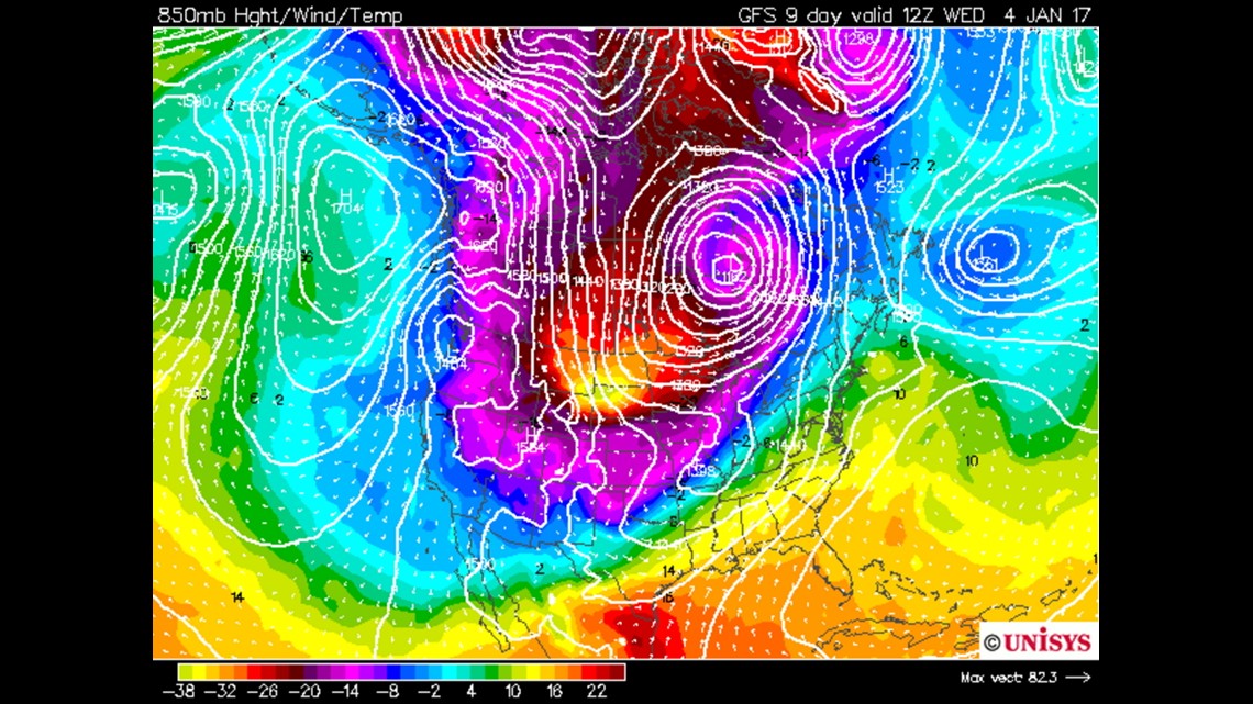
Long Range? There are hints of the next arctic invasion around January 4th.

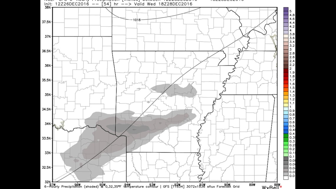
Wednesday’s rain chances this week look: “meh”. Maybe a stray shower but not much.

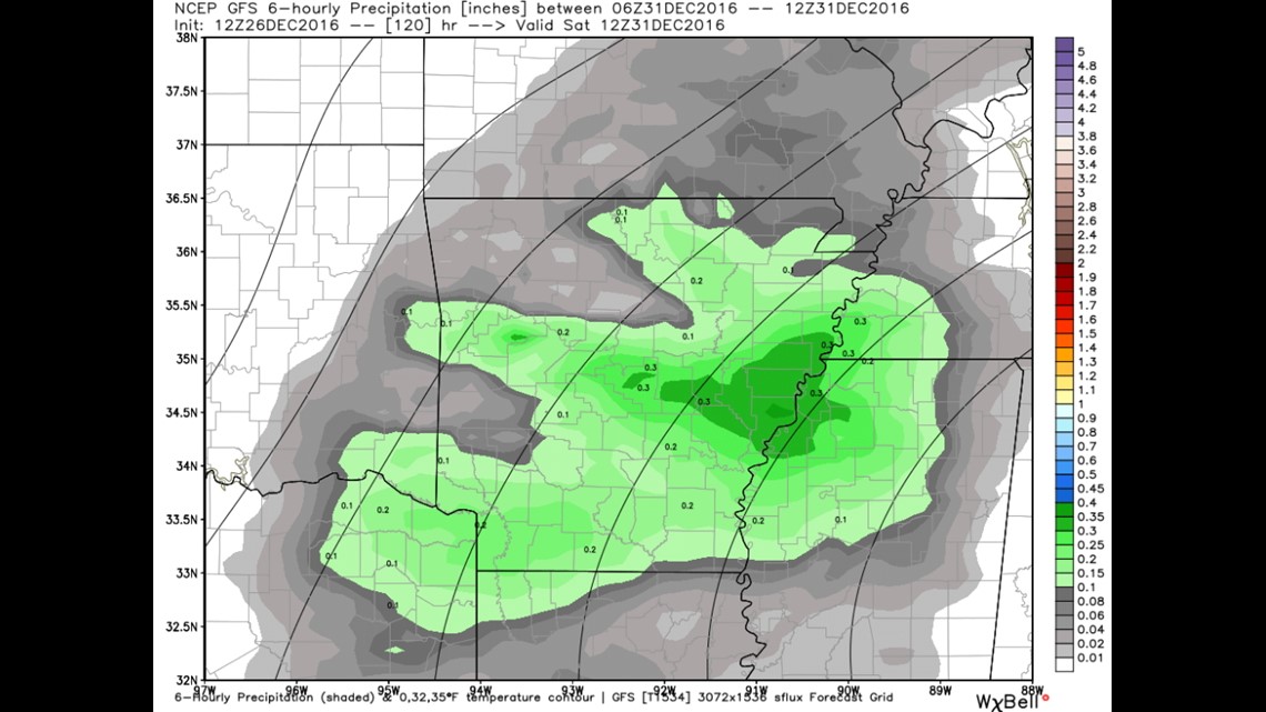
This is Saturday, New Year’s Eve. Rain chances are a little better but overall it doesn’t look like a huge soaking.
Right now, it appears everything will be liquid but with the cold air set to arrive shortly after New Year’s Day it’s possible wintry weather may be just around the corner. After all, January is the snowiest month of the year for our area.
-Garrett