5NEWS has implemented a Winter Weather Alert Day for Friday January 6th, 2017 for light snow which is expected to fall along and south of the I40 corridor in West Central Arkansas and Eastern Oklahoma.
A Winter Weather Alert Day is issued when winter weather is expected to affect travel or cause widespread delays or disruptions to your daily routine. During an Alert Day, expect more blogs, more video forecasts online, more Facebook Live broadcasts, & more coverage on-air about the event.


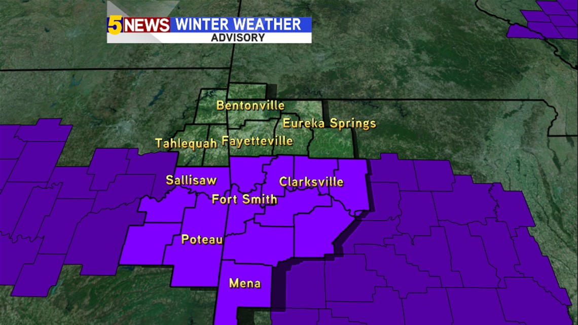
A Winter Weather Advisory has been issued from the National Weather Service for most locations south of the Hopper Tunnel in the River Valley and SE Oklahoma.

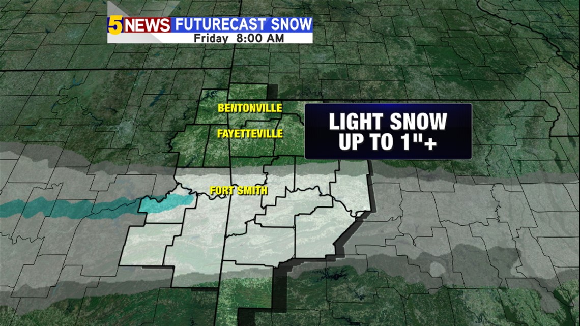
Accumulations should be around an inch or less with locally higher amounts. While the amounts won't be as much as some winter events, the temperatures in the teens should be cold enough for snow to accumulate and stick to bridges and overpasses easily overnight in any location where the snow falls. As such, expect travel to be slick and hazardous anywhere the snow accumulates.

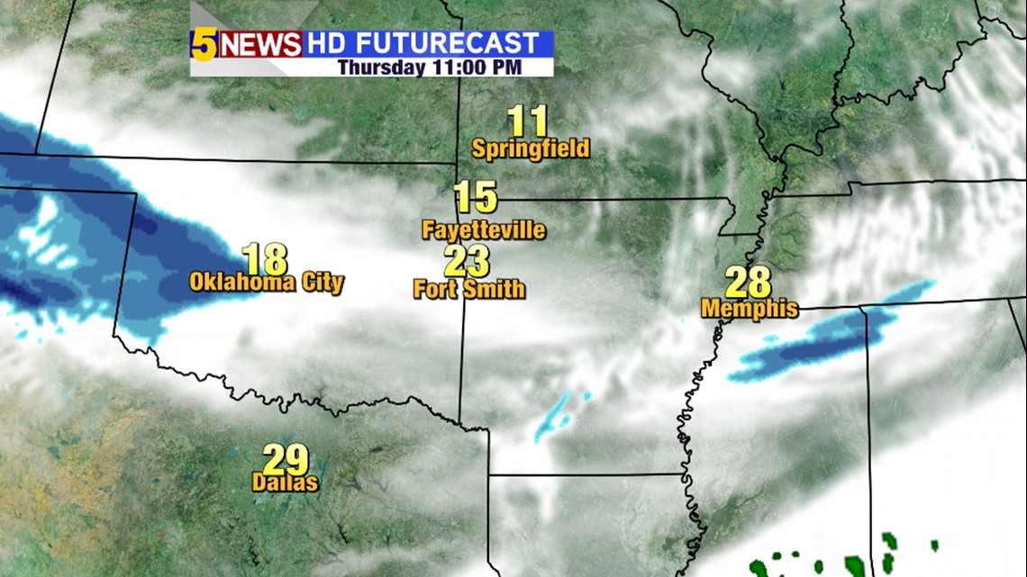
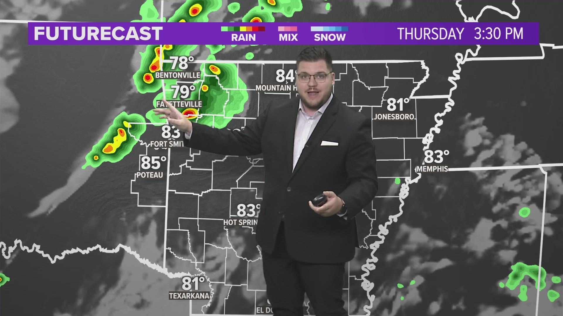
At 11pm Thursday: Expect overcast skies with snow moving into Oklahoma

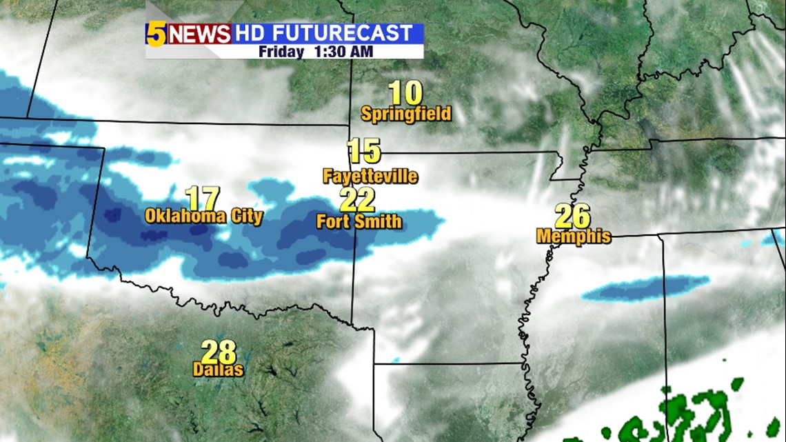
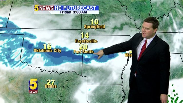
1:30AM Friday: Snow will be in the area after midnight. By 1am, snow should be falling and accumulating.

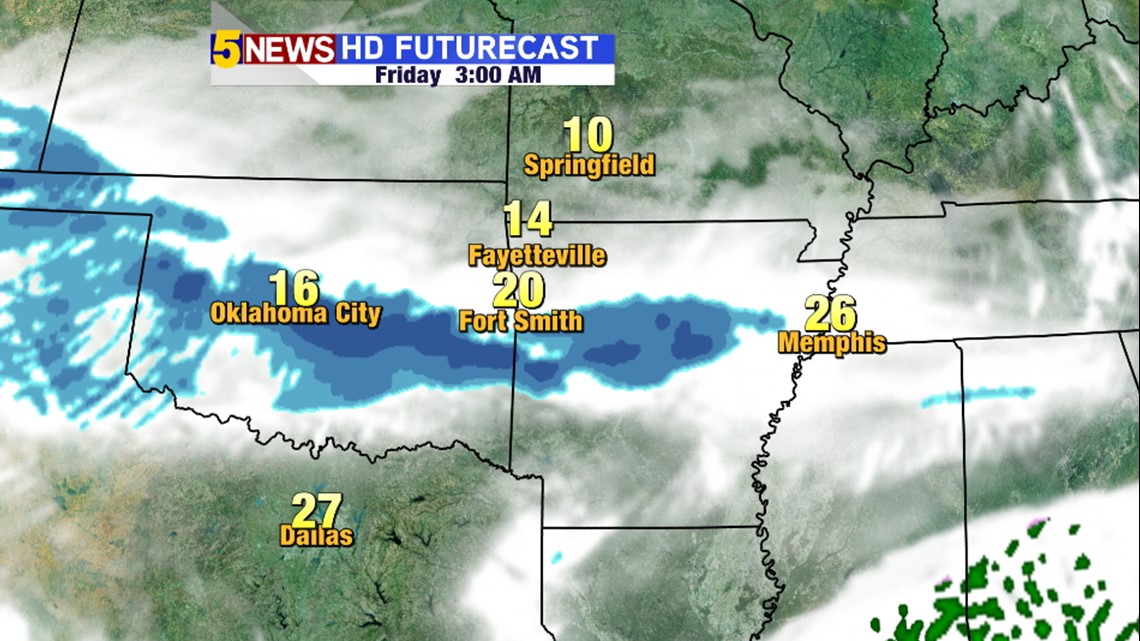
3AM Friday: A heavier band of snow is likely going to develop in SE Oklahoma and work it's way into SW Arkansas. This could be the band that gives a few of us snow totals near 1"

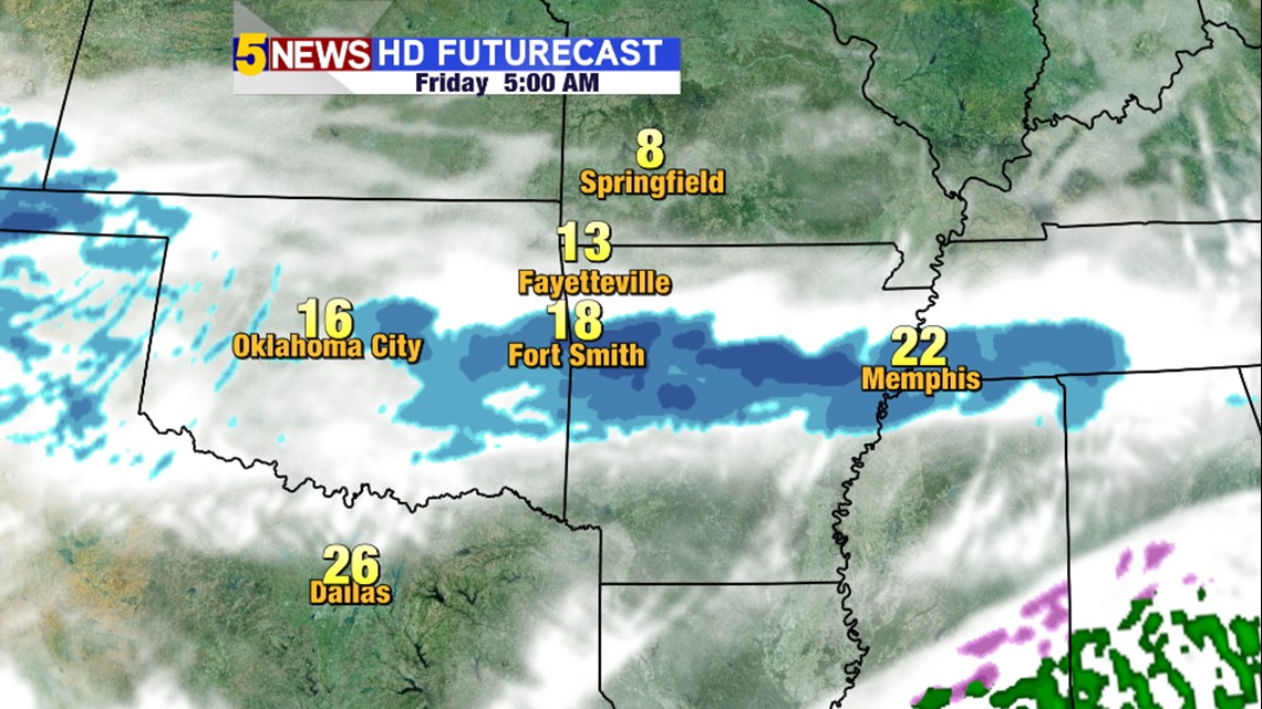
5AM: Friday: The heaviest area of snow will be moving out but accumulation is still likely in Clarksville and Booneville at this time.

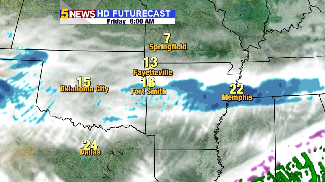
6AM Friday: By this time the event will be ending with snow coming to a close.
Expect another blog most later this evening with additional and new data on the track of the heaviest accumulations.
-Garrett