Severe weather in February? Actually, it’s probably more common than you think.

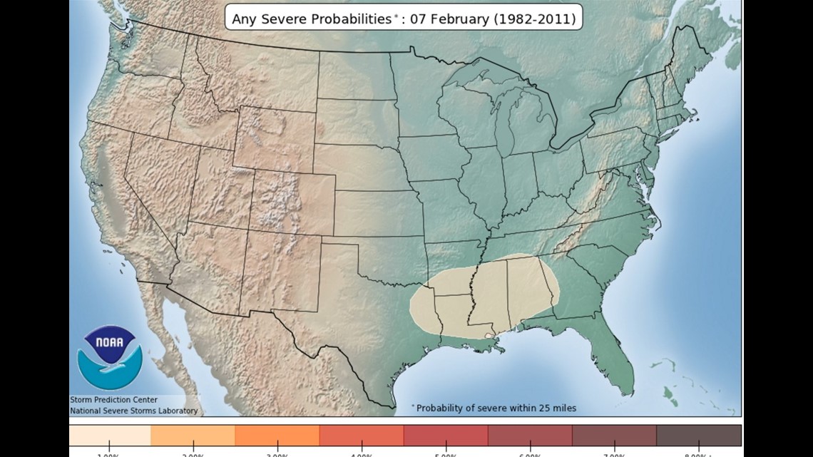
This highlighted area shows where severe weather is most common for the 7th of February.

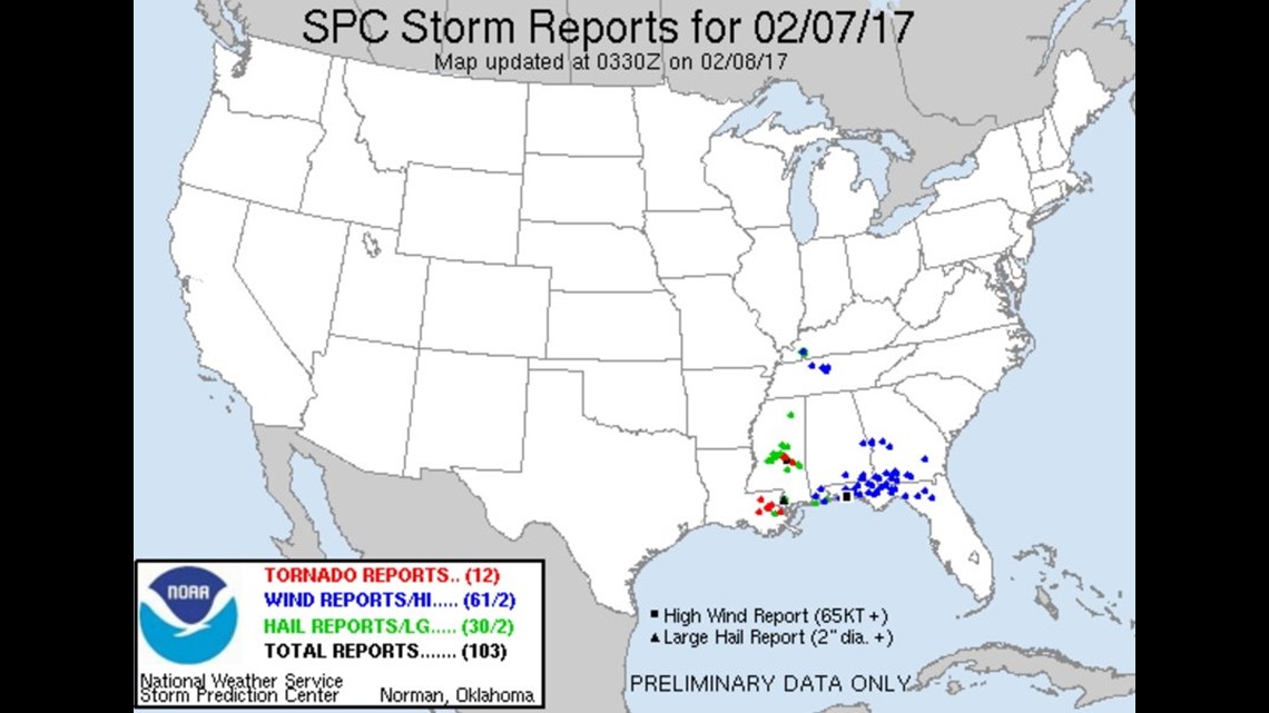
This is the storm report map that shows the location of severe weather reports; including the tornadoes in New Orleans.
Click the animation above from Storm Prediction Center Warning Coordination Meteorologist Patrick Marsh.
As the average location of jet stream winds shift from the Gulf of Mexico to the Northern United States the climatology of severe weather also shifts and tracks in that direction.

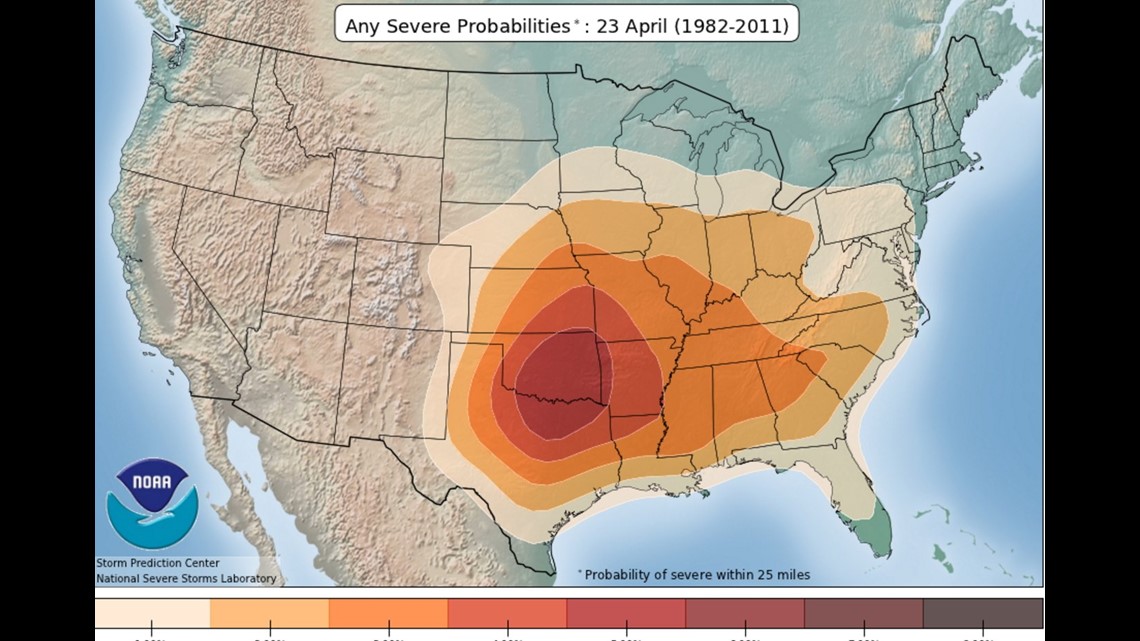
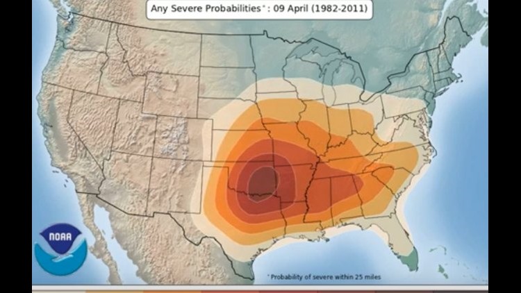
Severe weather climatology peaks in W/NW Arkansas in late April and early May before shifting farther north into Kansas by the summer months.

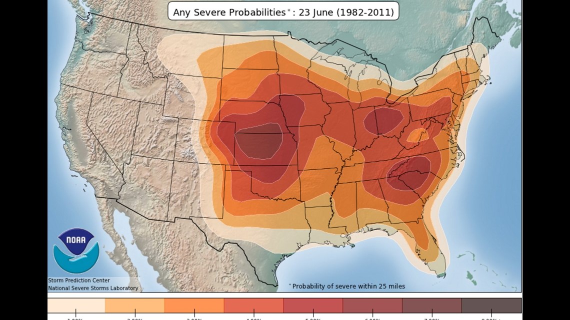
By late June, most of the severe weather reports favor Kansas and Nebraska.

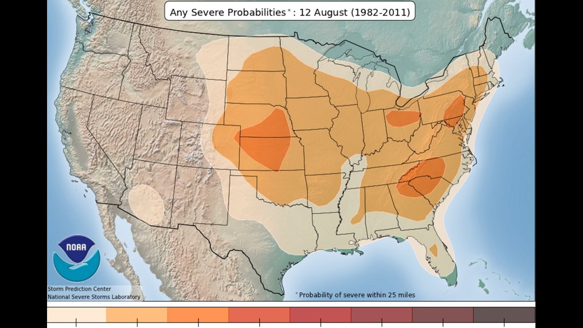
By August, the risk of severe weather is substantially lower as the ridge of high pressure usually builds across the Central United States and shunts most of the stronger jet stream winds to the north.
So in summary, Tuesday’s severe weather along the Gulf Coast really wasn’t out of the ordinary and we would expect to see this area of severe weather slow migrate north in the coming weeks.
-Garrett