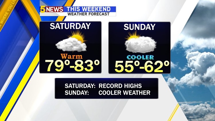

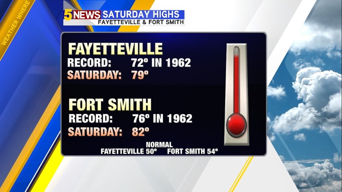
Saturday: Record highs will be set across the area with highs expected to be around 80º with breezy south winds.
Additionally, the fire danger will continue to be high with low humidity and breezy winds.

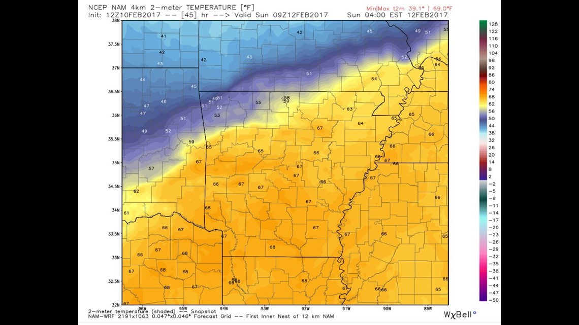
This map shows 3am on Sunday.
The cold front will be moving across the area and turning the wind direction around from breezy south winds to breezy north winds.

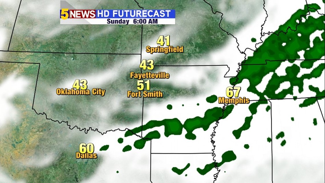
By Sunday morning the front will be across south Arkansas with temperatures falling from the north to the south.
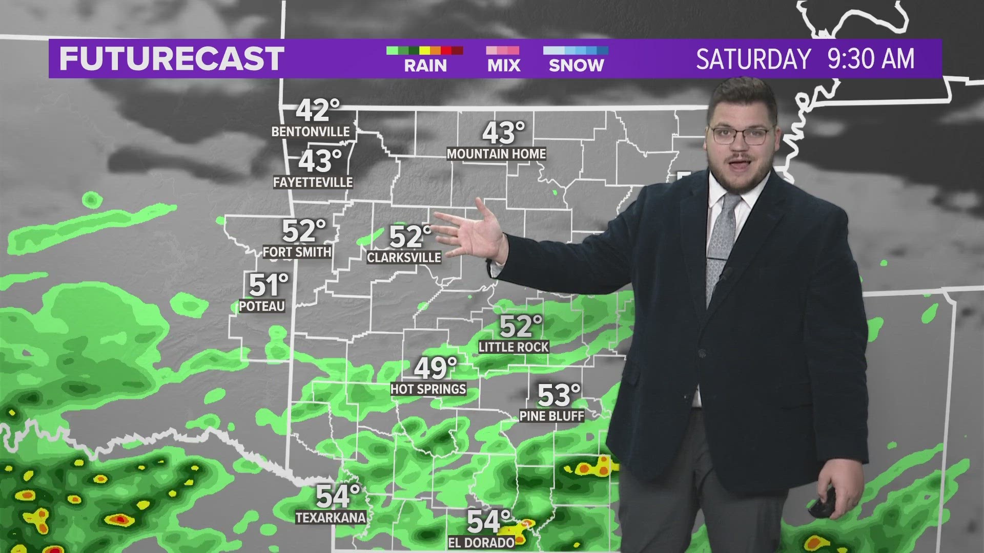
It does appear rain will be out of the area for Saturday and Sunday.


There will be a good deal of clouds on Saturday and even early Sunday with a little bit of a clearing on Sunday.

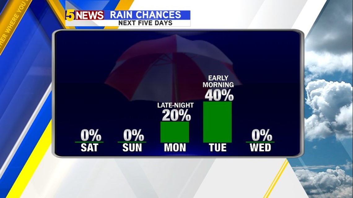
The next chance for rain looks to increase on Monday night into Tuesday with another storm system that’s actually passing to our south so we should see some light to moderate rain on the north side of the system in our area.

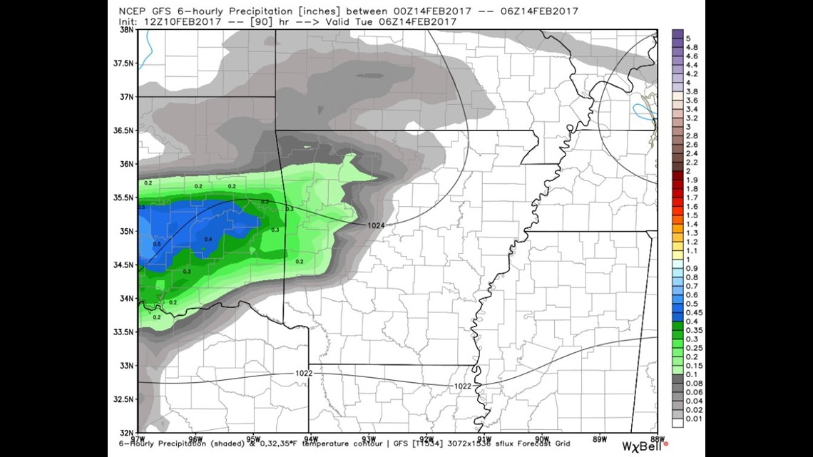
This show Midnight late Monday into early Tuesday with rain arriving from the southwest.

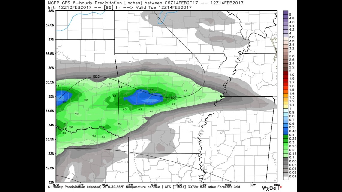
This image shows rain on Tuesday morning at 6am.
The Fort Smith area and points to the south will see higher rainfall totals than NW Arkansas based on the current track.
-Garrett