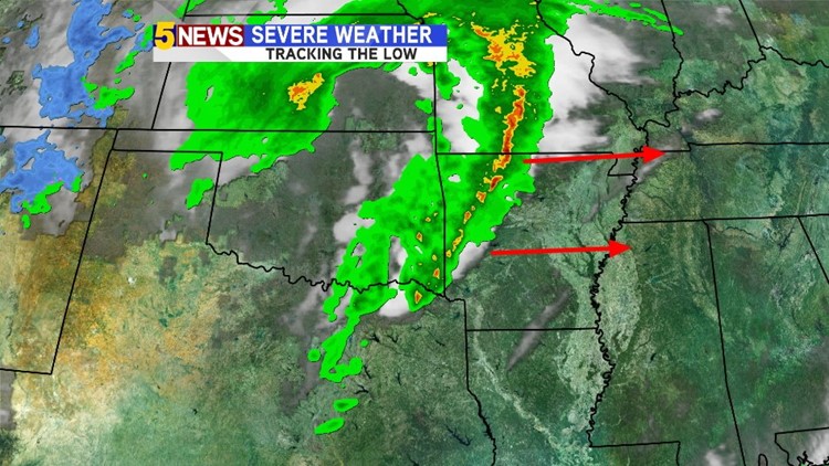
The severe thunderstorm and tornado risk has shifted to the east of our area with residual storms continuing into the overnight as the colder air moves in from Kansas.
Expect much colder weather for tomorrow with high temperatures held down into the 50s although cloudy skies and breezy north winds will make it feel colder.
A warming trend will take over for late week and the weekend with highs climbing back into the 70s to near 80.
-Garrett