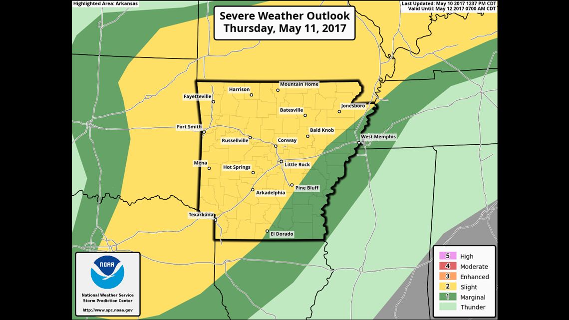
A severe thunderstorm risk will return to the area on Thursday with the best chance of showers and thunderstorms in the afternoon and evening.
The overall risk for tornadoes is lower than you otherwise would expect for May but it’s still present.
It looks like the greatest threat coming up on Thursday evening will be large hail from quarter to golf ball size.

The system exits quick with a lingering cold rain on Friday and eventually clearing skies on Friday evening.
The weekend looks fantastic with sunny skies and highs in the 70s.
Here’s how it looks hour-by-hour….

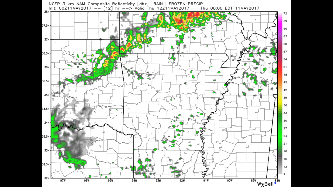
THURSDAY 7AM: A few showers will be possible early in the day as overnight storms from Kansas move into our area and weaken.

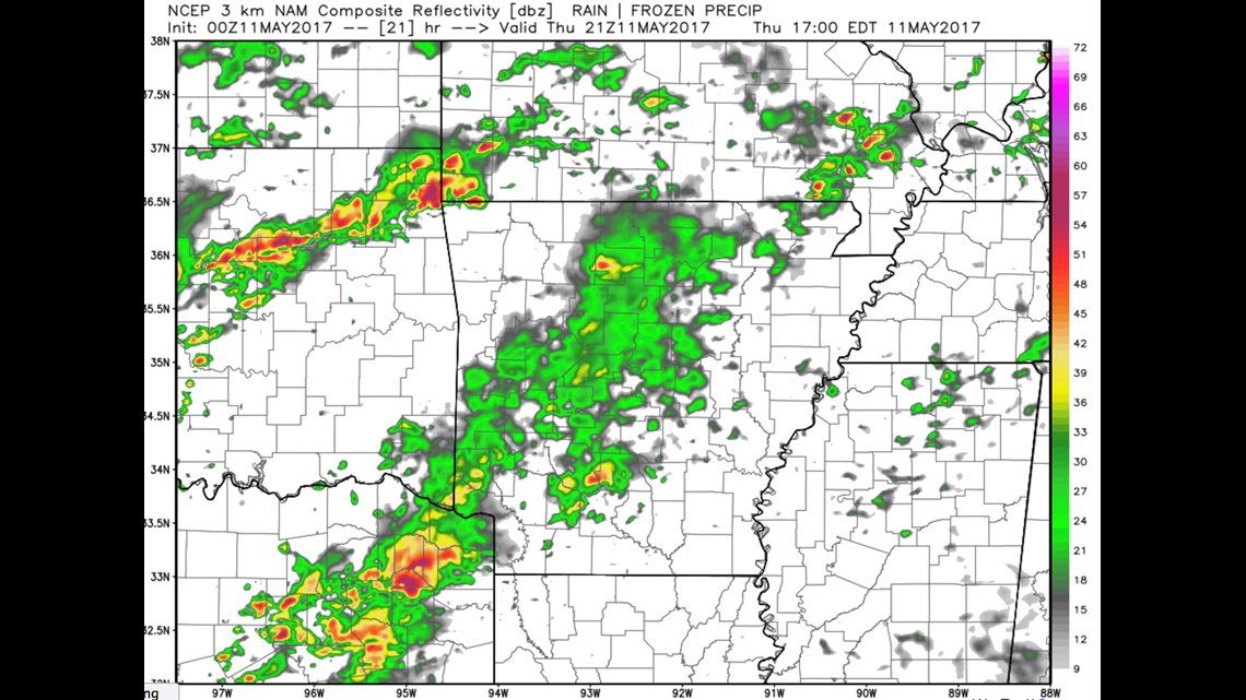
THURSDAY 4PM: Scattered storms begin to develop in Oklahoma and will move into our area.

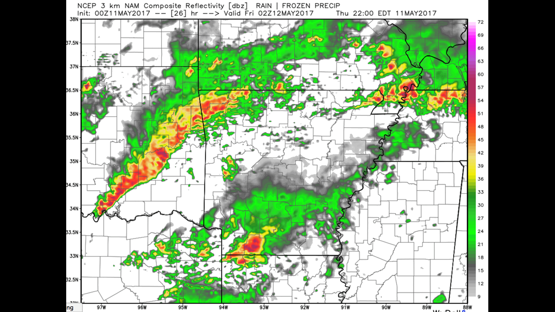
9PM THURSDAY: A line of strong to severe thunderstorms will be underway across Oklahoma and moving into our area late evening into the early overnight.
-Garrett