(When we’re non-stop with weather coverage, you can follow this link to watch us or download our 5NEWS App. We will automatically stream live on 5NEWS Facebook as well)
Storm coverage will increase across the area late Friday with widespread showers and thunderstorms across NW Arkansas the Greater Fort Smith area.
Isolated storms that develop in SE Oklahoma and move into Western Arkansas will have the highest potential to be rotating this evening. A few tornadoes are possible.

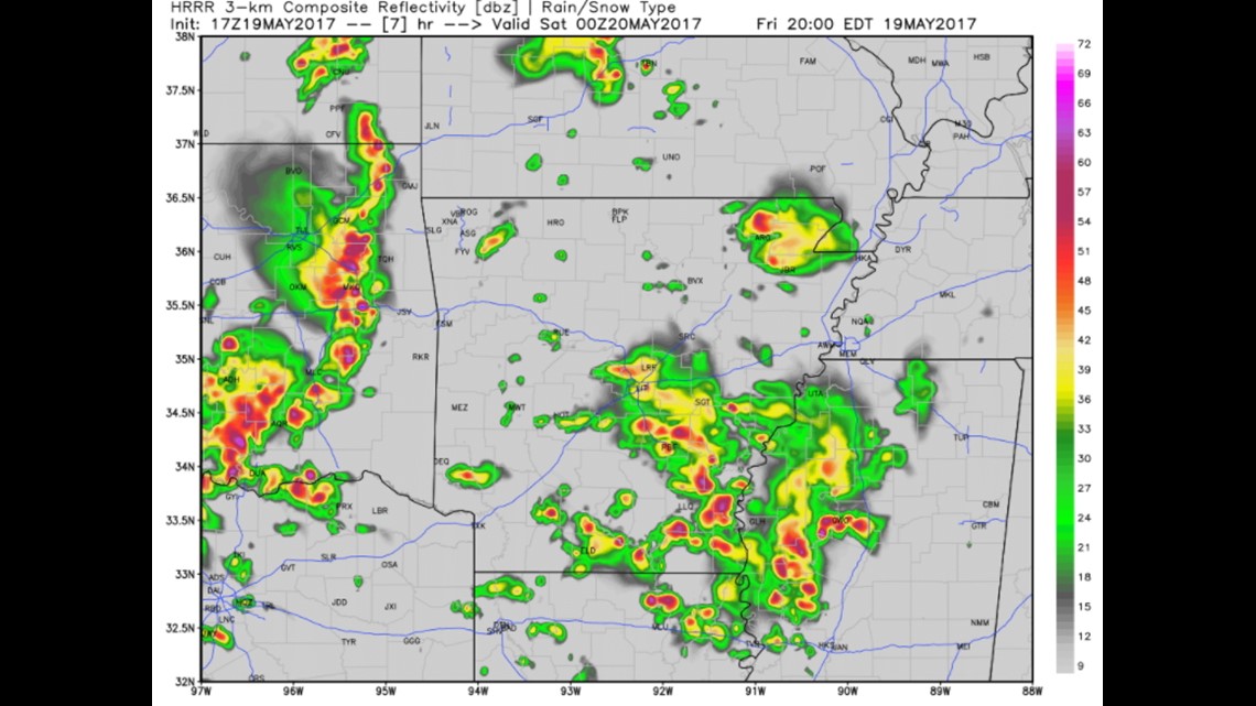
This map shows 7pm. These are expected to be the stronger storms with the higher tornado potential.

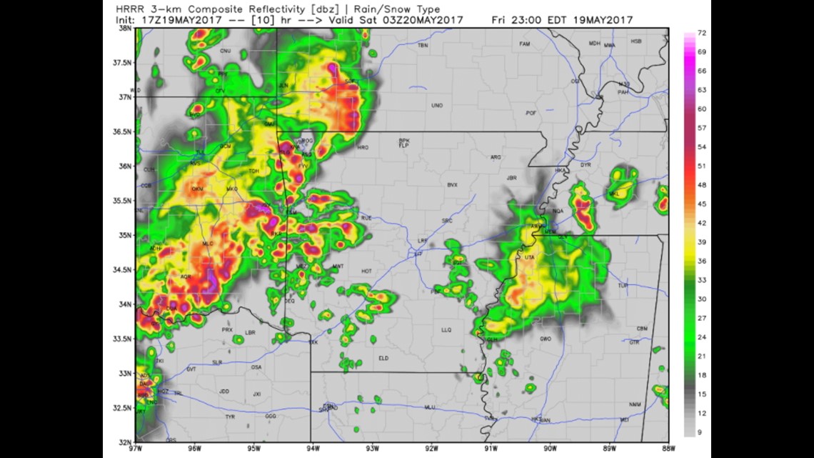
This map shows 10pm. We expect widespread thunderstorms to develop across the entire area with a risk of large hail, damaging winds and a few tornadoes. This threat should continue into the overnight before weakening as it moves east.

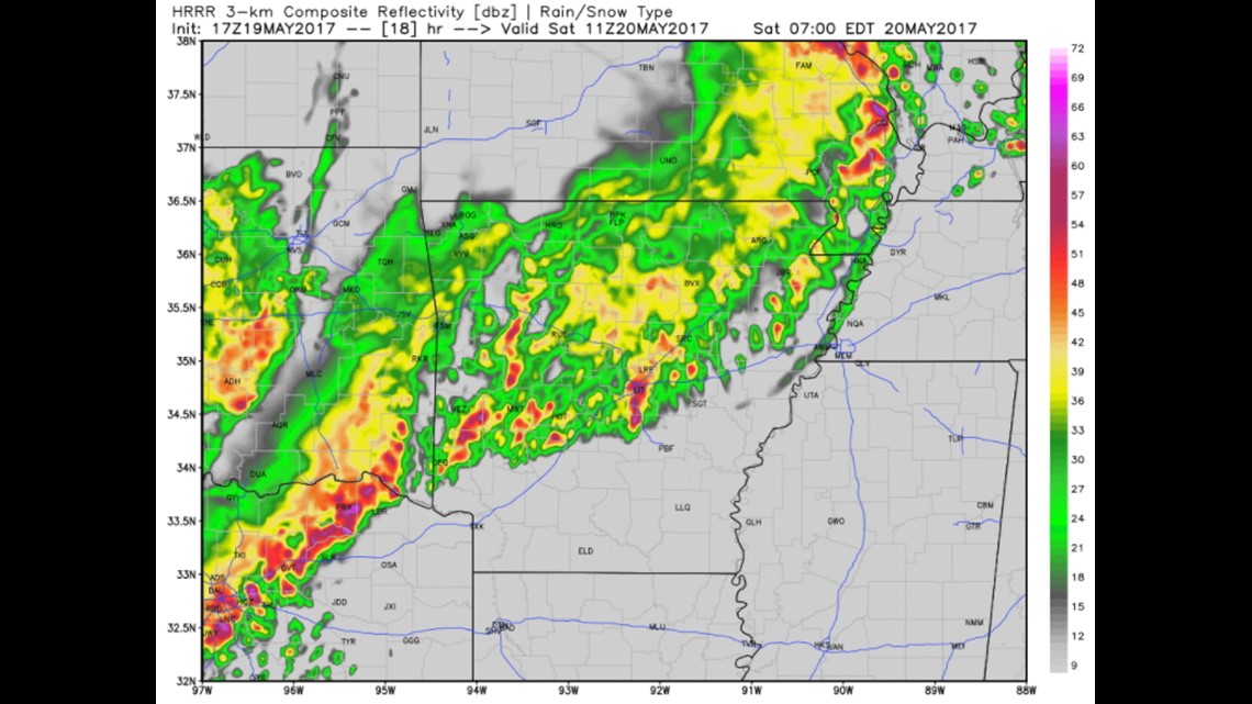
This map is 6am on Saturday. It will likely still be raining but the severe weather risk will be over. Flash flooding could be an issue with the stronger storms.

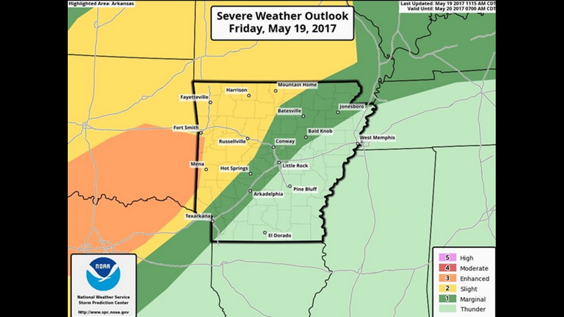
The highest risk for tornadoes will be in the Enhanced Risk of Eastern Oklahoma and West Central Arkansas.
-Garrett