The big weather story late this week and into the weekend will be the stalling cold front across the area with chances for showers and thunderstorms starting on Friday and continuing into the early next week.

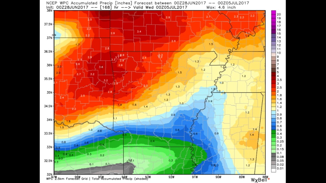
Rain totals over a 3-5 day stretch should be well over 1″ with many areas closing in on around 2-3″ by the time Monday rolls around.
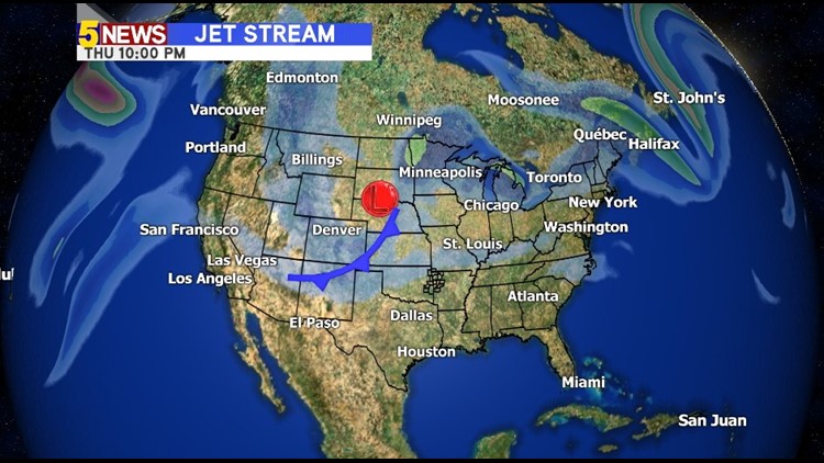
The lack of upper level winds (which is typical this time of year) is a double-edged sword. The severe weather risk will be low but the rain chances will likely linger well into next week as the front fizzles and falls apart.
Rain chances heading into July 4th may be more pronounced in the late afternoon or early evening.
The details on the exact timing of the rain rounds still need to be worked out and I’ll bring you another blog update as it gets closer.
I think the late Friday time-frame might be the best chance for the most widespread rainfall.
-Garrett