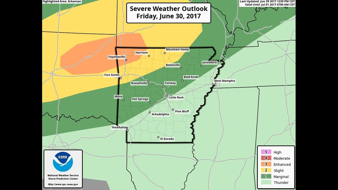
The chance for severe storms returns on Friday with a weak cold front dropping in from the north.
With the strongest storms, damaging wind will be the primary threat in addition to locally heavy rainfall.
The two rounds of storms will bookend the day on Friday.
- Expect storms Friday morning to start the day.
- Expect the next round Friday after sunset to end the day.
Here’s how it looks hour-by-hour and what we’re thinking about the timing.
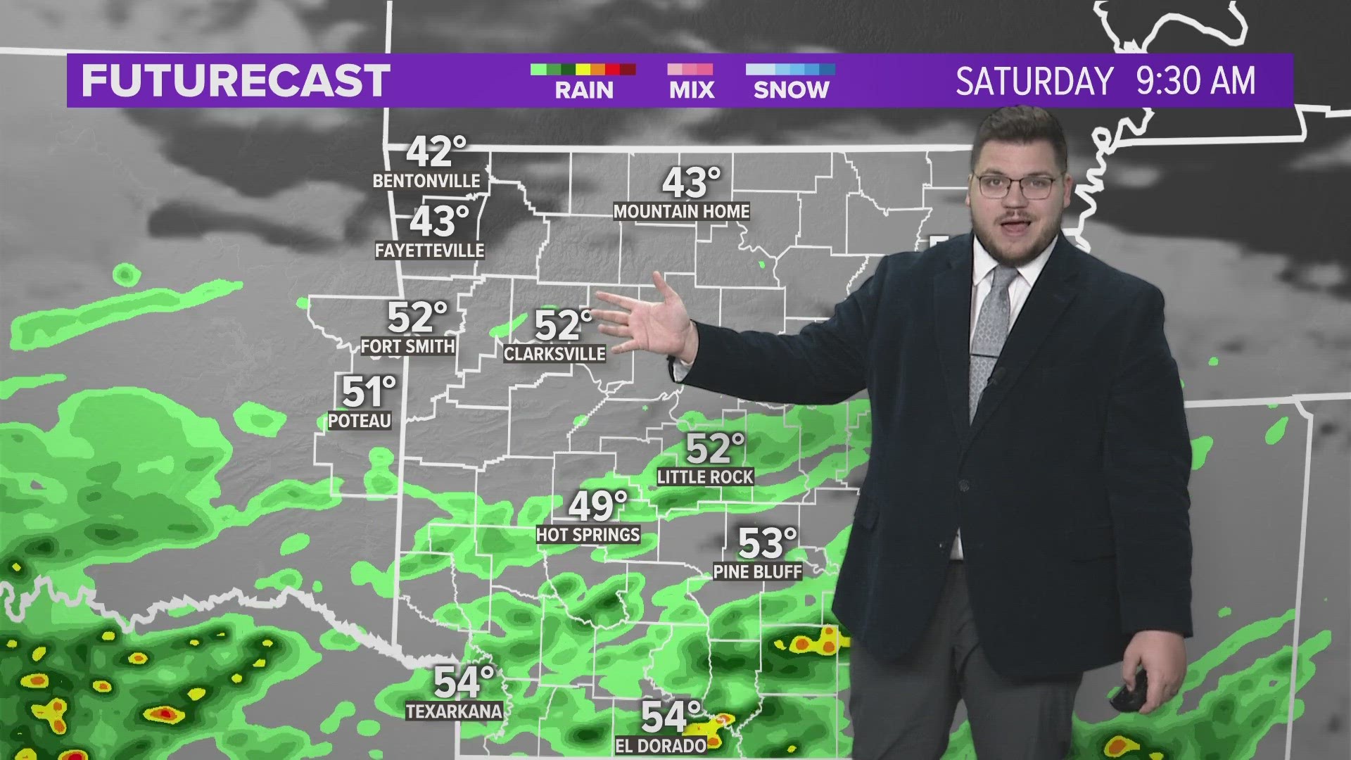
The timing of the rain on Saturday is still uncertain and depends largely on the location of any boundary created by the storms on Friday.

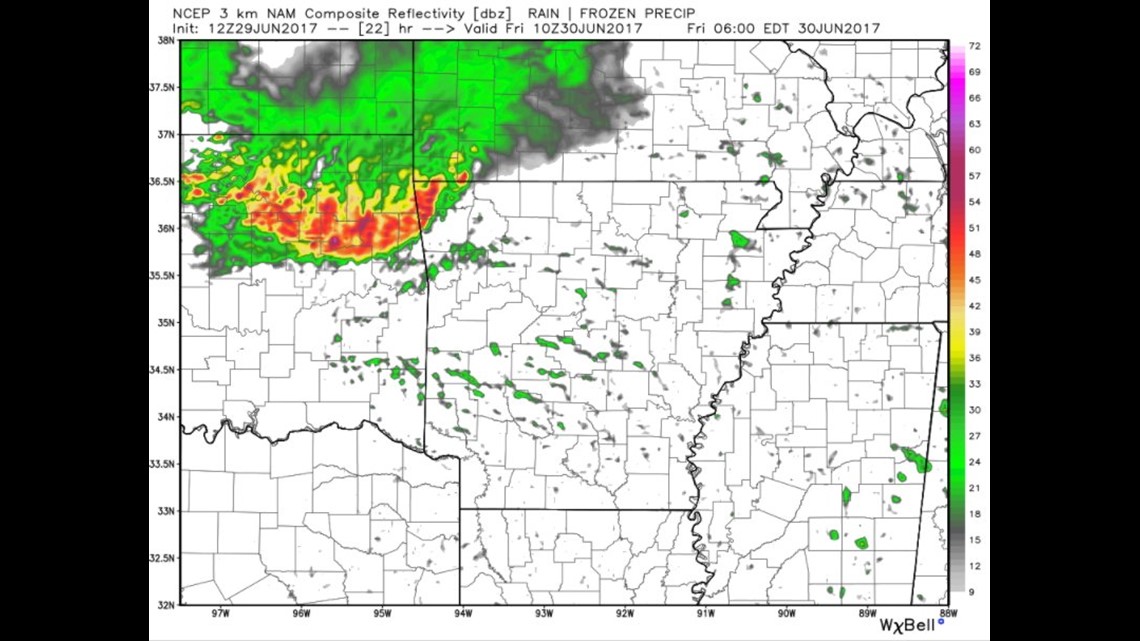
5AM FRIDAY: Showers and storms arriving from the northwest with damaging winds on the leading edge of the line.

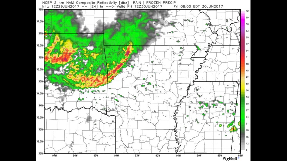
7AM FRIDAY: Rain and storms continue into the morning drive.

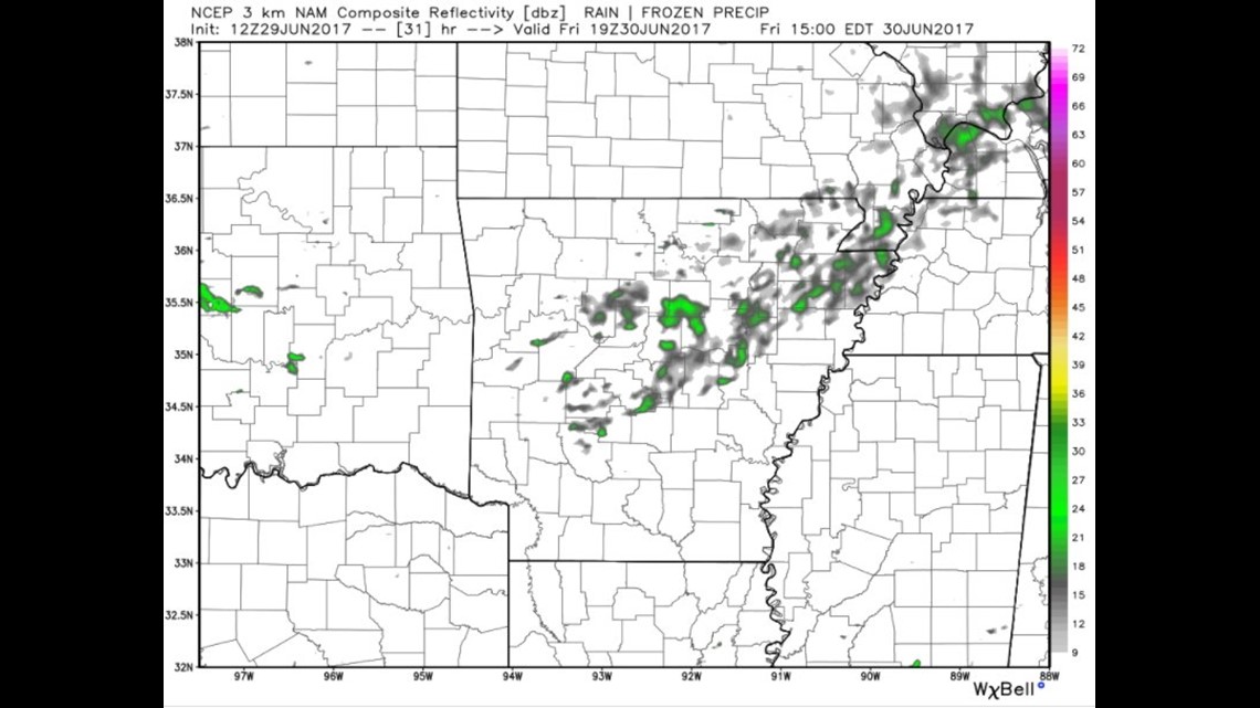
2PM FRIDAY: Expect a break midday with sunshine briefly returning and highs climbing into the 80s to near 90º.

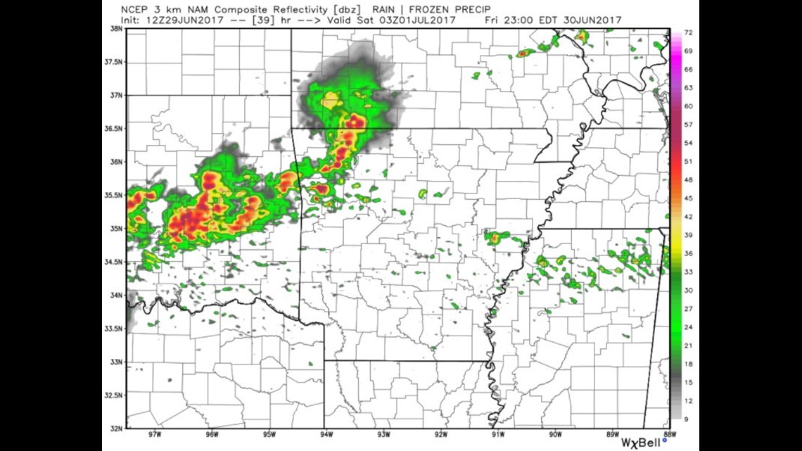
10PM FRIDAY: Additional storms will be underway. They may start developing as early as 6PM to our west. These storms also have the potential to be severe.

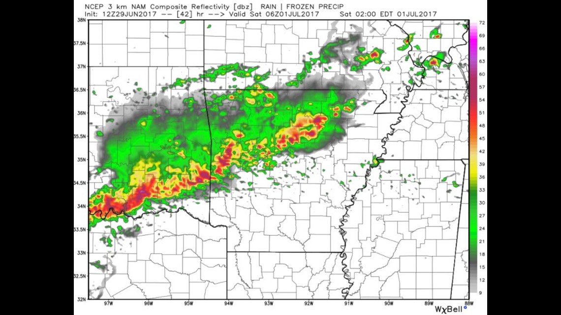
1AM SATURDAY: Showers and storms will be moving out of the area slowly from the NW to the SE. The placement of this boundary will determine where convection redevelops on Saturday.
I’ll have another blog update tomorrow with more detail on the upcoming weekend and the picture of what unfolds becomes clearer and better defined.
-Garrett