Cooler than normal temperatures will prevail this week with temperatures running in the 80s in the afternoon and 60s to low 70s in the morning.
More active weather arrives late-week into the weekend.
Short-Term: Monday-Thursday:


A nearly zonal (west to east) flow in the jet stream will lead to frequent clouds and a spotty shower or two for this week.
The best chance for widespread rain or thunderstorms should hold off until Friday into the weekend.
Long-Term: Friday-Weekend


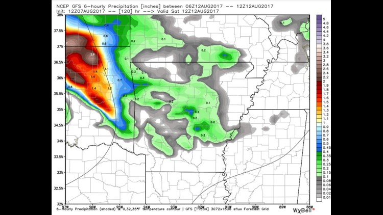
This image shows Saturday morning with scattered showers and storms across Eastern Oklahoma and NW Arkansas.


This image is Sunday morning with rain still remaining a possibility into the second half of the weekend.

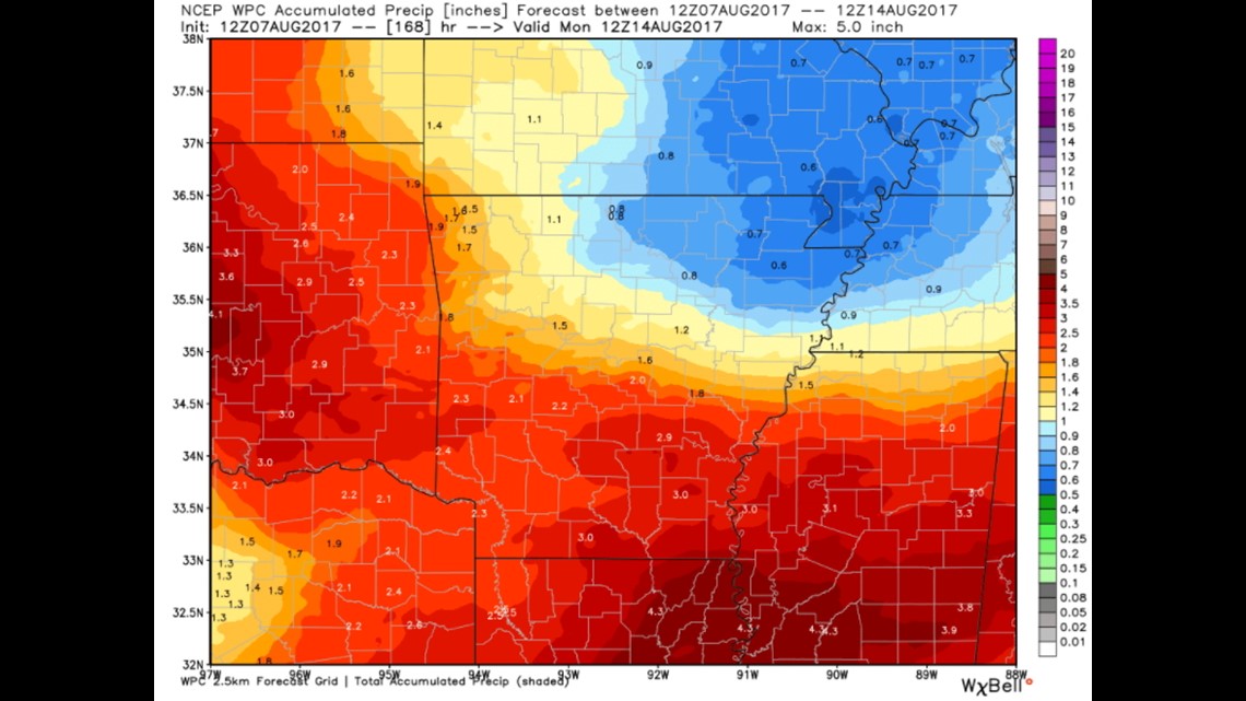
Rainfall totals for the next event are forecast to be another 1-2″ for most of our area Friday into the upcoming weekend.
-Garrett