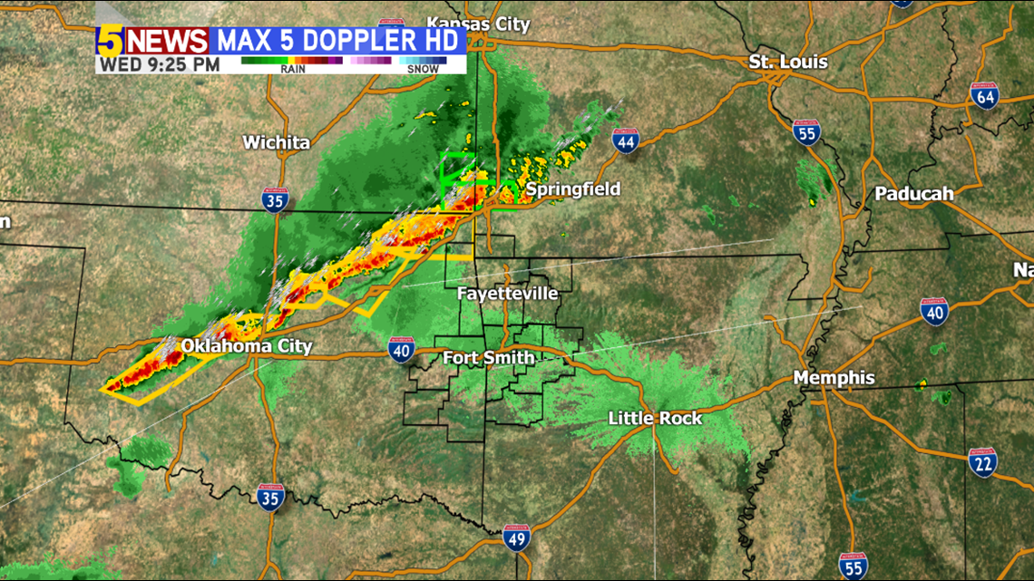
A line of strong to severe thunderstorms is currently in NE Oklahoma and tracking SE towards our area.
These storms will be in Fayetteville, Bentonville, & Rogers between midnight and 2am.
They arrive in Fort Smith from 2-5am late-night into the early morning hours on Thursday.
The instability falls off as the storms move east so I would expect a weakening trend as they push into our area. A severe warning or two is possible but the overall risk of widespread severe weather is not likely.
The faster storm movement lately has lowered the flash flooding risk some, which is good, but any amount of rainfall over areas already plagued with soaking rain could cause flash flooding concerns. A Flash Flood Watch is in effect until 7am.

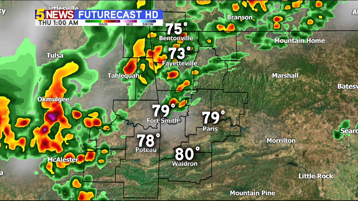
1AM THURSDAY: This image shows the storms that will arrive late tonight.

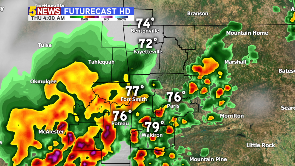
4AM THURSDAY: By this time, more showers and storms will be ongoing in the Fort Smith area.
-Garrett