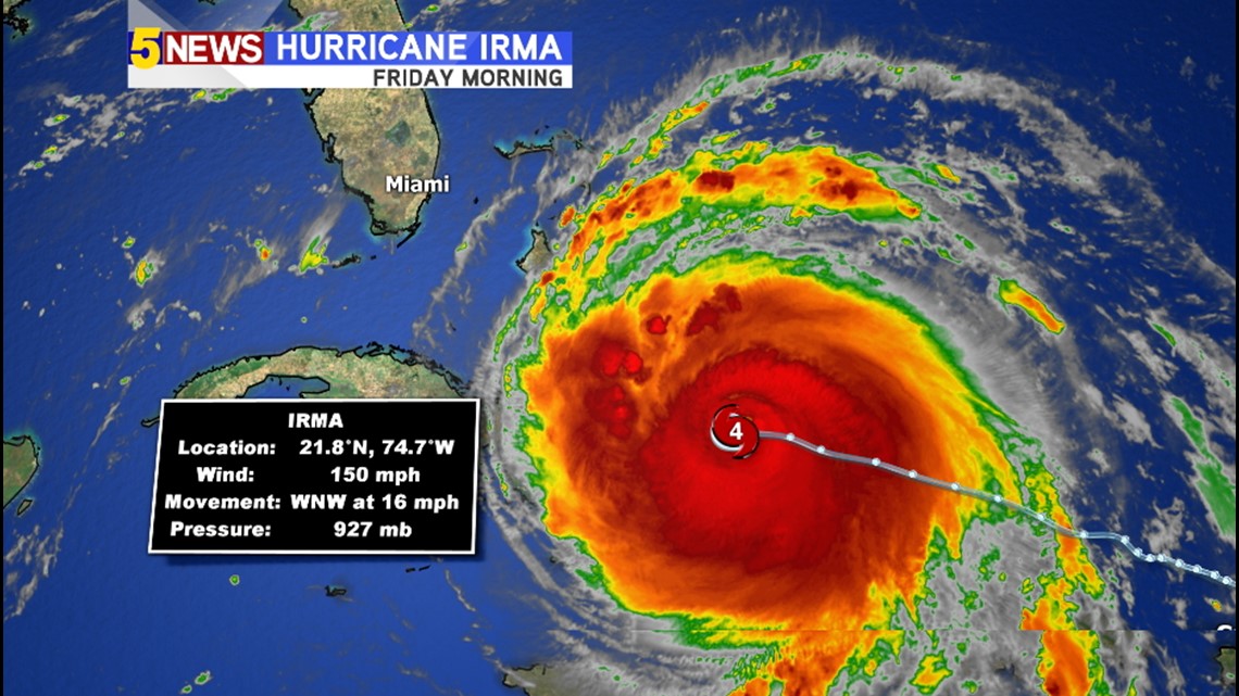
Hurricane Irma continues its path towards south Florida. Friday morning, the powerful cyclone was downgraded to a Category 4 storm. This however still classifies as a “catastropic” hurricane with sustained winds around 150mph. Will Irma strengthen once again or will it weaken? Here is an in-depth look from your 5NEWS Weather Team with what you can expect before the hurricane makes landfall.

First of all Hurricanes needs a few ingredients to form or strengthen: Water, heat, and little-to-no outside winds.
Here’s a detailed look at each one, specifically for Hurricane Irma.
WATER
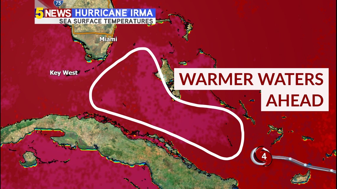
It may be obvious, but hurricanes need ocean water to survive. Essentially, a hurricane is just a lot of different forms of water (clouds and rain) swirling over the ocean. This means that any land a hurricane encounters will devastate its structure; the larger the landmass, the more the storm will be affected. Check out this map:

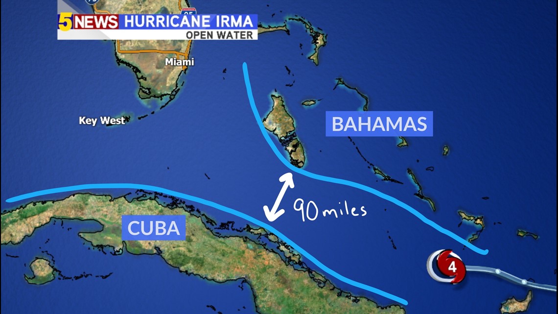
The current track of Hurricane Irma is important because it squeezes the storm between both the Bahamas and Cuba. There is 90-mile gap between Andros Island (the largest Bahamian island) and the northern coast of Cuba. This leaves just enough water for Irma to slide through and be relatively unaffected, except for the outer edges of the storm. A hit towards Cuba would severely hurt the storm and a hit through the Bahamas would at least relatively weaken the system.
This ingredient: Okay, but could be better!
HEAT
A hurricane is like an engine. It needs fuel to survive and gives off heat. These oceanic storms need warm waters to thrive (79 degrees or warmer). That is why hurricanes form in the late summer and close to the equator.

The latest data shows that Irma has even warmer water to ride over before reaching Florida. Sea surface temperatures just south and east of the Florida Keys increase just a bit. This will only help provide more heat to the storm, giving it the continued possibility of strengthening.
This ingredient: Great!
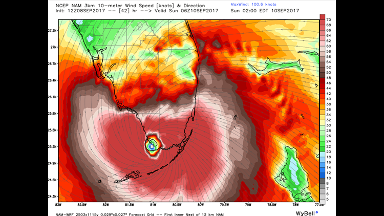
LITTLE-TO-NO-WINDS ABOVE
Hurricanes are sensitive creatures. They thrive in open water in areas of little wind. Meteorologists call this “wind shear”. A hurricane can be blown apart if there are strong winds high up in the atmosphere, similar to how a roof can be torn off a house in a major storm. When hurricanes enter a region of strong winds, they can collapse and turn into a mess of rain showers and storms.

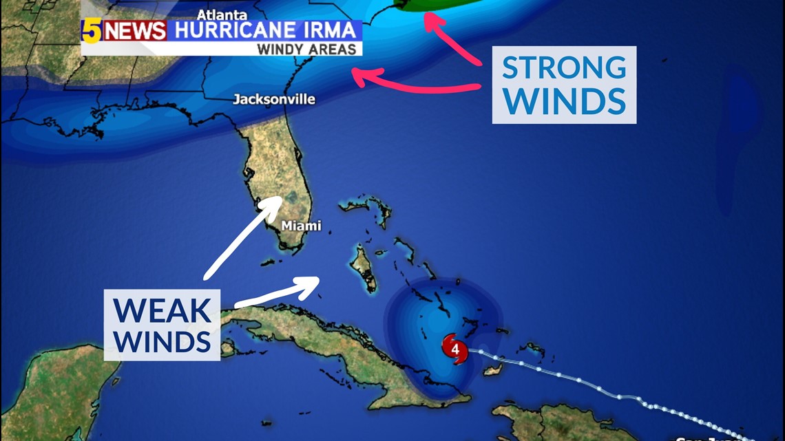
This map shows the upper-level winds near Irma, which are almost non-existent. This means the storm is still in a healthy environment. Irma isn’t expected to hit many outside winds until it reaches mainland United States.
This ingredient: Great!
OVERALL
Irma has a good shot of at least holding its strength for the next two days. Neither major strengthening nor major weakening is expected, but the storm bouncing back and forth between a category 4 and 5 is still possible. You can always check our Live Hurricane Tracker at any time for the most up-to-date information on the storm.
– Matt Standridge, 5NEWS Meteorologist