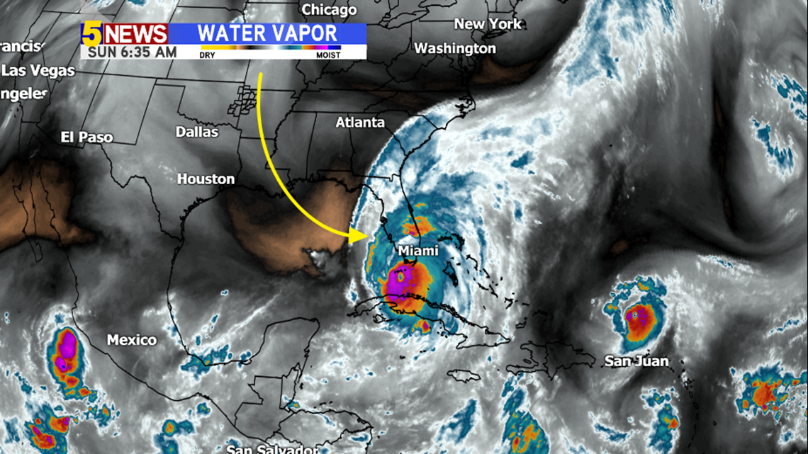
The brown/gold color on the Water Vapor image shows the shortwave disturbance that’s blocking Hurricane Irma from moving into the Gulf of Mexico. The storm will pick up speed because of this shortwave and also cause it to weaken in terms of wind speed.

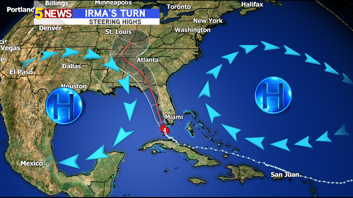
The storm has been caught between two ridges of high pressure.
The ridge to the east has been more dominate which has pushed Irma farther west than originally forecast.

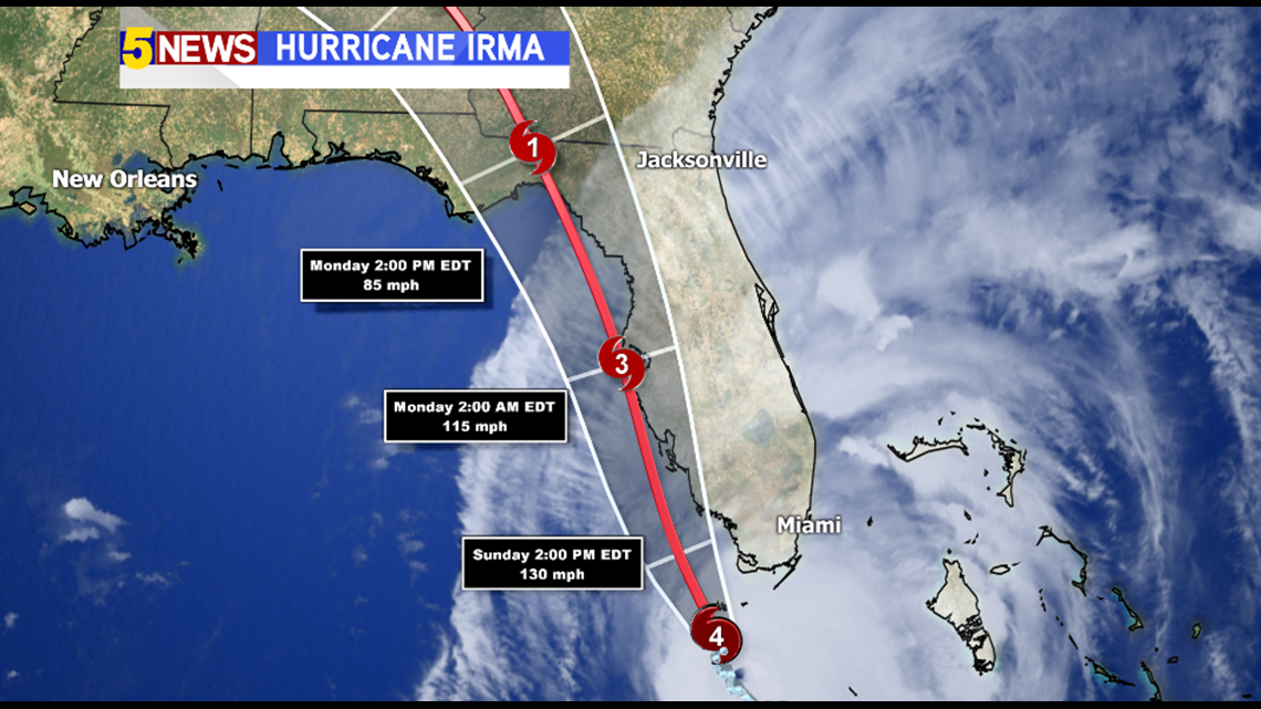
This track will push Irma into the NE part of the Gulf of Mexico into late Monday.

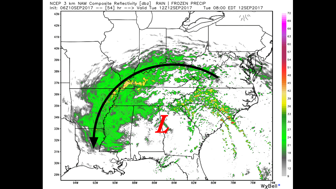
The farther west track of Irma will bring at least minimal rain chances into our area next week late Tuesday into Wednesday.
-Garrett