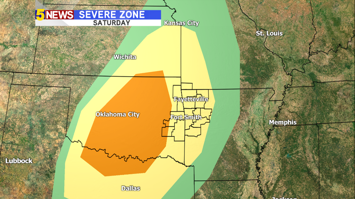
Heading into this weekend, severe weather will try to make a comeback in NW Arkansas and the River Valley. T-storms are expected to form along a cold front Saturday evening in Central Oklahoma. With these initial storms (over Central Oklahoma) all forms of severe weather will be possible, but strong winds and hail will be the primary concern. As the storms move in our direction, the area of focus will shift away from the hail threat and focus more on the potential for strong winds.

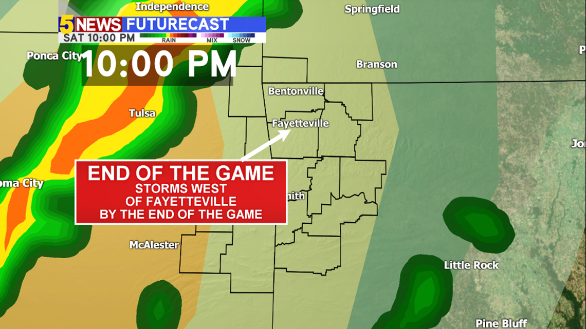
With so many outdoor events happening this weekend, a lot of people will be outdoors. We’ll need to pay attention to the weather, but thankfully the strongest storms are expected anywhere from midnight to 6am Saturday night/Sunday morning.


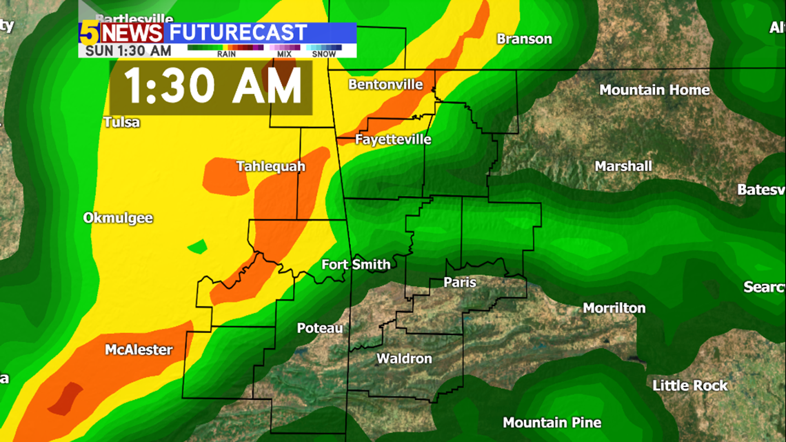
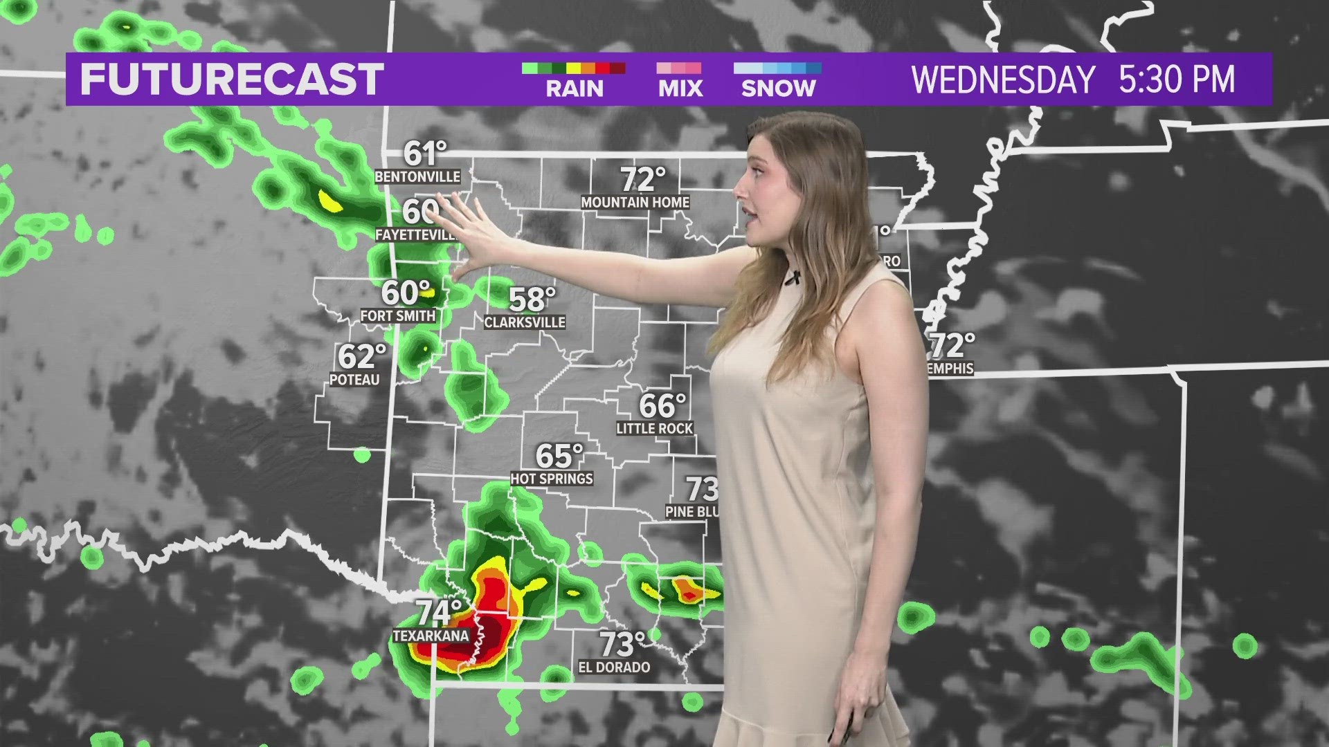
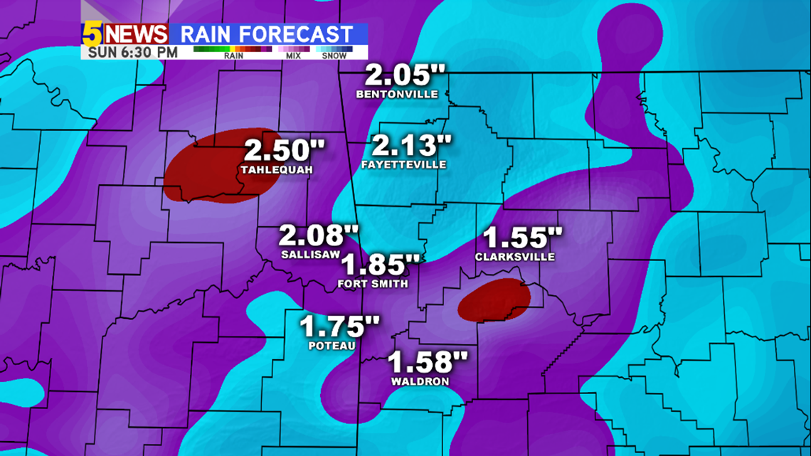
We could see quite a bit of rain from this line of storms as well, with rainfall totals of at least 1″ possible for both NW Arkansas and the River Valley with locally higher amounts possible.

-Chris