
A powerful cold front will sweep through the area late Saturday night and early Sunday morning. This will spark showers and storms in Oklahoma Saturday evening, which will march eastward towards Arkansas by nightfall.

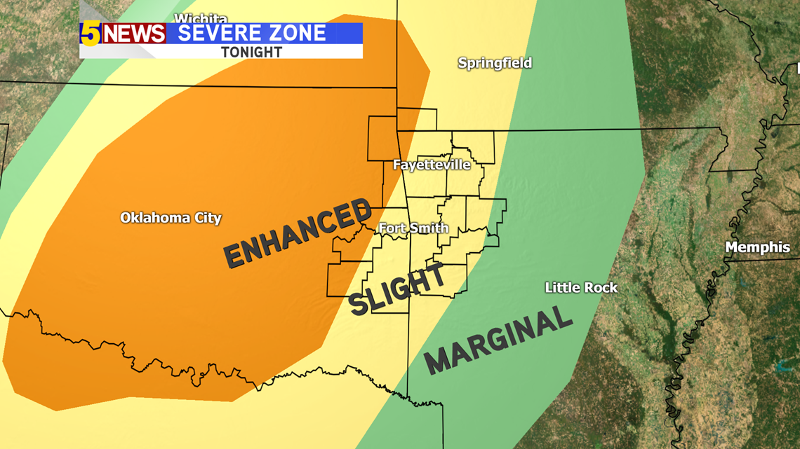
Strong storms will first fire in central Oklahoma. This is where they will be their most severe. As they move eastwards, they will all line up and come through as one strong line into Arkansas. In addition, they should weaken slowly over time as daytime heating is lost. The further west you live, the more severe weather you will see in your neighborhood.

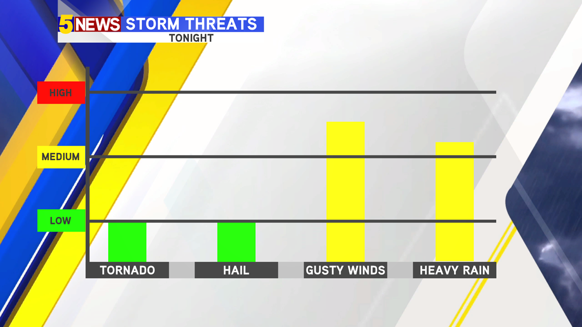
The storm threats mainly involve gusty winds and heavy rain as cold front moves through the region. It looks like tornado and severe hail chances remain low, thanks to the storms' linear nature. The tornado chance is not completely zero because there could be small spin-up tornadoes embedded in the long line of storms. The best chance for tornadoes will be in central Oklahoma when the storms first form.

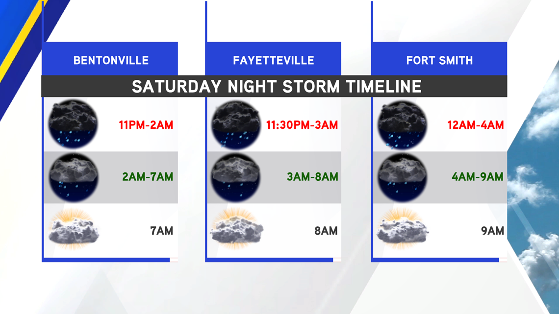
Here is when you can expect showers and storms where you live.

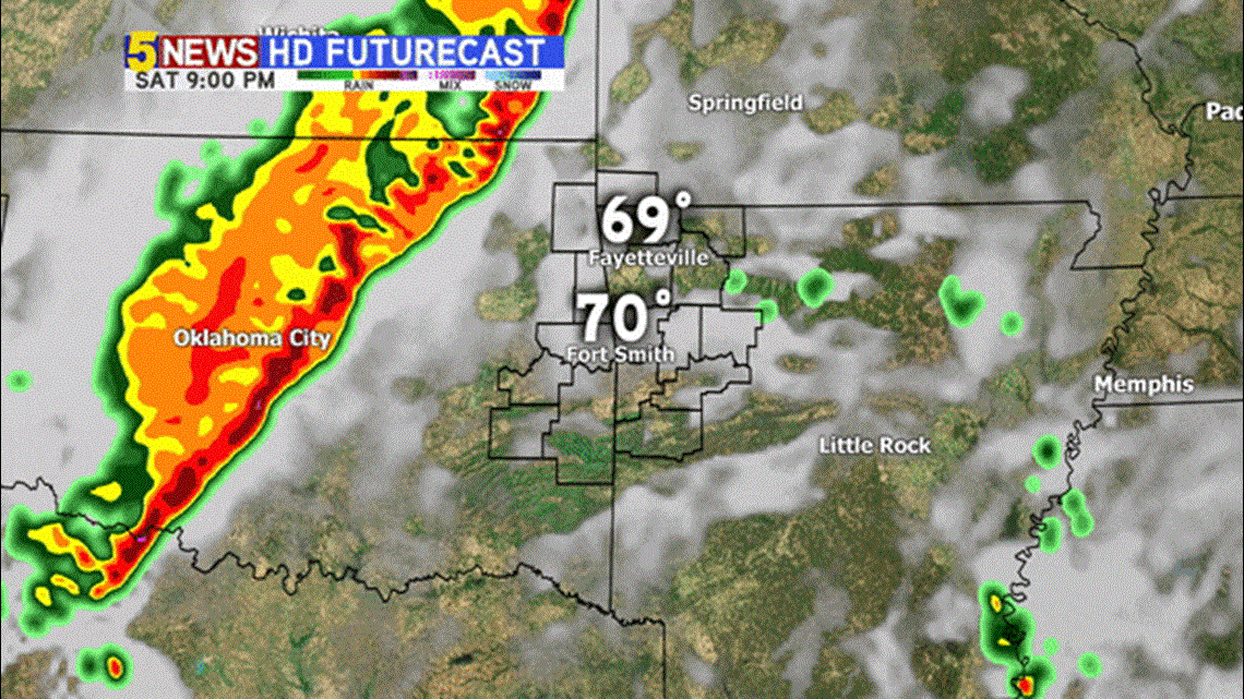
Futurecast shows the line of storms marching through close to and after midnight.
Chief Meteorologist Garrett Lewis will have more on the storms later this evening!
-Matt